

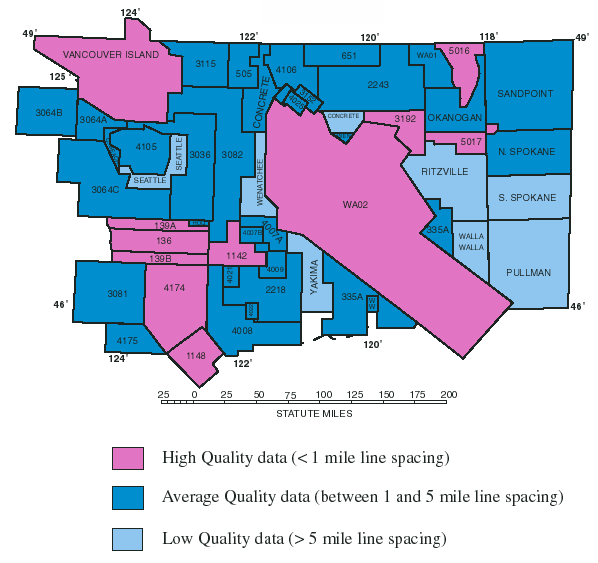
The Washington aeromagnetic compilation map contains data from 41 separate aeromagnetic surveys, digitized maps, and previous gridded compilations. This map is an index to the flightline spacing of the original surveys. A tabular index (see index) provides a summary of the data sources. The raw data for all these surveys are available from the National Geophysical Data Center (NGDC), Boulder, Colorado.
The Vancouver Island survey was provided by the Pacific Geoscience Center of the Geological Survey of Canada and contains three separate sections. Each section was flown in 1976 with north-south flight lines spaced at about 1 km and at barometric elevations of 1000', 4500', and 5500'.