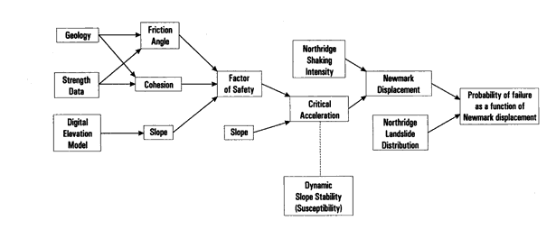
Figure 4. Flow chart showing steps involved in producing a seismic landslide hazard map.
U.S. Department of the Interior | U.S. Geological Survey URL: https://pubsdata.usgs.gov/pubs/of/1998/ofr-98-113/figure4.html Questions or Assistance: USGS Web Contact Page Last Modified: Wed Dec 7 16:46 EDT 2016