
by Mark L. Greninger1*, Simon L. Klemperer1, and Warren J. Nokleberg2, authors
Douglas S. Aitken2, Brian S. Bennett2, Keri L. Brennan3, Ronald W. Buhmann4, Stanislav G. Byalobzhesky5, Steven P. Gordey6, Roger A. Hansen7, Paul P. Hearn, Jr.8, Thomas G. Hildenbrand2, Allen M. Hittelman9, J. Murray Journeay6, Alexander I. Khanchuk10, Boris Khlebnikov11, D. Paul Mathieux8, James W. H. Monger6, Boris A. Natalin12, Leonid M. Parfenov13, Richard W. Saltus14, D.T. Sandwell15, Thomas Simkin16, Gregory Ulmishek8, and Frederic H. Wilson17, contributors
Warren J. Nokleberg2 and Michael F. Diggles2, editors
U.S. Geological Survey Open-File Report 99-422
Version 1.0
1999
U.S. DEPARTMENT OF THE INTERIOR
BRUCE BABBITT, Secretary
U.S. GEOLOGICAL SURVEY
Charles G. Groat, Director
This report is preliminary and has not been reviewed for conformity with U.S. Geological Survey editorial standards or with the North American Stratigraphic Code. Any use of trade, firm, or product names is for descriptive purposes only and does not imply endorsement by the U.S. Government.
*Now at: Anteon Corporation, PMD-10, 75 Hawthorne Street, San Francisco, CA 94105, USA
1 Department of Geophysics, Stanford University, Stanford, California, USA
2 U.S. Geological Survey, Menlo Park, California, USA
3 Chapleau, Ontario, Canada
4 National Geophysical Data Center, NOAA, Boulder, Colorado, USA
5 Russian Academy of Sciences, Magadan, Russia
6 Geological Survey of Canada, Vancouver, Canada
7 University of Alaska, Fairbanks
8 U.S. Geological Survey, Reston, Virginia, USA
9 National Geophysical Data Center, NOAA, Boulder, Colorado, USA
10 Russian Academy of Sciences, Vladivostok, Russia
11 Research Information Center, GlavNIC, Russian Ministry of Natural Resources, Moscow, Russia
12 Russian Academy of Sciences, Khabarovsk, Russia
13 Russian Academy of Sciences, Yakutsk, Russia
14 U.S. Geological Survey, Denver, Colorado, USA
15 University of California San Diego, San Diego, California, USA
16 Smithsonian Institution, Washington, DC, USA
17 U.S. Geological Survey, Anchorage, Alaska, USA
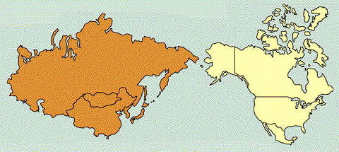
Geographic Information Systems (GIS) programs provide powerful tools for managing and analyzing spatial databases. Geological applications include regional tectonics, geophysics, mineral and petroleum exploration, resource management, and land-use planning. This CD-ROM contains thematic layers of spatial data-sets for geology, gravity field, magnetic field, oceanic plates, overlap assemblages, seismology (earthquakes), tectonostratigraphic terranes, topography, and volcanoes. The GIS compilation can be viewed, manipulated, and plotted with commercial software (ArcView and ArcInfo) or through a freeware program (ArcExplorer) that can be downloaded from http://www.esri.com for both Unix and Windows computers using the button below.

This publication was made using data made available by the following organizations (listed alphabetically):
Alaska Biological Science Center
Alaska Division of Oil and Gas
Defense Mapping Agency
Eros Data Center
European Space Agency
Exxon Production Research Company
Geological Society of America
Geological Survey of Canada
Geological Survey of Japan
International Seismological Centre
Japan Oceanographic Data Center
Lamont-Doherty Earth Observatory
Ministry of Geology, U.S.S.R.
National Aeronautics and Space Administration
National Earthquake Information Center
National Geophysical Data Center
National Ocean Service
National Oceanic and Atmospheric Administration
Naval Research Laboratory
Research Information Center (GlavNIC), Russian Ministry of
Natural Resources (RMNR)
Russian Academy of Sciences
Scripps Institution of Oceanography
Smithsonian Institution, Global Volcanism Program
Society of Exploration Geophysicists
Stanford University
United Nations Environment Programme/Global Resource
Information Database
U.S. Agency for International Development
United States Geological Survey
University of Alaska, Fairbanks
CLICK HERE to navigate the directory structure and access the documentation and data files.
To view PDF publications on this Web server, you will need Adobe Acrobat Reader which is available using the button below.

CLICK HERE view the readme file for this report (95 KB in PDF format).
CLICK HERE view the documentation file for this report (401 KB in PDF format).
The CD-ROM version of this report is for sale ($32 at time of this report) by:
U.S. Geological Survey
Information Services, National Mapping Division
Box 25046
Denver Federal Center
Denver, CO 80225-0046
Telephone: (888) ASK-USGS
To contact the senior editor, email Warren Nokleberg (wnokleberg@usgs.gov).