
1999
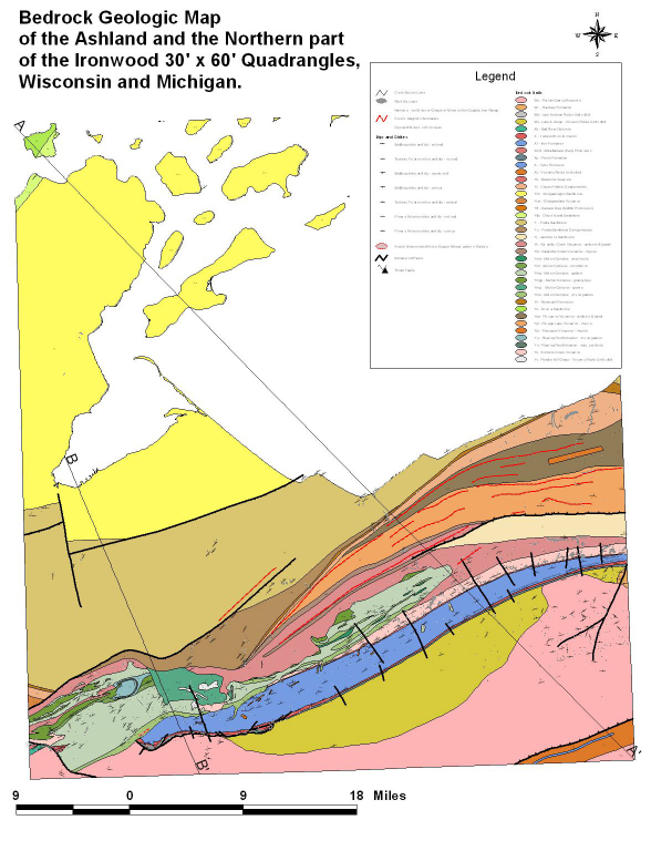 click here for larger image |
 click here for larger image |
Mineral Resource Studies in the Upper Midwest
 USGS Home Page
USGS Geologic Information
USGS Home Page
USGS Geologic Information
 USGS Help Page
Privacy statement -- General disclaimer
For Additional Information Contact: Connie Dicken
USGS Geologic Division, Eastern Mineral Resources
703-648-6399
12201 Sunrise Valley Drive, MS 954
Reston, VA   20192
This page is https://pubs.usgs.gov/openfile/of99-546/
Maintained by Eastern Publications Group
Last modified: 17 March 2000