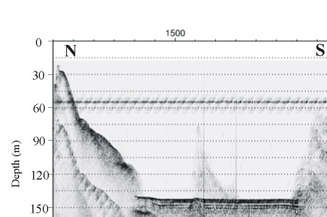
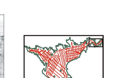
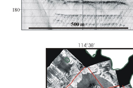
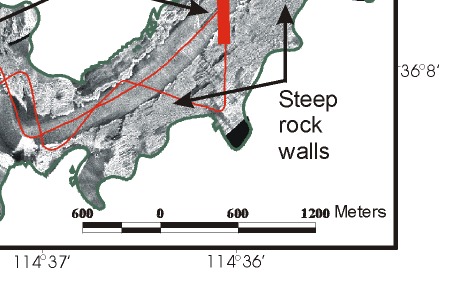
Figure 8.  Sidescan sonar image showing the steep, smooth rock walls in the Narrows (see inset map for figure location) with the post-impoundment sediment lapping up against these cliffs. The seismic profile (location is the heavy red line on the sidescan image) shows the thick sediment covering the floor of the lake and lapping up against the steep rock walls. Note that the surface of the sediment is flat and that no sediment drape is apparent on the adjacent rock faces. On the seismic profile, 0.02 sec. two-way travel time is approximately 15-m.

Figure 8.  Sidescan sonar image showing the steep, smooth  rock walls in the Narrows with the post-impoundment sediment lapping up against these cliffs. Figure 8.  Sidescan sonar image showing the steep, smooth  rock walls in the Narrows with the post-impoundment sediment lapping up against these cliffs.
Figure 8.  Sidescan sonar image showing the steep, smooth  rock walls in the Narrows with the post-impoundment sediment lapping up against these cliffs.
Figure 8.  Sidescan sonar image showing the steep, smooth  rock walls in the Narrows with the post-impoundment sediment lapping up against these cliffs. Figure 8.  Sidescan sonar image showing the steep, smooth  rock walls in the Narrows with the post-impoundment sediment lapping up against these cliffs.