|
FOREWORD
This report was prepared as part of the World Energy
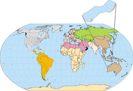
Project of the U.S. Geological Survey. In the project, the world was divided
into 8 regions and 937 geologic provinces. The provinces have been ranked
according to the discovered oil and gas volumes within each (Klett and
others, 1997). Then, 76 "priority" provinces (exclusive of the U.S. and
chosen for their high (ranking) and 26 "boutique" provinces (exclusive
of the U.S. and chosen for their anticipated petroleum richness or special
regional economic importance) were selected for appraisal of oil and gas
resources. The petroleum geology of these priority and boutique provinces
is described in this series of reports.
The purpose of this effort is to aid in assessing the
quantities of oil, gas, and natural gas liquids that have the potential
to be added to reserves within the next 30 years. These volumes either
reside in undiscovered fields whose sizes exceed the stated minimum-field-size
cutoff value for the assessment unit (variable, but must be at least 1
million barrels of oil equivalent) or occur as reserve growth of fields
already discovered.
The total petroleum system constitutes the basic geologic
unit of the oil and gas assessment. The total petroleum system includes
all genetically related petroleum that occurs in shows and accumulations
(discovered and undiscovered) that has been generated by a pod or by closely
related pods of mature source rock and which exists within a limited mappable
geologic space, together with the essential mappable geologic elements
(source, reservoir, seal, and overburden rocks) that control
the fundamental processes of generation, expulsion, migration, entrapment,
and preservation of petroleum. The minimum petroleum system is that part
of a total petroleum system encompassing discovered shows and accumulations
together with the geologic space in which the various essential elements
have been proved by these discoveries.
An assessment unit is a mappable part of a total petroleum
system in which discovered and undiscovered fields constitute a single
relatively homogenous population such that the chosen methodology of resource
assessment based on estimation of the number and sizes of undiscovered
fields is applicable. A total petroleum system might equate to a single
assessment unit. If necessary, a total petroleum system may be subdivided
into two or more assessment units such that each assessment unit is sufficiently
homogeneous in terms of geology, exploration considerations, and risk to
assess individually.
A graphical depiction of the elements of the a
total petroleum system is provided in the form of an event chart
that shows the time of deposition of essential rock units; the time processes,
such as trap formation, necessary to the accumulation of hydrocarbons took
place; the critical moment in the total petroleum system; and the preservation
time, if any.
|
|
|
|
A numeric code identifies each region, province, total
petroleum system, and assessment unit; these codes are uniform throughout
the project and will identify the same item in any of the publications.
The code is as follows:
|
Example |
| Region, single digit |
3 |
| Province, three digits to the
right of region code |
3162 |
| Total Petroleum System, two digits
to the right of province code |
316205 |
| Assessment unit, two digits to
the right of petroleum system code |
31620504 |
The codes for the regions and provinces are listed in
Klett and others, 1997.
Oil and gas reserves quoted in this report are derived
from Petroleum Exploration and Production database (Petroconsultants, 1996)
and other area reports from Petroconsultants, Inc., unless otherwise noted.
Fields, for the purpose of this report, include producing fields, discoveries (suspended and abandoned)
and shows as defined by PetroConsultants (1996) and may consist of a single well with no production.
Figure(s) in this report that show boundaries of the total
petroleum system(s), assessment units, and pods of active source rocks
were compiled using geographic information system (GIS) software. Political
boundaries and cartographic representations were taken, with permission,
from Environmental Systems Research Institute's ArcWorld 1:3 million digital
coverage (1992), have no political significance, and are displayed for
general reference only. Oil and gas field centerpoints, shown on this(these)
figure(s), are reproduced, with permission, from Petroconsultants, 1996.
REFERENCES
Environmental Systems Research Institute Inc., 1992, ArcWorld
1:3M digital database: Environmental Systems Research Institute, Inc. (ESRI),
available from ESRI, Redlands, CA, scale: 1:3,000,000.
Klett, T.R., Ahlbrandt, T.A., Schmoker, J.W., and Dolton,
G.L., 1997, Ranking of the worlds oil and gas provinces by known petroleum
volumes: U.S. Geological Survey Open-File Report 97-463, one CD-ROM.
Petroconsultants, 1996, Petroleum Exploration and Production
Database : Petroconsultants, Inc., P.O. Box 740619, 6600 Sands Point Drive,
Houston TX 77274-0619, USA or Petroconsultants, Inc., P.O. Box 152, 24
Chemin de la Mairie, 1258 Perly, Geneva,
|
|