![]()
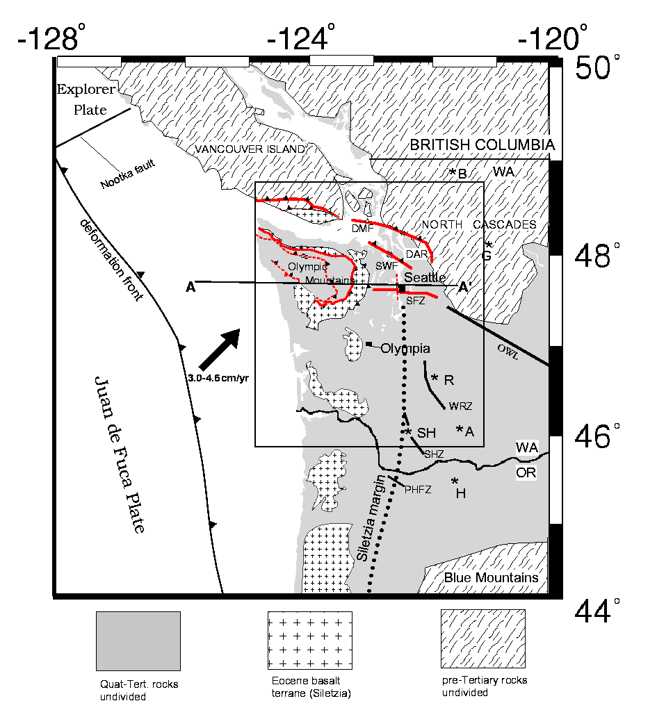
Figure 1---Geologic and tectonic index map of northern Cascadia. Geology adapted from Snavely and Wells (1996). Secondary thrust faults (dotted) in the Olympic Mts. adapted from Brandon et al. (1998). Cross pattern is mafic Coast Range rocks of Siletz River, Crescent, and Tillamook Volcanics (informally known as the Siletzia terrane after Irving, 1979). Closed area of Siletzia in southwestern Olympic Mts. (just below M in Mountains) inferred from gravity data, magnetotelluric models, and tomographic velocity results. Dotted line in western Oregon and Washington represents probable extent of Siletzia in the subsurface as determined from gravity and magnetic data. Asterisks are Cascade volcanoes: B=Mt. Baker; G=Glacier Peak; R=Mt. Rainier; SH=Mt. St. Helens; A=Mt. Adams; H=Mt. Hood; J=Mt. Jefferson. Key faults and slip zones in the region are: OWL=Olympic-Wallowa lineament; PHFZ=Portland Hills Fault zone; SHZ=St. Helens zone; WRZ=Western Rainier zone; SFZ=Seattle fault zone; SWF=South Whidbey Island fault; DMF=Devils Mt. fault zone; DAR=Darrington fault zone. The region covered by our tomographic velocity model is indicated by the rectangle.