
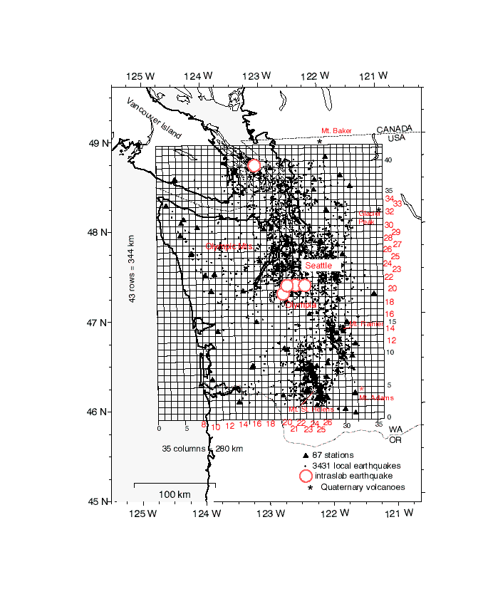
Figure 5--Model grid coverage for tomographic inversion. Triangles are seismic stations of the Pacific Northwest
Seismic Network used in our tomographic study. Circles are earthquakes used in the inversion. Open triangles are
volcanoes. The model grid used for P-velocity inversions is shown by the light grid, with rows and column intervals
labelled. Rows and columns shown as cross-sections in Figs. 6 and 7
are indicated by the bolder lines. These lines are indicated in the center of the cells, used for calculation of
latitude and longitude for the cross-sections. The location of the four intraslab earthquakes in southern Puget
Sound are shown to allow close registration with the velocity model.