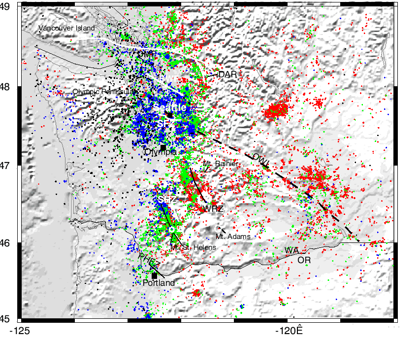
Figure 46--This map shows all of the earthquakes (from the Pacific Northwest Seismic Network), including those relocated using the tomographic velocity model. The colors represent depth ranges for the earthquakes with red for 0-10 km, green for 10-20 km, blue for 20-30 km, and black for 30-60 km. PHFZ=Portland Hills fault zone, SHZ=St. Helens zone, WRZ=western Rainier zone, SFZ=Seattle fault zone, SWF=South Whidbey Island fault, SJF=San Juan fault, DMF=Devils Mt. fault zone, DAR=Darrington fault zone, OWL=Olympic-Wallowa lineament.

Figure 47--This image shows earthquakes occuring at depth from 0 to 10 km, with the blue dots representing events relocated with the tomographic velocity model and red dots are events as located by in the PNSN (Pacific Northwest Seismic Network) catalog. Faults abbreviated as in Fig. 46. Dense shallow seismicity occurs along the SHZ and WRZ, near Seattle, and along the DAR. Numerous patches of shallow seismicity also occur in the central Columbia Basin region, especially along east-west faults within the folded basaltic rocks that occupy this region.

Figure 48--Events from 10-20 km depth are shown in this plot, with blue dots representing relocated earthquakes. Fault abbreviations as in Fig. 46. The trend of the SHZ and WRZ are outlined by earthquakes in this depth range, and there are interesting stepover features from the SHZ to the WRZ as discussed by Stanley et al. (1996). The other, more diffuse stepover pattern extends from the northern part of the SHZ to toward the WRZ at the latitude of Mt. Rainier. There is a dramatic increase in the number of earthquakes in this depth range in the Puget Sound region surrounding Seattle, extending eastward to the margin of the North Cascades. In addition, earthquakes line up approximately along the DMF and DAR.
Stanley, W. D., Johnson, S. Y., Qamar, A. I., Weaver, C. S., and Williams, J. M., 1996, Tectonics and seismicity of the southern Washington Cascade Range: Bulletin of the Seismological Society of America: 86, No. 1A, 1-18.

Figure 49--For depths of 20-30 km shown on this plot, seismicity is largely concentrated in the Puget Lowland region, centered on Seattle.
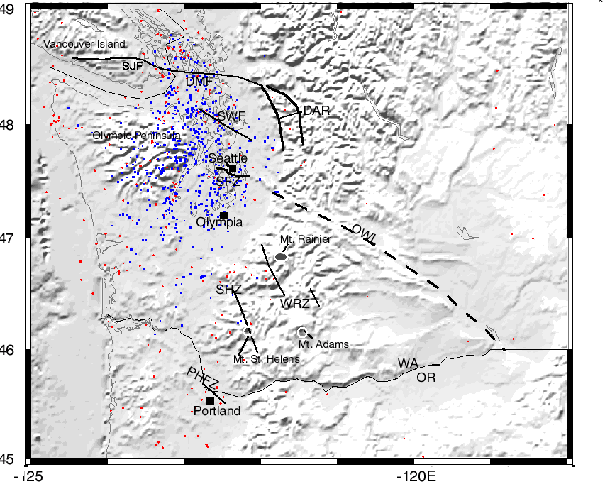
Figure 50--For depths of 30-60 km, shown in this plot, earthquakes are primarily within the upper part of the subducting Juan de Fuca plate and reflect bending stresses within the arching part of the plate under the Olympic Peninsula and Puget Sound region (Ma, et al., 1996). The events effectively outline the nose of the arch, just updip from where the dip in the subducting plate changes from about 12 degrees to more than 35 degrees.
Ma, Li, Crosson, Robert, and Ludwin, Ruth, 1996, Western Washington earthquake focal mechanisms and their relationship to regional tectonic stress: in U. S. Geological Survey Professional Paper 1560, Assessing Earthquake Hazards and Reducing Risk in the Pacific Northwest, A. M. Rogers, T. J. Walsh, W. J. Kockelman, and G. R. Priest (eds.), p. 257-263.