| Prev |
| Next |
| Map |
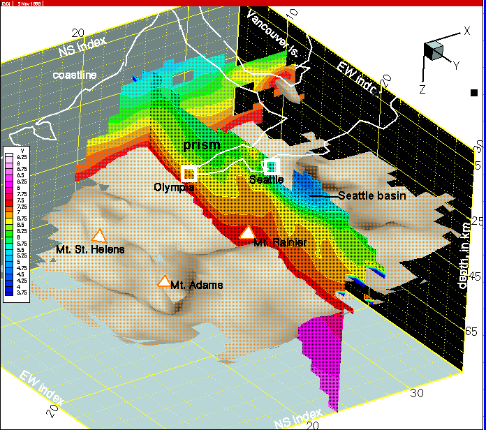
Figure 21--At row 24, Seattle basin sediments are even thicker. The basin is highly elongate in an east-west direction. The basin developed by downwarping of Crescent Fm. basement above the obvious gap in the deep mafic wedge (see review this gap, click here).