| Prev |
| Next |
| Map |
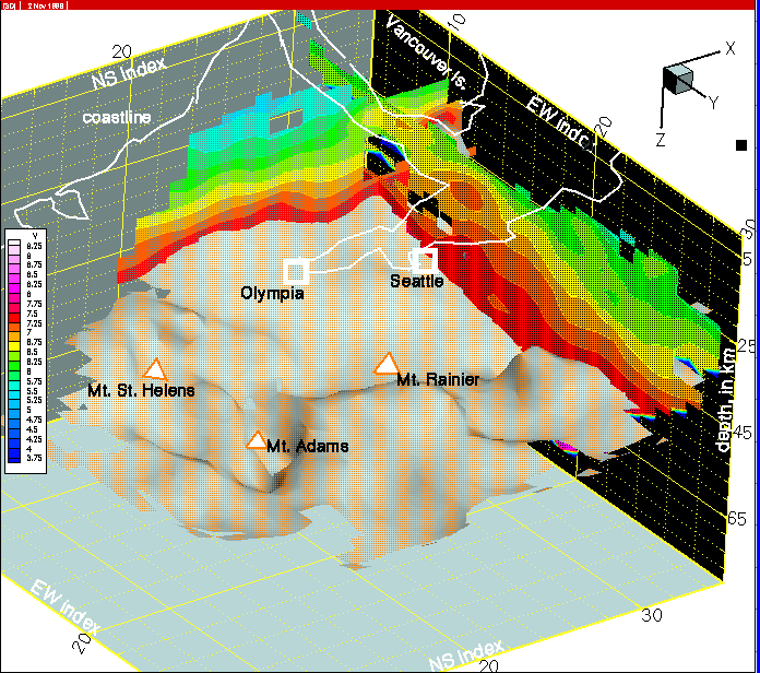
Figure 29--Most of the continental crust on this section at row 33 consists of mafic rocks that extend under Vancouver Island to depths as shallow as 19 km, as previously mapped in seismic reflection/refraction surveys by Clowes et al. (1987).