| Prev |
| Fig. 43 |
| Map |
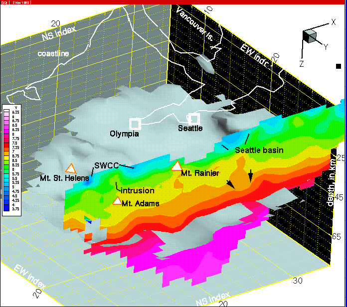
Figure 42--On column 26 the last vestiges of the Seattle basin appear and the intrusion within the SWCC is seen more clearly. IF YOU ACCESSED THIS IMAGE FROM THE OPEN FILE REPORT, CLICK IN THE LEFT FRAME FOR THE NEXT ILLUSTRATION AND DON'T USE THE BACK BUTTON. IF YOU ACCESSED THE IMAGE FROM THE GEOHAZARDS WEB PAGE, CLICK THE HOME BUTTON AT THE LEFT.