Rock falls from Glacier Point above Camp Curry, Yosemite National Park, California
Rock falls from Glacier Point above Camp Curry, Yosemite National Park, California
Open-file Report 99-385
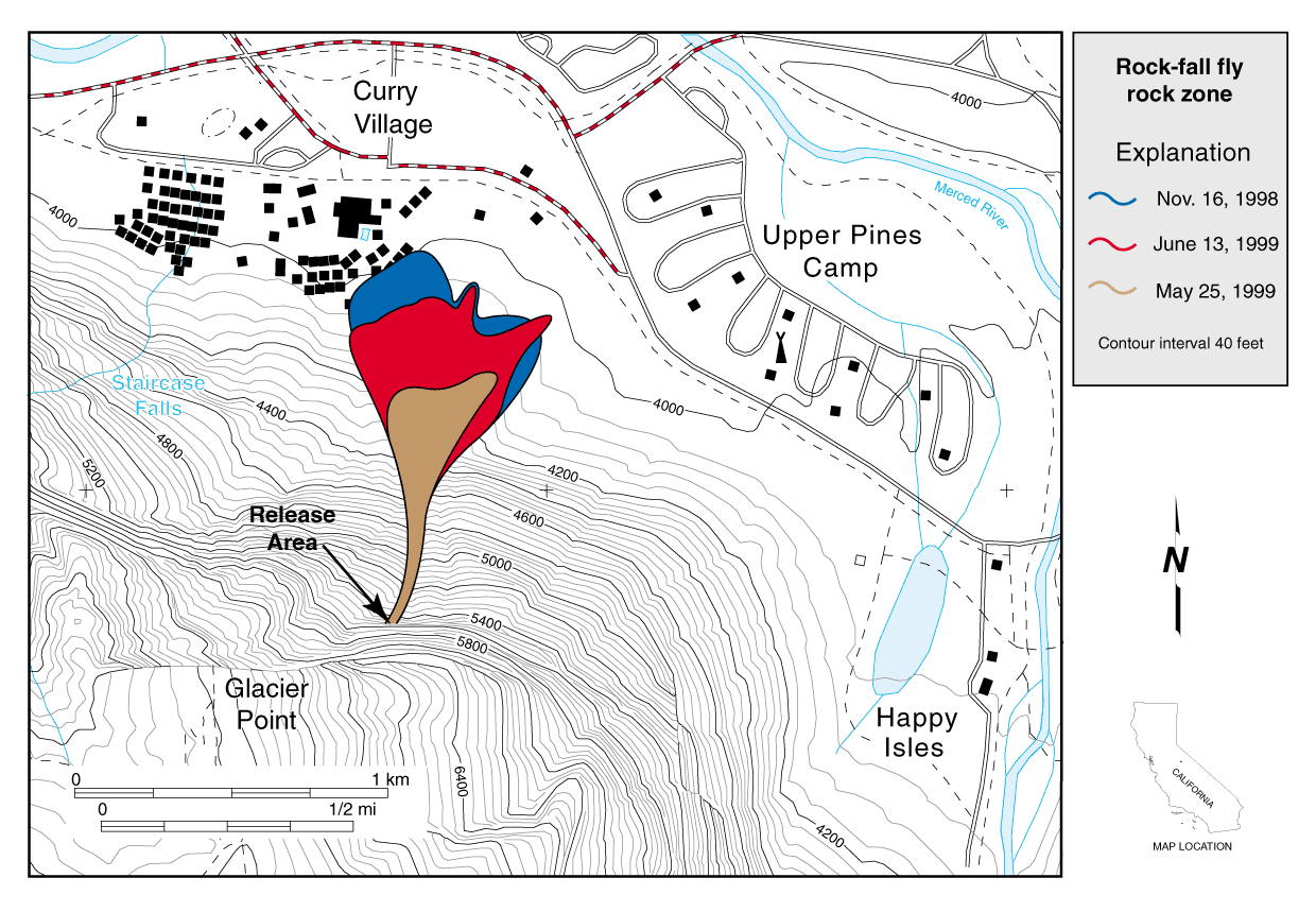
Figure 2B- Maps of rock-fall release area below Glacier Point and affected areas in Camp Curry, Yosemite National Park. Maps does not include locations of all structures within Curry Village. Recent rock-fall fly rock zone near Camp Curry. Outlines of 11/16/98 (blue), 5/25/99 (brown), and 6/13/99 (red) rock-fall flyrock zones.
Gerald F. Wieczorek, U.S. Geological Survey and James B. Snyder, National Park Service
| AccessibilityFOIAPrivacyPolicies and Notices | |
| |
|