

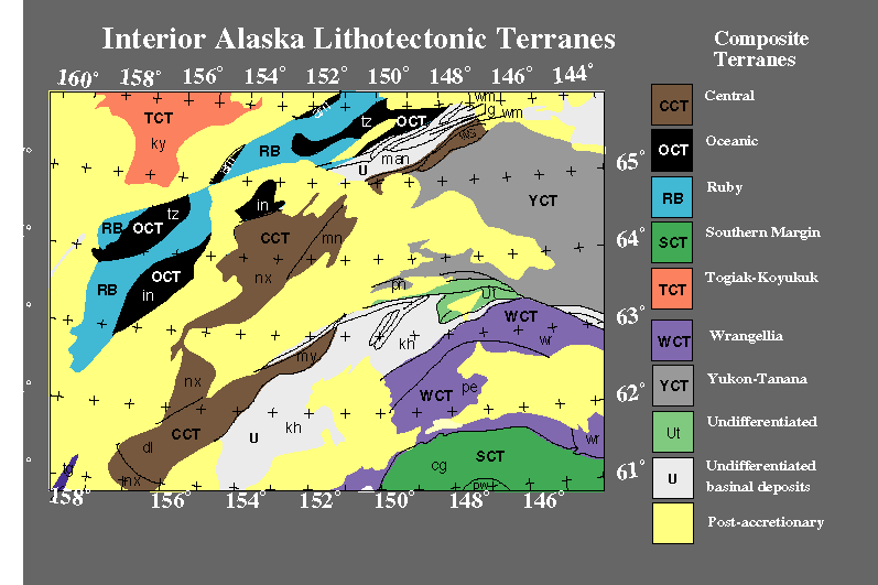
As this slide shows, this part of Alaska is mapped as a diverse set of tectonic elements. Also note the prevalence of (Mesozoic and Cenozoic) post-accretionary cover rocks in this part of Alaska. Gravity and magnetic data can help characterize the lithology or tectonic affinity of rocks beneath this cover.
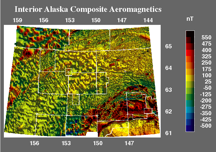
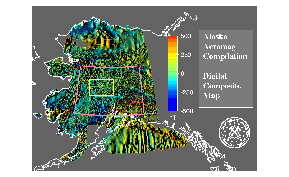
This slide depicts the composite magnetic map for interior Alaska, a subset of the Alaska state compilation - this is actually the first portion of the compilation that was completed. The data are illuminated from the northeast which highlights some subtle NW trending features in the data. We have shaded these data to enhance contrasts caused by shallow geologic features. This contrasts with the upward-continuation filter we used before to highlight deeper features.
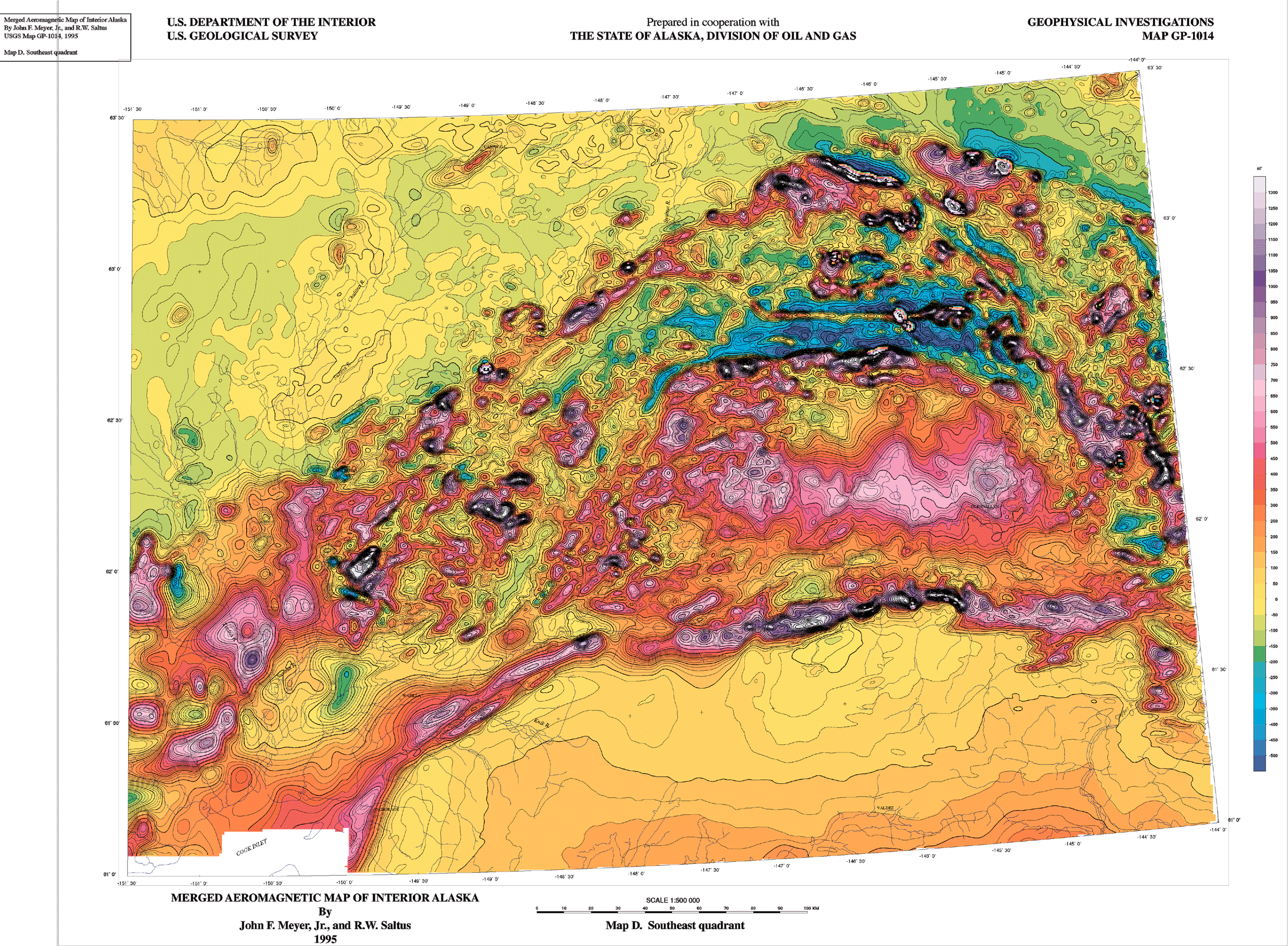
This is a slide of one quadrant of the published 1:500,000-scale merged aeromagnetic map of interior Alaska produced in 1995 as a cooperative effort of the USGS and the State of Alaska, Division of Oil and Gas. This map shows contours of magnetic intensity on a hydrographic base. It is available from the USGS as Map GP-1014 (Meyer and Saltus, 1995).
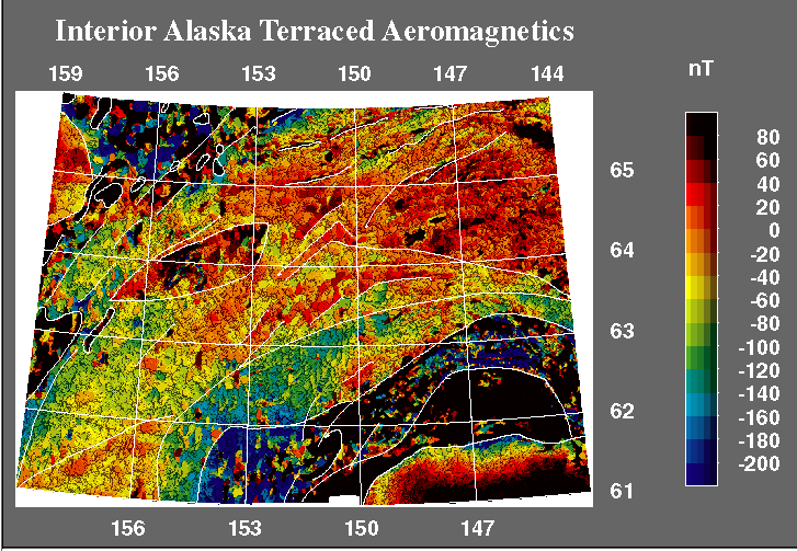
This is a "terrace map" based on the merged aeromagnetic data for interior Alaska. Terracing is a scheme for accentuating the gradients in the dataset. This operation tends to enhance subtle details of the map and assists the eye in identifying regions with common patterns. The lines on the map indicate our hand-tracing of regions with common magnetic fabric.

This is a terrace map based on the isostatic residual gravity data for interior Alaska (a contour map of these data is published as USGS Map GP-1016; Meyer and others, 1996). The isostatic residual gravity anomaly reflects lateral density variation in the upper 10 km or so of the crust. We have used the terrace filter to accentuate the gradients in this map. This allows us to more easily identify boundaries between rock units with contrasting density. The white lines indicate boundaries that we consider to be the most significant (selected by hand). These boundaries were used, along with the boundaries picked from the terraced magnetic data, to construct the tectono-geophysical domains in the next slide.
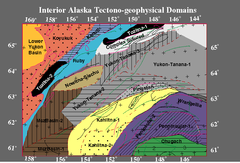
This figure shows the tectono-geophysical domains for interior Alaska as identified from gravity and aeromagnetic data. The magenta lines are boundaries identified from the terraced aeromagnetic data. The green lines are boundaries identified from the terraced gravity data. The coloring and nomenclature for these domains reflect terrane mapping for interior Alaska. For detailed description of these shallow domains, see Saltus and others (1997).
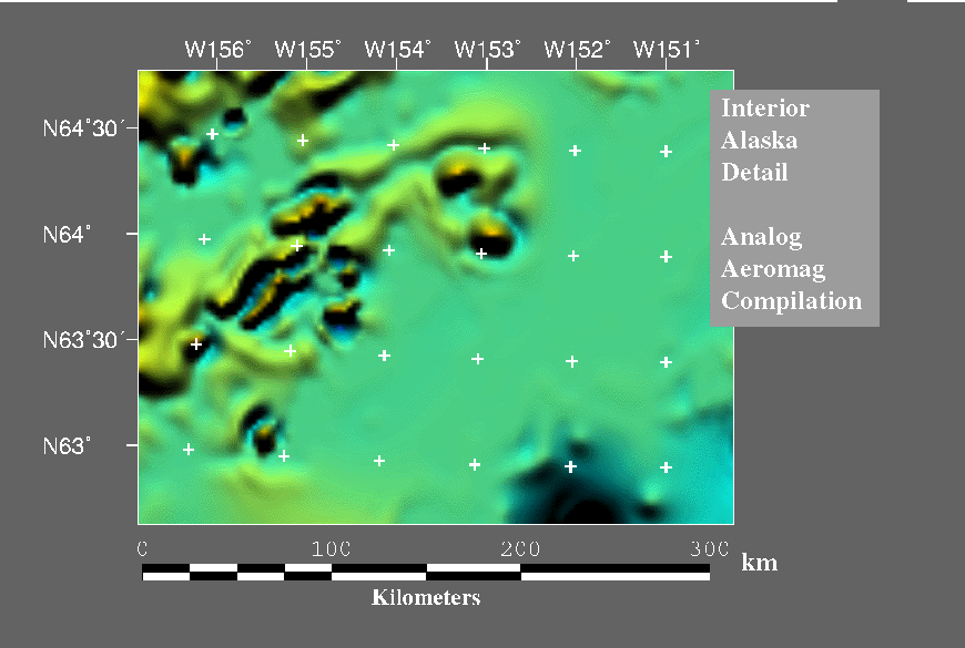
This figure is an enlarged view of a portion of interior Alaska showing the previous (analog) aeromagnetic data compilation (Godson, 1994). The next figure shows the same view of the new digital compilation. These two compilations are based on the same original aeromagnetic surveys, the difference in resolution in the resulting grid arises from the difference in compilation techniques (analog verses digital).
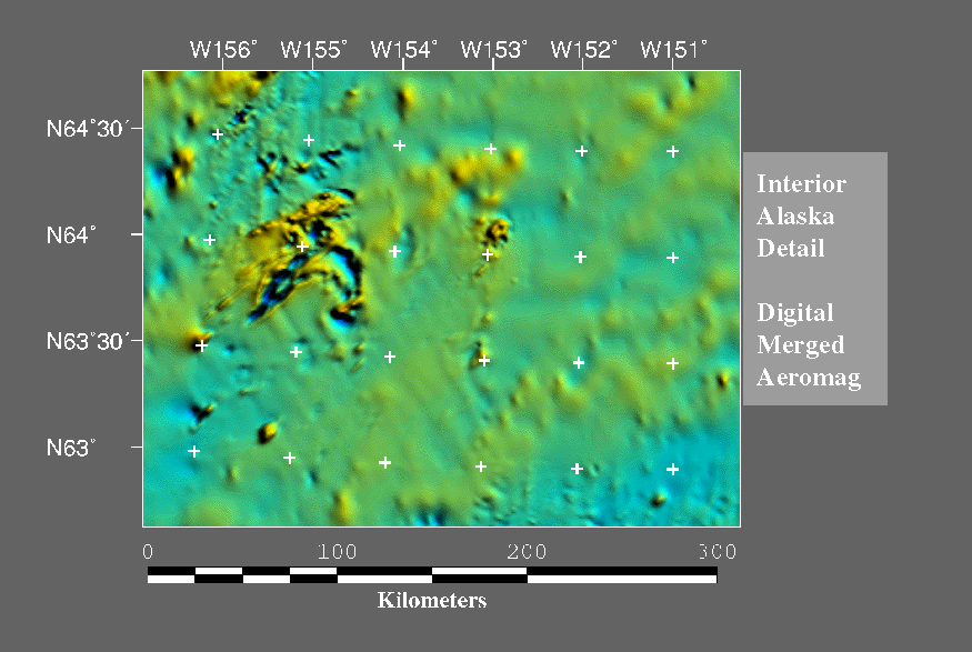
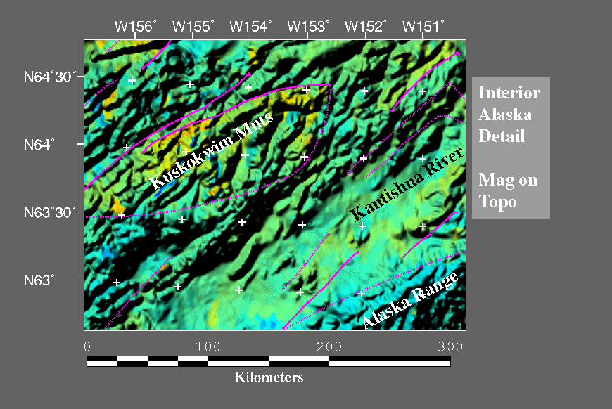
This figure is an enlarged view of a portion of interior Alaska showing the detail present in the new (digital) aeromagnetic compilation (Saltus and Simmons, 1997). The lens-shaped region centered on about 64 degrees north and 155 degrees west is the Nowitna-Sischu domain that spans and connects two regions of mapped surficial volcanic rocks.
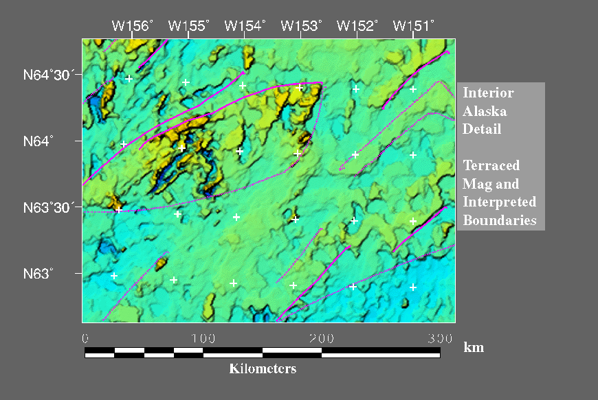
This view shows a terraced version of the same portion of interior Alaska based on the new digital compilation. The magenta lines are some of the primary magnetic boundaries that we used to define tectono- geophysical domains. The boundaries of the Nowitna-Sischu domain are shown. These boundaries are not easy to see in the old analog compilation.
This is yet another view of the enlarged portion of interior Alaska. Here we have added shading from a digital elevation model to colors from the aeromagnetic data. This gives a geographic reference to the anomalies and boundaries. The magenta lines are the primary (solid) and secondary (dashed) magnetic boundaries identified from the terraced magnetics.
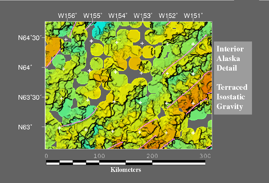
This is the enlarged view of the terraced isostatic gravity for this same portion of interior Alaska. Although the gravity data are quite sparse, there are some significant northeast-southwest structural trends visible in this area. The pink lines are the significant density boundaries identified from the terraced gravity and used to help define tectono-geophysical domains.