 Introduction Introduction
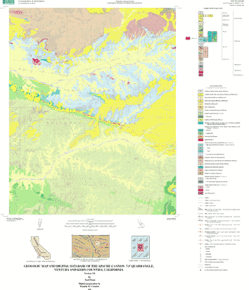
The Apache Canyon 7.5-minute quadrangle is located in southwestern California about 55 km northeast of Santa Barbara and 65 km southwest of Bakersfield. This report presents the results of a geologic mapping investigation of the Apache Canyon quadrangle that was carried out in 1997-1999 as part of the U.S. Geological Survey's Southern California Areal Mapping Project. This quadrangle was chosen for study because it is in an area of complex, incompletely understood Cenozoic stratigraphy and structure of potential importance for regional tectonic interpretations, particularly those involving the San Andreas fault located just northwest of the quadrangle and the Big Pine fault about 10 km to the south. In addition, the quadrangle is notable for its well-exposed sequences of folded Neogene nonmarine strata including the Caliente Formation of Miocene age from which previous workers have collected and described several biostratigraphically significant land-mammal fossil assemblages. During the present study, these strata were mapped in detail throughout the quadrangle to provide an improved framework for possible future paleontologic investigations. The Apache Canyon quadrangle is in the eastern part of the Cuyama 30-minute by 60-minute quadrangle and is largely part of an erosionally dissected terrain known as the Cuyama badlands at the east end of Cuyama Valley. Most of the Apache Canyon quadrangle consists of public lands in the Los Padres National Forest.
|
First posted October 26, 2000
Readme's and Metadata
Data
Files for Viewing and Plotting
Learn more about the Apache Canyon data set and its contents.
Visit the GeoScience Node of the National Spatial Data Clearinghouse to find other geologic-map datasets in southern California or elsewhere in the Nation.
Part or all of this report is presented in Portable Document Format (PDF). For best results viewing and printing PDF documents, it is recommended that you download the documents to your computer and open them with Adobe Reader. PDF documents opened from your browser may not display or print as intended. Download the latest version of Adobe Reader, free of charge.
|