
U.S. Geological Survey
Open-File Report 00-043, Version 2.0
Bathymetric, Geophysical and Geologic Sample Data from Medicine Lake, Siskiyou County, Northern California
by
Jonathan R. Childs (1), Jacob B.
Lowenstern (2) , R.
Lawrence Phillips (1), Patrick Hart (1), James J.
Rytuba (3), John A. Barron (2), Scott W. Starratt (2), and Sarah Spaulding (4)
Open File Report 00-043
2000
This report is preliminary and has not been reviewed for conformity with U.S. Geological Survey editorial standards or with the North American Stratigraphic Code. Any use of trade, product, or firm names is for descriptive purposes only and does not imply endorsement by the U.S. Government.
U.S. DEPARTMENT OF THE INTERIOR
Appendices: 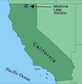 |
 Figure A2: Aerial view of Medicine Lake from the northeast. Photo by Julie Donnelly-Nolan, USGS
|
Introduction
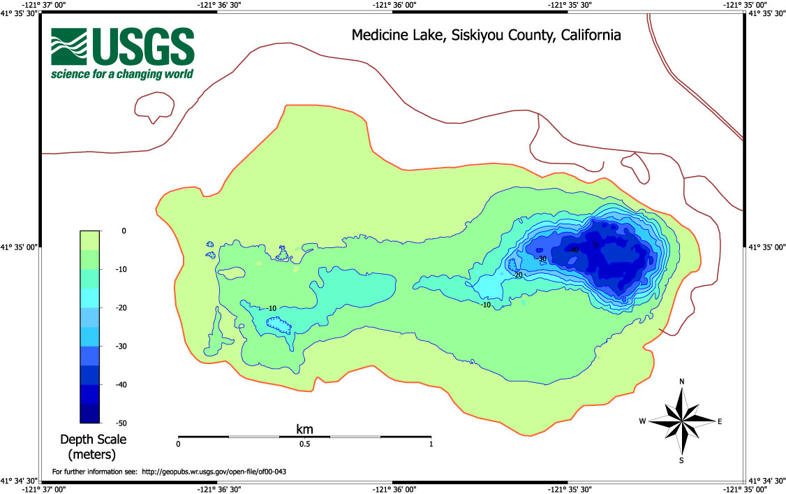
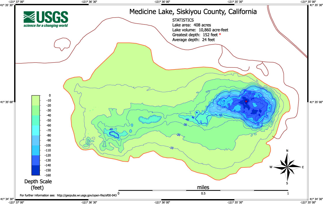
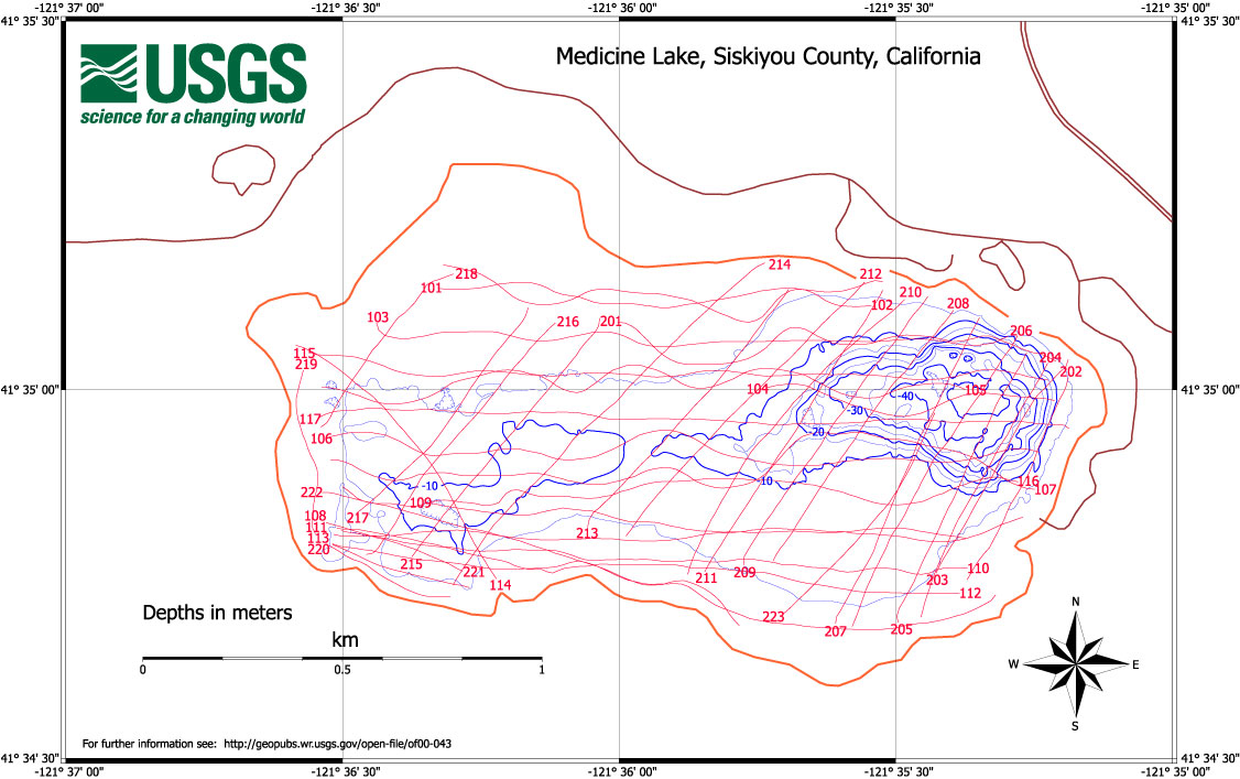
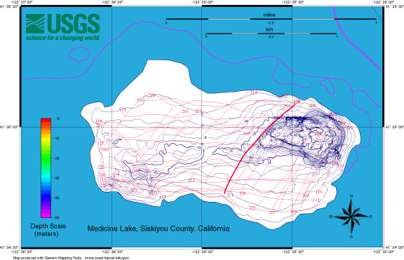
In September, 1999, the U.S. Geological Survey
acquired high-resolution bathymetry, seismic reflection profiles, and
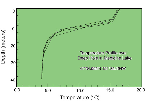
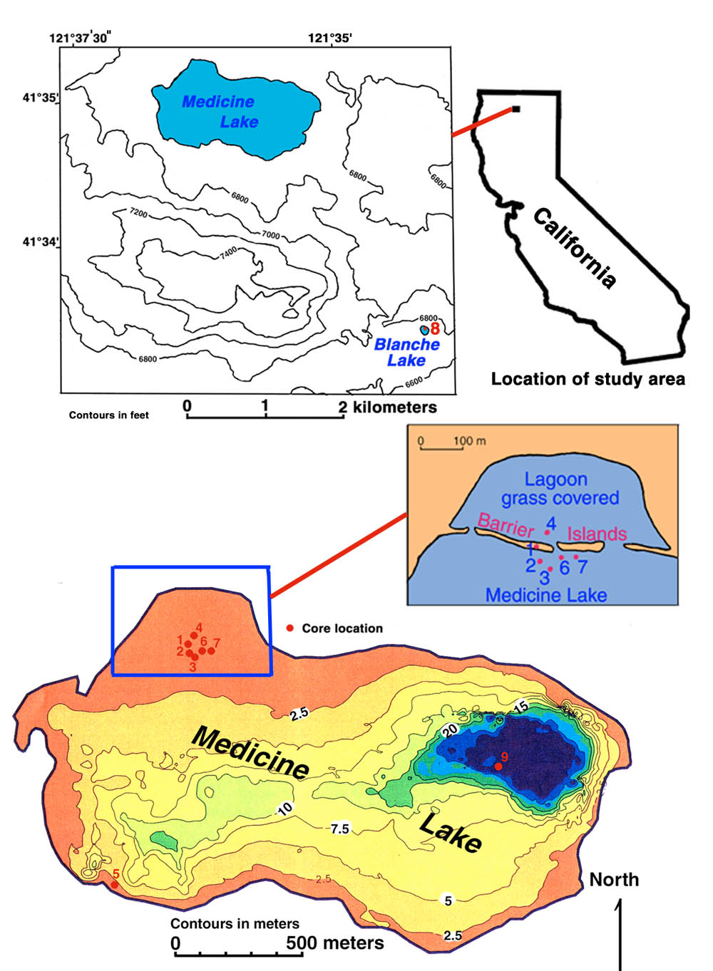
geologic sample data from Medicine Lake, a high altitude (2,036 m)
lake located within the summit caldera/basin at Medicine Lake volcano
(MLV), a dormant Quaternary shield volcano located in the Cascade
Range, 50 km northeast of Mt. Shasta. It last erupted less than 1000
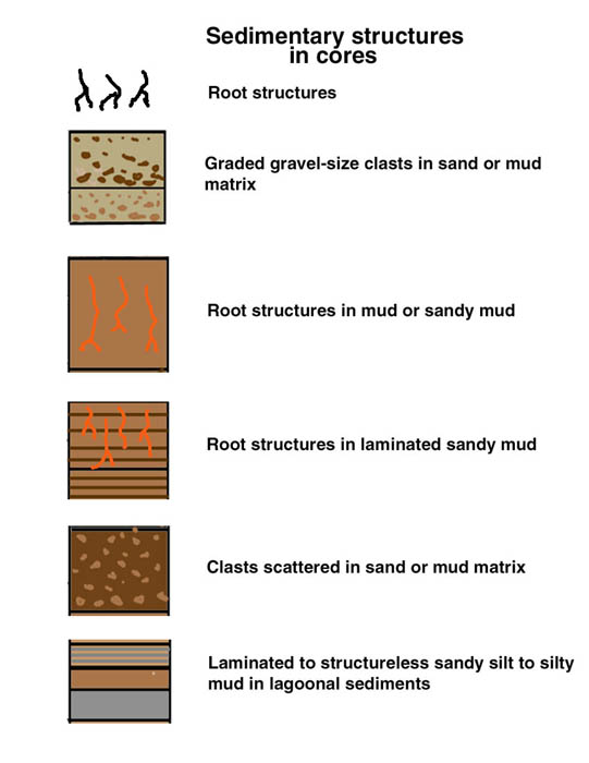
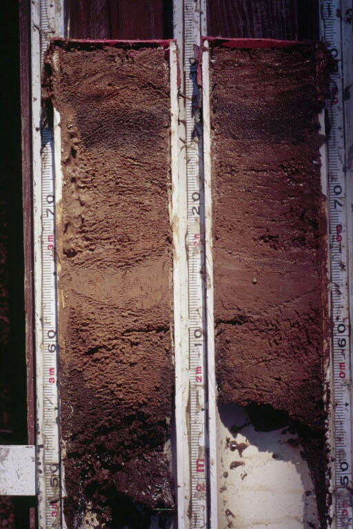
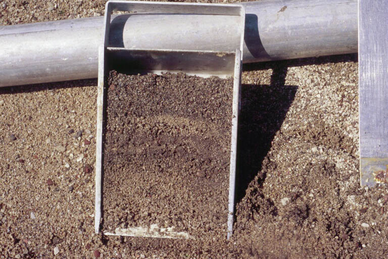
years ago.The purpose of this work was to assess whether sediments in
the lake might provide a high-resolution record of the climate,
volcanic and geochemical (particularly mercury) history of the
region. We are still working with our data to assess whether the
sediments are appropriate for further study. This report provides a
summary of what we have learned to date.
Selected data products include:
Geographic location, geologic setting, and physiographic environment of the Medicine Lake volcanic region are described at:
http://vulcan.wr.usgs.gov/Volcanoes/MedicineLake/framework.html
http://vulcan.wr.usgs.gov/Volcanoes/California/Maps/map_medlake_shasta.html
http://vulcan.wr.usgs.gov/Volcanoes/MedicineLake/Maps/map_lavabeds.html
|
Jon Childs | |
|
U.S. Geological Survey |
U.S. Geological Survey |
|
M/S 999 |
M/S 910 |
|
345 Middlefield Rd. |
345 Middlefield Rd. |
|
Menlo Park CA 94025 |
Menlo Park CA 94025 |
|
(650) 329-5195 |
(650) 329-5238 |
We appreciate considerable logistical assistance from Jayne Biggerstaff, Dan Meza, Brad Reed and Randall Sharp of the U.S. Forest Service, Modoc National Forest. At the USGS, Julie Donnelly-Nolan and Duane Champion offered advice and geologic expertise. Gerald O'Brien and Larry Kooker kept the Fast Eddy and the geophysical surveying equipment in top working order and the field program running smoothly. This work was funded through the USGS Volcano Hazards, Mineral Resources, Earth Surface Dynamics and Coastal and Marine Surveys Programs as well as through a grant from the Office of the Chief Geologist.

![]() U.S. Department of the Interior |
U.S. Geological Survey
U.S. Department of the Interior |
U.S. Geological Survey
URL: http://pubsdata.usgs.gov/pubs/of/2000/of00-043/index.html
Page Contact Information: GS Pubs Web Contact
Page Last Modified: Wednesday, 07-Dec-2016 18:13:33 EST