Woods Hole Field Center Home Page Coastal and Marine Geology Program Home Page U.S. Geological Survey with link to U.S.G.S. Home Page
USGS Banner


National Assessment of Coastal Vulnerability to Sea-Level Rise: Preliminary Results for the U.S. Pacific Coast


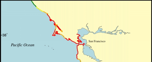
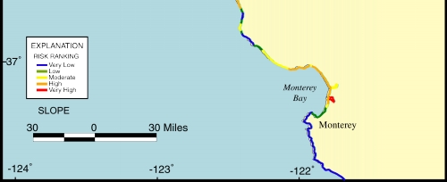
Figure 10.   Map of the coastal slope variable for the San Francisco - Monterey region. The coastal slope is relatively steep (low risk) in the Monterey region and at the rocky headlands to the south of San Francisco, but is quite low (high risk) at the open ocean coast at the mouth of San Francisco Bay.

Click on map to zoom in

Figure 10. Map of the coastal slope variable for the San Francisco - Monterey region.


 Contents  Back to Top  Title Page

 Introduction  Risk
Variables
 Data
Ranking
 C.V.I.  Results  Discussion  Summary  References

[an error occurred while processing this directive]