Woods Hole Field Center Home Page Coastal and Marine Geology Program Home Page U.S. Geological Survey with link to U.S.G.S. Home Page
USGS Banner


National Assessment of Coastal Vulnerability to Sea-Level Rise: Preliminary Results for the U.S. Pacific Coast


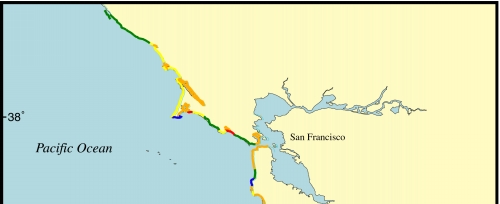
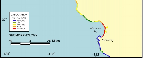
Figure 11.   Map of the geomorphology variable for the San Francisco - Monterey region. The shoreline is composed of higher-risk sandy pocket beaches interspersed with lower-risk rocky headlands, as well as areas of low sea-cliffs and high coastal bluffs.


Click on map to zoom in

Figure 11. Map of the geomorphology variable for the San Francisco/Monterey region.


 Contents  Back to Top  Title Page

 Introduction  Risk
Variables
 Data
Ranking
 C.V.I.  Results  Discussion  Summary  References

[an error occurred while processing this directive]