Woods Hole Field Center Home Page Coastal and Marine Geology Program Home Page U.S. Geological Survey with link to U.S.G.S. Home Page
USGS Banner


National Assessment of Coastal Vulnerability to Sea-Level Rise: Preliminary Results for the U.S. Pacific Coast


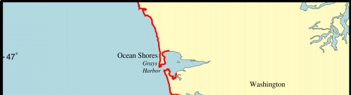
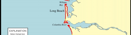
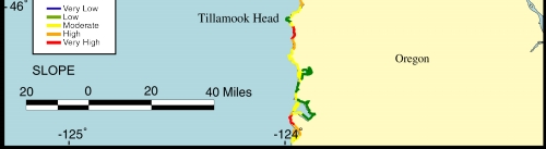
Figure 5.   Map of the coastal slope variable for southwestern Washington and northwestern Oregon. The coastal slope is relatively steep (low risk) in northwestern Oregon, but is quite low (high risk) in southwestern Washington.


Click on map to zoom in

Figure 5. Map of the coastal slope variable for southwestern Washington and northwestern Oregon


 Contents  Back to Top  Title Page

 Introduction  Risk
Variables
 Data
Ranking
 C.V.I.  Results  Discussion  Summary  References

[an error occurred while processing this directive]