|
|
|
| Introduction | |
| GIS Data Layer Development and Content | |
| Acknowledgments | |
| References | |
| Table Captions | |
| Digital Data and Metadata | |
| Back to Table of Contents | |
|
|
|

Chapter 10
By
Roman N. Zajac1, Ralph
S. Lewis2, Larry J. Poppe3,
David C. Twichell3, Joseph Vozarik4
and
Mary L. DiGiacomo-Cohen2
|
|
|
| Introduction | |
| GIS Data Layer Development and Content | |
| Acknowledgments | |
| References | |
| Table Captions | |
| Digital Data and Metadata | |
| Back to Table of Contents | |
|
|
|
To open a georeferenced displays of these themes in ESRI's ArcView program
make sure the application is loaded on your computer. Users should
go to the lisound directory located on the top level of this
CD-ROM and double click on the lisound.apr project file.
The individual ArcView shapefiles may also be opened directly with any
Arc application (e.g. ArcInfo, ArcExplorer) and can also be found on the
data
page. Further detailed information can be found on the ArcView
Project Filepage.
Several more detailed data layers are presented using data from Pellegrino
and Hubbard (1983). These include species richness (the total number of
species found at each stations), total abundance (the total number of individuals
collected at each station), and community composition. Community composition
was determined by first reviewing data at all 413 of their sampling
stations and selecting the 35 most commonly found species for further detailed
analysis. These analyses consisted of a multivariate clustering
analysis of the 413 stations, based on a community matrix comprised of
the 35 species, and some simple univariate statistics using the stations
comprising each cluster. Details of these analyses are given
in Zajac (1996, 1998). In the benthic community data layer,
the associated data table depicts the cluster designation for each
station the number of species at that station and of the mean abundance
of each of the 35 species selected for the analysis across the stations
comprising that community type. The communities depicted in
the data layer were interpreted based on the main groupings of stations
(or clusters) revealed by the classification analysis. It must
be stressed that the results depict general assemblage types that
can occur at various locations with then LIS. The data used for the
analyses were collected only at one time for each station.
Therefore, they represent a "snapshot" of the ecological communities
that are present in the Sound, and are best interpreted as representing
the general spectrum of community types that occur in different areas
of the Sound.
 benthic
surveying techniques in an area south of New London, Connecticut
(Zajac 1996, Zajac and others 2000). A sidescan sonar mosaic
was developed and subsequently sampled to collect data on physical
and biological features. The sidescan mosaic of the sea-floor, covers approximately
19.4 km2 (7.5 square miles) at the mouth of the Thames River from
approximately 41o 15.5'N, 72o 08' W to 41o
18.5' N, 72o 02' W. The sea-floor is approximately 10
to 15 m deep in the northeast section of the study area, increasing to
20 to 30 m in southwestern part.
benthic
surveying techniques in an area south of New London, Connecticut
(Zajac 1996, Zajac and others 2000). A sidescan sonar mosaic
was developed and subsequently sampled to collect data on physical
and biological features. The sidescan mosaic of the sea-floor, covers approximately
19.4 km2 (7.5 square miles) at the mouth of the Thames River from
approximately 41o 15.5'N, 72o 08' W to 41o
18.5' N, 72o 02' W. The sea-floor is approximately 10
to 15 m deep in the northeast section of the study area, increasing to
20 to 30 m in southwestern part.
Data for the image were collected during October 1991 aboard the RV UCONN using a 100-kHz EG&G sidescan sonar unit set for a 100-m range and towed approximately 3-4 m above the bottom. Navigation utilized DelNorte (PINSS input) and Miniranger systems. Data collection and processing was performed by Shannon Byrne and Eric Halter at the Ocean Mapping Development Center, University of Rhode Island. The mosaic was originally produced at 1:3,479-scale utilizing the U.S. Geological Survey Mini Image Processing system (MIPS) in an Equatorial Mercator Projection. Processing included; (1) bottom, ratio, and radiometry corrections; (2) sectioning the survey area; (3) "Geoming" individual map sections; (4) "stenciling" and "mosaicing"; and (5) building the final image. Dark tones in the mosaic indicate fine sediment (fine sand, silt and clay) and light tones indicate coarse sediment. Rough and "grainy" patches indicate glacial drift or bedrock outcrops.
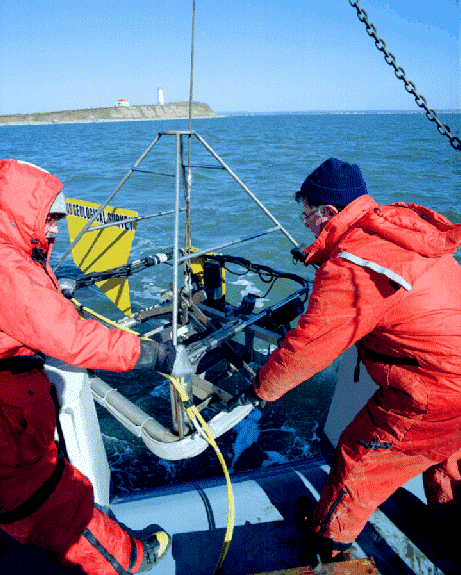
In June 1992, benthic samples and concurrent video were taken at 60
stations using a 0.1 m2 Van Veen
grab sampler equipped with an 8 mm video camera system and a shipboard
cassette recorder. Navigation al control was provided by GPS
and LORAN-C. Sub-samples (6 cm diameter x 10 cm deep) for infauna
were taken from the grabs and preserved whole in 10% formalin. They
were later washed on a 300 m sieve and the residues were transferred
to 70% ethanol. Details on surficial sediment characteristics
are given in Poppe and others (1992). Details on the sea floor structure
and related benthic communities are given in Zajac (1996, 2000) and
Zajac and others (2000). An overview of the information in
the GIS data layers are given below:
Franz, D., 1976, Benthic molluscan assemblages in relation to sediment gradients in northeastern Long Island Sound, Connecticut: Malacologia, v. 15, p. 377-399.
Knebel, H.J. and Poppe, L.J. 2000, Sea-floor environments within Long Island Sound: A regional overview: Journal of Coastal Research, Thematic section, In press
McCall, P.L., 1975, The Influence of Disturbance on Community Patterns and Adaptive Strategies of the Infaunal Benthos of Central Long Island Sound: Ph.D. Thesis, Yale University, New Haven, Connecticut, 198 p.
McCall, P.L., 1977, Community patterns and adaptive strategies of the infaunal benthos of Long Island Sound: Journal Marine Research, v. 35, p. 221-226.
Pellegrino, P. and Hubbard, W., 1983, Baseline Shellfish Data for the Assessment of Potential Environmental Impacts Associated with Energy Activities in Connecticut's Coastal Zone: Volumes I & II, Report to the State of Connecticut, Department of Agriculture, Aquaculture Division, Hartford, Connecticut, 177 p.
Poppe, L.J.; Lewis, R.S., and Moffet, A.M., 1992, The texture of surficial sediments in northeastern Long Island Sound: U. S. Geological Survey Open-File Report 92-550, 13 p
Reid, R.N.; Frame, A.B., and Draxler, A.F., 1979, Environmental baselines in Long Island Sound, 1972-1973: National Oceanic and Atmospheric Administration, Technical Report SSRF-738. 31 p.
Rohlf, F.J., 1993, NTSYS-pc: Numerical Taxonomy and Multivariate Analysis System: Setauket, New York: Exeter Software.
Sanders, H.L. 1956, Oceanography of Long Island Sound. X. The biology of marine bottom communities: Bulletin Bingham Oceanography Collection 15, p. 245-258.
Swanson, K., 1977, Benthic Polychaete Distributions in Fisher Island Sound and Their Relationship to the Substrate: M.S. Thesis, University of Connecticut, Storrs, Connecticut, 61 p
Zajac, R.N., 1996, Ecologic Mapping and Management-based Analyses of Benthic Habitats and Communities in Long Island Sound: Final Report, Long Island Sound Research Fund, Connecticut Department of Environmental Protection, Hartford, Connecticut, 82 p.
Zajac, R.N., 1998, A review of research on benthic communities conducted in Long Island Sound and an assessment of structure and dynamics, In: L.J. Poppe and C. Polloni (eds.) Long Island Sound Environmental Studies, U.S. Geological Survey, Open-File Report 98-502, 1 CD-ROM.
Zajac, R.N., 1999, Understanding the seafloor landscape in relation to assessing and managing impacts on coastal environments, In: J.S. Gray; W. Ambrose Jr., and A. Szaniawska (eds.) Biogeochemical Cycling and Sediment Ecology: Dordrecht: Kluwer Publishing, p. 211-227.
Zajac, R.N., 2000, Organism-sediment relations at multiple spatial scales: Implications for community structure and successional dynamics, In: S.A. Woodin (ed). Organism- Sediment Interactions: Columbia: University of South Carolina Press, in press.
Zajac, R.N., Lewis, R.S., Poppe, L. J.Twichell, D.C., Vozarik,
J.and DiGiacomo-Cohen, M.L. 2000, Relationships between sea-floor structure
and benthic communities in Long Island Sound at regional and benthoscape
scales: Journal of Coastal Research, Thematic Section, in press.