ESRI northeast counties shapefiles

Metadata:


Identification_Information:
Citation:
Citation_Information:
Originator: Valerie Paskevich(ed.)
Originator: Environmental Systems Research Institute, Inc. (ESRI)(comp.)
Publication_Date: 20000617
Title: ESRI northeast counties shapefiles
Geospatial_Data_Presentation_Form: map
Publication_Information:
Publication_Place: Woods Hole Field Center, Woods Hole, MA
Publisher: U. S. Geological Survey
Online_Linkage: <http://www.esri.com/data/online/>
Larger_Work_Citation:
Citation_Information:
Originator: Valerie Paskevich(ed.)
Originator: Larry Poppe(ed.)
Publication_Date: 20001101
Publication_Time: Unknown
Title:
Georeferenced Sea-Floor Mapping and Bottom Photography in Long Island Sound
Series_Information:
Series_Name: U. S. Geological Survey Open-File Report
Issue_Identification: OFR 00-304
Publication_Information:
Publication_Place: Woods Hole Field Center, Woods Hole, MA
Publisher: U. S. Geological Survey
Description:
Abstract:
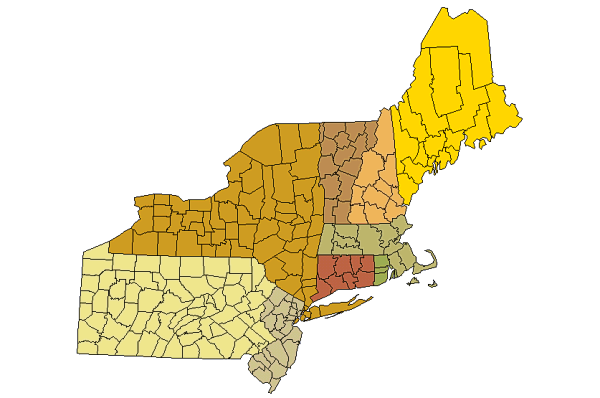
This is a polygon GIS layer background of the U.S. states counties bordering the Long Island Sound study area.
Purpose:
The purpose of this data layer is to provide a broad and general reference of the U.S. land mass surrounding the Long Island Sound study area. It provides a regional overview of the U.S. northeast region and contains all six New England states and 3 Mid-Atlantic states.
Supplemental_Information:
This data layer is a subset of a data layer provided by Environmental Systems Research Institute, Inc (ESRI). Though its coastline is very coarse, it provides a general reference for the individual U.S. lands surrounding the Long Island Sound study area. It has been edited from the original ESRI data set to eliminate several of the census attributes contained in the original dataset table. The user wishing the full, unedited dataset should contact ESRI or refer to the data provided by ESRI with their software installations. Additionally, since the coastline is very coarse, overlaying the medium resolution data layer, cst27, to this data set shows a number of errors in the accuracy of the coastline in this data layer. It is used and included here as a simple and quck way to provide a visual of the US land body for the ArcView project views.
Time_Period_of_Content:
Time_Period_Information:
Single_Date/Time:
Calendar_Date: 20000718
Currentness_Reference: Publication Date
Status:
Progress: Complete
Maintenance_and_Update_Frequency: None planned
Spatial_Domain:
Bounding_Coordinates:
West_Bounding_Coordinate: -81.2807
East_Bounding_Coordinate: -66.6017
North_Bounding_Coordinate: 47.4264
South_Bounding_Coordinate: 38.7281
Keywords:
Theme:
Theme_Keyword_Thesaurus: General
Theme_Keyword: U.S. Geological Survey
Theme_Keyword: USGS
Theme_Keyword: Coastal and Marine Geology Team
Theme_Keyword: Coastal and Marine Geology Program
Theme_Keyword: Woods Hole Field Center
Theme_Keyword: Connecticut Department of Environmental Protection
Theme_Keyword: ArcView
Theme_Keyword: arcview
Theme_Keyword: shapefile
Theme_Keyword: polygons
Theme_Keyword: counties
Theme_Keyword: northeast states
Theme_Keyword: mid-atlantic
Theme_Keyword: new england
Theme_Keyword: ESRI
Theme_Keyword: Environmental Systems Resources Institute, Inc.
Place:
Place_Keyword_Thesaurus: General
Place_Keyword: Long Island Sound
Place_Keyword: Connecticut
Place_Keyword: New York
Place_Keyword: Maine
Place_Keyword: New Hampshire
Place_Keyword: Vermont
Place_Keyword: Massachusetts
Place_Keyword: Rhode Island
Place_Keyword: New Jersey
Place_Keyword: Pennsylvania
Place_Keyword: New England
Place_Keyword: Mid-Atlantic
Access_Constraints: None
Use_Constraints:
Although this derived data set and its lineage dataset have been used by the USGS, no warranty, expressed or implied, is made by the USGS as to the accuracy of the data and/or related materials. The act of distribution shall not constitute any such warranty, and no responsibility is assumed by the USGS in the use of these data or related materials.
Point_of_Contact:
Contact_Information:
Contact_Organization_Primary:
Contact_Organization: U. S. Geological Survey
Contact_Person: Valerie Paskevich
Contact_Position: Computer Specialist
Contact_Address:
Address_Type: mailing and physical address
Address: 384 Woods Hole Road
City: Woods Hole
State_or_Province: MA
Postal_Code: 02543-1598
Country: USA
Contact_Voice_Telephone: (508) 548-8700 x2281
Contact_Electronic_Mail_Address: vpaskevich@usgs.gov
Browse_Graphic:
Browse_Graphic_File_Name: counties.gif
Browse_Graphic_File_Description: GIF
Browse_Graphic_File_Type:
image showing the extent of the GIS layer and the counties of the U.S. states that comprise the nestates data layer.
Native_Data_Set_Environment:
ArcView version 3.2 shapefile format - lissound\data\esri\counties.shp

Data_Quality_Information:
Logical_Consistency_Report:
No additional checks for topological consistency were performed on this data set.
Completeness_Report: none
Lineage:
Source_Information:
Source_Citation:
Citation_Information:
Originator: Environmental Systems Research Institute, Inc.(comp.)
Publication_Date: Unknown
Publication_Time: Unknown
Title: ESRI counties shapefile
Geospatial_Data_Presentation_Form: map
Online_Linkage: <http://www.esri.com>
Type_of_Source_Media: CD-ROM
Source_Time_Period_of_Content:
Time_Period_Information:
Single_Date/Time:
Calendar_Date: 20000813
Source_Currentness_Reference: final revision
Source_Citation_Abbreviation: counties.shp
Source_Contribution:
The ArcView shapefile, counties.shp, provided by ESRI with their software distribution was used to create the nestate data layer for use with the Long Island Sound study project views.
Process_Step:
Process_Description:
The counties.shp file was projected from geographic to UTM zone 18, WGS84 spheroid.
Source_Used_Citation_Abbreviation: counties.dbf
Source_Used_Citation_Abbreviation: counties.shp
Source_Used_Citation_Abbreviation: counties.shx
Process_Date: 20000718
Source_Produced_Citation_Abbreviation: countiesp.dbf
Source_Produced_Citation_Abbreviation: countiesp.shp
Source_Produced_Citation_Abbreviation: countiesp.shx
Process_Contact:
Contact_Information:
Contact_Person_Primary:
Contact_Person: Valerie Paskevich
Contact_Organization: U. S. Geological Survey
Contact_Position: Computer Specialist
Contact_Address:
Address_Type: mailing and physical address
Address: 384 Woods Hole Road
City: Woods Hole
State_or_Province: MA
Postal_Code: 02543-1598
Country: USA
Contact_Voice_Telephone: (508) 548-8700 x2281
Contact_Facsimile_Telephone: (508) 457-2310
Contact_Electronic_Mail_Address: vpaskevich@usgs.gov
Process_Step:
Process_Description:
The projected shapefile, countiesp, was edited to delete the unwanted state polygons.
Source_Used_Citation_Abbreviation: countiesp.dbf
Source_Used_Citation_Abbreviation: countiesp.shp
Source_Used_Citation_Abbreviation: countiesp.shx
Process_Date: 20000718
Source_Produced_Citation_Abbreviation: counties.dbf
Source_Produced_Citation_Abbreviation: counties.shp
Source_Produced_Citation_Abbreviation: counties.shx
Process_Contact:
Contact_Information:
Contact_Person_Primary:
Contact_Person: Valerie Paskevich
Contact_Organization: U. S. Geological Survey
Contact_Position: Computer Specialist
Contact_Address:
Address_Type: mailing and physical address
Address: 384 Woods Hole Road
City: Woods Hole
State_or_Province: MA
Postal_Code: 02543-1598
Country: USA
Contact_Voice_Telephone: (508) 548-8700 x2281
Contact_Facsimile_Telephone: (508) 457-2310
Contact_Electronic_Mail_Address: vpaskevich@usgs.gov
Process_Step:
Process_Description:
The counties.dbf file was edited to remove unwanted U.S. census data fields.
Source_Used_Citation_Abbreviation: counties.dbf
Source_Used_Citation_Abbreviation: counties.shp
Source_Used_Citation_Abbreviation: counties.shx
Process_Date: 20000813
Source_Produced_Citation_Abbreviation: counties.dbf
Source_Produced_Citation_Abbreviation: counties.shp
Source_Produced_Citation_Abbreviation: counties.shx
Process_Contact:
Contact_Information:
Contact_Person_Primary:
Contact_Person: Valerie Paskevich
Contact_Organization: U. S. Geological Survey
Contact_Position: Computer Specialist
Contact_Address:
Address_Type: mailing and physical address
Address: 384 Woods Hole Road
City: Woods Hole
State_or_Province: MA
Postal_Code: 02543-1598
Country: USA
Contact_Voice_Telephone: (508) 548-8700 x2281
Contact_Facsimile_Telephone: (508) 457-2310
Contact_Electronic_Mail_Address: vpaskevich@usgs.gov

Spatial_Data_Organization_Information:
Direct_Spatial_Reference_Method: Vector
Point_and_Vector_Object_Information:
SDTS_Terms_Description:
SDTS_Point_and_Vector_Object_Type: GT-polygon composed of chains
Point_and_Vector_Object_Count: 217

Spatial_Reference_Information:
Horizontal_Coordinate_System_Definition:
Planar:
Grid_Coordinate_System:
Grid_Coordinate_System_Name: Universal Transverse Mercator
Universal_Transverse_Mercator:
UTM_Zone_Number: 18
Transverse_Mercator:
Scale_Factor_at_Central_Meridian: 0.99960
Longitude_of_Central_Meridian: -075.000000
Latitude_of_Projection_Origin: +00.000000
False_Easting: 500000
False_Northing: 0
Planar_Coordinate_Information:
Planar_Coordinate_Encoding_Method: coordinate pair
Coordinate_Representation:
Abscissa_Resolution: 2000
Ordinate_Resolution: 1200
Planar_Distance_Units: Meters
Geodetic_Model:
Horizontal_Datum_Name: North American Datum of 1983
Ellipsoid_Name: WGS_1984
Semi-major_Axis: 6378137.00
Denominator_of_Flattening_Ratio: 0.003352810664747

Entity_and_Attribute_Information:
Detailed_Description:
Entity_Type:
Entity_Type_Label: counties.dbf
Entity_Type_Definition: Shapefile attribute file
Entity_Type_Definition_Source: ESRI
Attribute:
Attribute_Label: name
Attribute_Definition: County name
Attribute_Definition_Source: User Defined
Attribute_Domain_Values:
Unrepresentable_Domain: Character field
Attribute:
Attribute_Label: State_name
Attribute_Definition: Text field containing state name.
Attribute_Definition_Source: User Defined
Attribute_Domain_Values:
Unrepresentable_Domain: Character field
Attribute:
Attribute_Label: State_fips
Attribute_Definition: Numeric field containing State fips code.
Attribute_Definition_Source: User Defined
Attribute_Domain_Values:
Unrepresentable_Domain: Character field
Attribute:
Attribute_Label: Cnty_fips
Attribute_Definition: Numeric field containing County fips code.
Attribute_Definition_Source: User Defined
Attribute_Domain_Values:
Unrepresentable_Domain: Character field
Attribute:
Attribute_Label: fips
Attribute_Definition: Numeric field containing fips code.
Attribute_Definition_Source: User Defined
Attribute_Domain_Values:
Unrepresentable_Domain: Character field
Attribute:
Attribute_Label: Area
Attribute_Definition: Area of Polygon
Attribute_Definition_Source: Software computed
Attribute_Domain_Values:
Range_Domain:
Range_Domain_Minimum: 22.7889
Range_Domain_Maximum: 6807.1890
Attribute:
Attribute_Label: Pop1990
Attribute_Definition: U.S. 1990 census population value for state.
Attribute_Definition_Source: User Defined
Attribute_Domain_Values:
Range_Domain:
Range_Domain_Minimum: 4802
Range_Domain_Maximum: 2300664
Attribute:
Attribute_Label: Pop1999
Attribute_Definition: U.S. 1999 census population value for state.
Attribute_Definition_Source: User Defined
Attribute_Domain_Values:
Range_Domain:
Range_Domain_Minimum: 5024
Range_Domain_Maximum: 2267441

Distribution_Information:
Distributor:
Contact_Information:
Contact_Person_Primary:
Contact_Person: Valerie Paskevich
Contact_Organization: U. S. Geological Survey
Contact_Position: Computer Specialists
Contact_Address:
Address_Type: mailing and physical address
Address: 384 Woods Hole Road
City: Woods Hole
State_or_Province: MA
Postal_Code: 02543-1598
Country: USA
Contact_Voice_Telephone: (508) 548-8700 x2281
Contact_Facsimile_Telephone: (508) 457-2310
Contact_Electronic_Mail_Address: vpaskevich@usgs.gov
Resource_Description: Long Island Sound: counties.shp
Distribution_Liability:
Although this derived data set and it's lineage dataset have been used by the USGS, no warranty, expressed or implied, is made by the USGS as to the accuracy of the data and/or related materials. The act of distribution shall not constitute any such warranty, and no responsibility is assumed by the USGS in the use of these data or related materials.
Standard_Order_Process:
Digital_Form:
Digital_Transfer_Information:
Format_Name: ARCV
Format_Information_Content:
counties.dbf
counties.shp
counties.shx
counties.avl
counties.sbn
counties.sbx
counties.aih
counties.ain
File_Decompression_Technique: No compression applied
Transfer_Size: 162Kbytes
Digital_Transfer_Option:
Offline_Option:
Offline_Media: CD-ROM
Recording_Capacity:
Recording_Density: 650
Recording_Density_Units: Mbytes
Recording_Format: ISO 9600
Compatibility_Information:
The user must have a system with a CD-ROM capable of reading an ISO-9660 standard CD-ROM disk. To browse the information contained on this disk, the user must also have a current version of a WWW browser available.
Digital_Form:
Digital_Transfer_Information:
Format_Name: ARCV
Format_Information_Content:
The eight ArcView files (counties.dbf, counties.shp, counties.shx, counties.avl, counties.sbn, counties.sbx, counties.aih, counties.ain) comprising a general data layer showing the U.S. counties bordering the Long Island Sound study area.
File_Decompression_Technique: zip
Transfer_Size: 72Kbytes
Digital_Transfer_Option:
Offline_Option:
Offline_Media: CD-ROM
Recording_Capacity:
Recording_Density: 650
Recording_Density_Units: Mbytes
Recording_Format: ISO 9600
Compatibility_Information:
The user must have a system with a CD-ROM capable of reading an ISO-9660 standard CD-ROM disk. To browse the information contained on this disk, the user must also have a current version of a WWW browser available. The user must also have the software installed on their computer system capable to unzip the archived file.
Fees: none
Technical_Prerequisites:
This GIS layer is available in an ArcView shapefile format. Users must have ArcView 3.0 or later, or another GIS application capable of importing the data.
Available_Time_Period:
Time_Period_Information:
Single_Date/Time:
Calendar_Date: 20001101

Metadata_Reference_Information:
Metadata_Date: 20000813
Metadata_Contact:
Contact_Information:
Contact_Person_Primary:
Contact_Person: Valerie Paskevich
Contact_Organization: U. S. Geological Survey
Contact_Position: computer specialist
Contact_Address:
Address_Type: mailing and physical address
Address: 384 Woods Hole Road
City: Woods Hole
State_or_Province: MA
Postal_Code: 02543-1598
Country: USA
Contact_Voice_Telephone: (508) 548-8700 x2281
Contact_Facsimile_Telephone: (508) 457-2310
Contact_Electronic_Mail_Address: vpaskevich@usgs.gov
Metadata_Standard_Name: FGDC Content Standards for Digital Geospatial Metadata
Metadata_Standard_Version: FGDC-STD-001-1998
Metadata_Time_Convention: Local time
Metadata_Access_Constraints: None
Metadata_Use_Constraints: None

Generated by mp version 2.5.3 on Sun Aug 13 11:13:00 2000