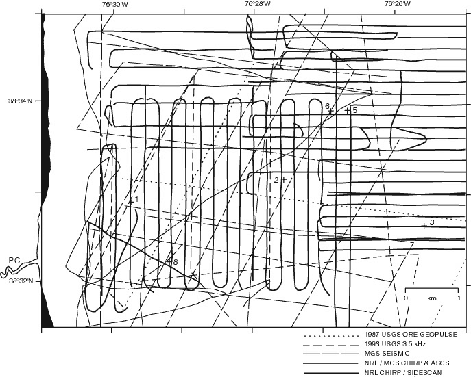
| Figure 2.3. Seismoacoustic track lines and core locations (crosses) in the Chesapeake Bay area east of Parkers Creek (PC). USGS/MGS data (dashed lines) include ORE Geopulse (0.3-5.0 Khz) and Datasonics 3.5 Khz data discussed in Colman and others (1989), as well as subsequent seismic data collected by one of us (J. Ha;ka, unpublished data). Edgetech 100 kHz sidescan and 2-15 kHz chirp sonar data collected along thick solid lines were used in Hagen and Vogt (1999). Thin solid lines include chirp profile and NRL ASCS (Acoustic Sediment Classification System) data reported in Vogt and others (1996). Dotted lines are unpublished 3.5 kHz data collected by S. Colman (personal communication, 1999). Formal core numbers are: 1, PRCK1; 2, PRCK2; 3, PRCK3; 5, MD99-22-5; 6, MD99-2206; and 8, MD99-2208. Area location shown in Figure 2.1. |
TO RETURN TO REPORT, CLOSE THIS WINDOW.
U.S. Department of Interior, U.S. Geological Survey
URL of this page: https://pubs.usgs.gov/openfile/of00-306/chapter2/fig2-3.html
Maintained by: Eastern Publications Group Web Team
Last modified: 03.28.01 (krw)