US Gulf of Mexico coastal states
displayed over study project
background extent.

U.S. Gulf of Mexico Coastal States

Metadata:


Identification_Information:
Citation:
Citation_Information:
Originator: Valerie Paskevich(comp.)
Publication_Date: 19990624
Title: U.S. Gulf of Mexico Coastal States
Larger_Work_Citation:
Citation_Information:
Originator: Defense Mapping Agency(comp.)
Publication_Date: Unknown
Publication_Time: Unknown
Title: World Data Bank II
Description:
Abstract:
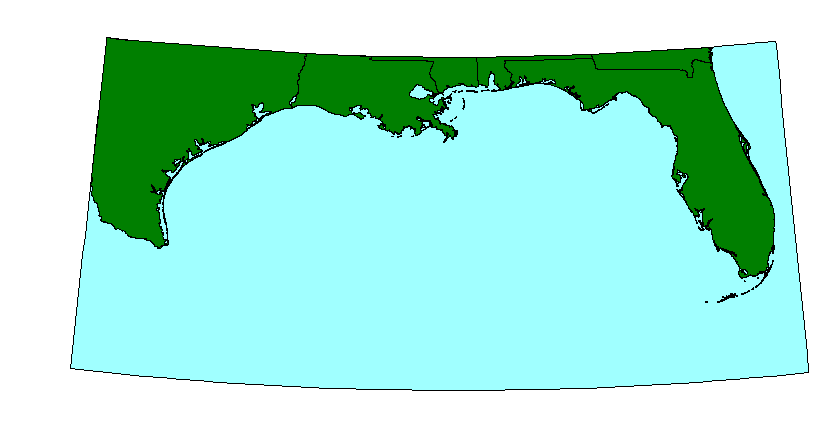
This ArcView GIS layer is intended as a backdrop to the Gulf of Mexico area map. It contains the U.S. state boundaries in a polyline format. The coastal states area has been cropped to provide an overview extent for the Gulf of Mexico region.
Purpose:
This GIS overlay is a component of the U. S. Geological Survey, Woods Hole Field Center's, Gulf of Mexico ArcView GIS database. The Gulf of Mexico GIS database is intended to organize and display USGS held data and provide on-line (WWW) access to the data and/or metadata.
Time_Period_of_Content:
Time_Period_Information:
Single_Date/Time:
Calendar_Date: 19981002
Currentness_Reference: Publication Date
Status:
Progress: Complete
Maintenance_and_Update_Frequency: None planned
Spatial_Domain:
Bounding_Coordinates:
West_Bounding_Coordinate: -99.5000
East_Bounding_Coordinate: -80.0283
North_Bounding_Coordinate: 31.1004
South_Bounding_Coordinate: 24.5382
Keywords:
Theme:
Theme_Keyword_Thesaurus: General
Theme_Keyword: U.S. Geological Survey
Theme_Keyword: Woods Hole Field Center
Theme_Keyword: Gulf of Mexico database
Theme_Keyword: U. S. state boundaries
Theme_Keyword: polyline
Theme_Keyword: vectors
Theme_Keyword: ArcView
Theme_Keyword: shapefile
Theme_Keyword: polygons
Place:
Place_Keyword_Thesaurus: General
Place_Keyword: Gulf of Mexico
Place_Keyword: Florida
Place_Keyword: Alabama
Place_Keyword: Louisiana
Place_Keyword: Mississippi
Place_Keyword: Texas
Place_Keyword: Georgia
Access_Constraints: None
Use_Constraints: None
Point_of_Contact:
Contact_Information:
Contact_Organization_Primary:
Contact_Organization: U. S. Geological Survey
Contact_Person: Valerie Paskevich
Contact_Position: Computer Specialist
Contact_Address:
Address_Type: mailing and physical address
Address: 384 Woods Hole Road
City: Woods Hole
State_or_Province: MA
Postal_Code: 02532
Country: USA
Contact_Voice_Telephone: (508) 548-8700 x2281
Contact_Facsimile_Telephone: (508) 457-2310
Contact_Electronic_Mail_Address: vpaskevich@usgs.gov
Hours_of_Service: M-Thu 6:30am-3:30pm; Fri 6:30am-10:30am
Browse_Graphic:
Browse_Graphic_File_Name: usa.gif
Browse_Graphic_File_Description: GIF
Browse_Graphic_File_Type:
image showing the extent of the U.S coastal states of Gulf of Mexico as utilized in the ArcView project file
Native_Data_Set_Environment: ESRI Shapefile format; ArcView version 3.0b; data/misc/usa.shp

Data_Quality_Information:
Attribute_Accuracy:
Attribute_Accuracy_Report: none
Logical_Consistency_Report:
none No additional checks for topological consistency were performed on this data set.
Completeness_Report: none
Lineage:
Source_Information:
Source_Citation:
Citation_Information:
Originator: U. S. Defense Mapping Agency(comp.)
Publication_Date: Unknown
Publication_Time: Unknown
Title: World Data Bank II coastline
Edition: U. S. Defense Mapping Agency
Source_Scale_Denominator: 2000000
Type_of_Source_Media: magnetic tape
Source_Time_Period_of_Content:
Time_Period_Information:
Single_Date/Time:
Calendar_Date: 19981005
Source_Currentness_Reference: Publication Date
Source_Citation_Abbreviation: WDBII
Source_Contribution:
The World Data Bank II political boundary information (state, coastline and international boundaries) were used to generate a vector dataset for the United States Gulf of Mexico coastal state boundaries.
Process_Step:
Process_Description:
The World Data Bank II coastline information has been stored in a format for use with the U.S. Geological Survey's MAPGEN prorgam. The vector latitude/longitude coordinates were extracted from from the Mapgen file with the area coordinates of -99.5, 31.1 and -79.5, 22.5. This retrieval was done for the U. S. state boundaries, coastline and international boundaries creating three ASCII files. The three individual files were combined to create one ASCII data file.
Source_Used_Citation_Abbreviation: WDBII
Source_Used_Citation_Abbreviation: MAPGEN coast files
Process_Date: 19981002
Source_Produced_Citation_Abbreviation: usstates.txt
Process_Contact:
Contact_Information:
Contact_Person_Primary:
Contact_Person: Valerie Paskevich
Contact_Organization: U. S. Geological Survey
Contact_Position: Computer Specialist
Contact_Address:
Address_Type: mailing and physical address
Address: 384 Woods Hole Road
City: Woods Hole
State_or_Province: MA
Postal_Code: 02543
Country: USA
Contact_Voice_Telephone: (508) 548-8700 x2281
Contact_Facsimile_Telephone: (508) 457-2310
Contact_Electronic_Mail_Address: vpaskevich@usgs.gov
Process_Step:
Process_Description:
The ASCII file generated from the MAPGEN coast files were imported to PCI Remote Sensing Software's Imageworks program. The vector information was then checked for digitizing errors using PCI's Imageworks. Errors found from digitizing overshoots and undershoots in the original digitizing were corrected. All polygons were checked for closure. The corrected segment was exported in the ARC export format (usstates.e00) with the nodes recorded as latitude/longitude coordinates in decimal degrees.
Source_Used_Citation_Abbreviation: usstates.txt
Process_Date: 19980928
Source_Produced_Citation_Abbreviation: usstates.e00
Process_Contact:
Contact_Information:
Contact_Person_Primary:
Contact_Person: Valerie Paskevich
Contact_Organization: U. S. Geological Survey
Contact_Position: Computer Specialist
Contact_Address:
Address_Type: mailing and physical address
Address: 384 Woods Hole Road
City: Woods Hole
State_or_Province: MA
Postal_Code: 02543
Country: USA
Contact_Voice_Telephone: (508) 548-8700 x2281
Contact_Facsimile_Telephone: (508) 457-2310
Contact_Electronic_Mail_Address: vpaskevich@usgs.gov
Process_Step:
Process_Description:
The ARC export file, usstates.e00, was imported to ARC as coverage usstates. No clean was applied to the dataset as it has been verified clean in the previous processing steps. The ARC polygon coverage was created and a new field, state, was added to the attribute table. Polygons were grouped together and the table field was updated by identifing the state name in the added field.
Source_Used_Citation_Abbreviation: usstates.e00
Process_Date: 19981005
Source_Produced_Citation_Abbreviation: usa.pat
Process_Contact:
Contact_Information:
Contact_Person_Primary:
Contact_Person: Valerie Paskevich
Contact_Organization: U. S. Geological Survey
Contact_Position: Computer Specialist
Contact_Address:
Address_Type: mailing and physical address
Address: 384 Woods Hole Road
City: Woods Hole
State_or_Province: MA
Postal_Code: 02543
Country: USA
Contact_Voice_Telephone: (508) 548-8700 x2281
Contact_Facsimile_Telephone: (508) 457-2310
Contact_Electronic_Mail_Address: vpaskevich@usgs.gov
Process_Step:
Process_Description:
The ARC polygon coverage, usa.pat, was exported as an ArcView shapefile, usa.
Source_Used_Citation_Abbreviation: usa.pat
Process_Date: 19981002
Source_Produced_Citation_Abbreviation: usa.shp
Source_Produced_Citation_Abbreviation: usa.dbf
Source_Produced_Citation_Abbreviation: usa.shx
Process_Contact:
Contact_Information:
Contact_Person_Primary:
Contact_Person: Valerie Paskevich
Contact_Organization: U. S. Geological Survey
Contact_Position: Computer Specialist
Contact_Address:
Address_Type: mailing and physical address
Address: 384 Woods Hole Road
City: Woods Hole
State_or_Province: MA
Postal_Code: 02543
Country: USA
Contact_Voice_Telephone: (508) 548-8700 x2281
Contact_Facsimile_Telephone: (508) 457-2310
Contact_Electronic_Mail_Address: vpaskevich@usgs.gov
Process_Step:
Process_Description:
The ArcView shapefile, usstates, was brought into ArcView for final viewing and verification. No further editting or changes were needed. This is the final file created for this overlay/theme.
Source_Used_Citation_Abbreviation: usa.shp
Source_Used_Citation_Abbreviation: usa.dbf
Source_Used_Citation_Abbreviation: usa.shx
Process_Date: 19981002
Source_Produced_Citation_Abbreviation: usa.shp
Source_Produced_Citation_Abbreviation: usa.dbf
Source_Produced_Citation_Abbreviation: usa.shx
Process_Contact:
Contact_Information:
Contact_Person_Primary:
Contact_Person: Valerie Paskevich
Contact_Organization: U. S. Geological Survey
Contact_Position: Computer Specialist
Contact_Address:
Address_Type: mailing and physical address
Address: 384 Woods Hole Road
City: Woods Hole
State_or_Province: MA
Postal_Code: 02543
Country: USA
Contact_Voice_Telephone: (508) 548-8700 x2281
Contact_Facsimile_Telephone: (508) 457-2310
Contact_Electronic_Mail_Address: vpaskevich@usgs.gov

Spatial_Data_Organization_Information:
Direct_Spatial_Reference_Method: Vector
Point_and_Vector_Object_Information:
SDTS_Terms_Description:
SDTS_Point_and_Vector_Object_Type: GT-polygon composed of chains
Point_and_Vector_Object_Count: 121

Spatial_Reference_Information:
Horizontal_Coordinate_System_Definition:
Geographic:
Latitude_Resolution: .005
Longitude_Resolution: .005
Geographic_Coordinate_Units: Decimal degrees
Geodetic_Model:
Horizontal_Datum_Name: North American Datum of 1927
Ellipsoid_Name: Clarke 1866
Semi-major_Axis: 6378206.4
Denominator_of_Flattening_Ratio: 294.98

Entity_and_Attribute_Information:
Detailed_Description:
Entity_Type:
Entity_Type_Label: usstates.dbf
Entity_Type_Definition: Shapefile Attribute Table
Entity_Type_Definition_Source: None
Attribute:
Attribute_Label: Area
Attribute_Definition: Total computed area of shapefile.
Attribute_Definition_Source: Software computed
Attribute_Domain_Values:
Range_Domain:
Range_Domain_Minimum: 0.000
Range_Domain_Maximum: 18.119
Attribute:
Attribute_Label: Perimeter
Attribute_Definition: Total computed perimeter of shapefile
Attribute_Definition_Source: Software computed
Attribute_Domain_Values:
Range_Domain:
Range_Domain_Minimum: 0.010
Range_Domain_Maximum: 43.622
Attribute:
Attribute_Label: Usa_
Attribute_Definition:
Carried over from the ArcInfo attribute USA#. USA# is an ArcInfo internal control parameter and has no applicable relevance to the use of the data.
Attribute_Definition_Source: User Defined
Attribute_Domain_Values:
Range_Domain:
Range_Domain_Minimum: 2
Range_Domain_Maximum: 122
Attribute:
Attribute_Label: Usa_id
Attribute_Definition:
Carried over from the ArcInfo attribute USA_ID. USA_ID is an ArcInfo internal control parameter and has no applicable relevance to the use of the data.
Attribute_Definition_Source: User Defined
Attribute_Domain_Values:
Range_Domain:
Range_Domain_Minimum: 1
Range_Domain_Maximum: 121
Attribute:
Attribute_Label: State
Attribute_Definition:
Character string identifying polygon affiliation with state name.  The field contains one of the following items:
  • Alabama
  • Florida
  • Georgia
  • Louisiana
  • Mississippi
  • Texas
  • Attribute_Definition_Source: User Defined
    Attribute_Domain_Values:
    Unrepresentable_Domain: Character field

    Distribution_Information:
    Distributor:
    Contact_Information:
    Contact_Person_Primary:
    Contact_Person: Valerie Paskevich
    Contact_Organization: U.S. Geological Survey
    Contact_Position: Computer Specialist
    Contact_Address:
    Address_Type: mailing and physical address
    Address: 384 Woods Hole Road
    City: Woods Hole
    State_or_Province: MA
    Postal_Code: 02543-1598
    Country: USA
    Contact_Voice_Telephone: (508) 548-8700 x2281
    Contact_Facsimile_Telephone: (508) 457-2310
    Contact_Electronic_Mail_Address: vpaskevich@usgs.gov
    Resource_Description: Gulf of Mexico: usa.shp
    Distribution_Liability:
    Although this derived data set and it's lineage dataset have been used by the USGS, no warranty, expressed or implied, is made by the USGS as to the accuracy of the data and/or related materials. The act of distribution shall not constitute any such warranty, and no responsibility is assumed by the USGS in the use of these data or related materials.
    Standard_Order_Process:
    Digital_Form:
    Digital_Transfer_Information:
    Format_Name: ARCV
    Format_Information_Content:
    usa.dbf usa.shp usa.shx
    File_Decompression_Technique: No compression applied
    Transfer_Size: 425Kbytes
    Digital_Transfer_Option:
    Offline_Option:
    Offline_Media: CD-ROM
    Recording_Capacity:
    Recording_Density: 650
    Recording_Density_Units: Mbytes
    Recording_Format: ISO 9600
    Compatibility_Information:
    The user must have a system with a CD-ROM capable of reading an ISO-9660 standard CD-ROM disk. To browse the information contained on this disk, the user must also have a current version of WWW browser available.
    Digital_Form:
    Digital_Transfer_Information:
    Format_Name: ARCV
    Format_Information_Content:
    The three ArcView shapefiles (usa.dbf, usa.shp, usa.shx) that contain the U.S. coastal states used in the ArcView project files.
    File_Decompression_Technique: zip
    Transfer_Size: 155Kbytes
    Digital_Transfer_Option:
    Offline_Option:
    Offline_Media: CD-ROM
    Recording_Capacity:
    Recording_Density: 650
    Recording_Density_Units: Mbytes
    Recording_Format: ISO 9600
    Compatibility_Information:
    The user must have a system with a CD-ROM capable of reading an ISO-9660 standard CD-ROM disk. To browse the information contained on this disk, the user must also have a current version of WWW browser available. The user must also have the software installed on their computer system capable to unzip the archived file.
    Fees: none
    Technical_Prerequisites:
    The US Gulf of Mexico coastal states are available in an ArcView shapefile format. The user must have ESRI's ArcView 3.0 or greater software to read and process the data file. In lieu of Arcview, the user may utilize another GIS application package capable of importing the data.

    Metadata_Reference_Information:
    Metadata_Date: 20000428
    Metadata_Contact:
    Contact_Information:
    Contact_Person_Primary:
    Contact_Person: Valerie Paskevich
    Contact_Organization: U. S. Geological Survey
    Contact_Position: Computer Specialist
    Contact_Address:
    Address_Type: mailing and physical address
    Address: 384 Woods Hole Rd.
    City: Woods Hole
    State_or_Province: MA
    Postal_Code: 02543-1598
    Country: USA
    Contact_Voice_Telephone: (508) 5488700 x2281
    Contact_Facsimile_Telephone: (508) 457-2310
    Contact_Electronic_Mail_Address: vpaskevich@usgs.gov
    Metadata_Standard_Name: FGDC Content Standards for Digital Geospatial Metadata
    Metadata_Standard_Version: FGDC-STD-001-1998
    Metadata_Time_Convention: Local time
    Metadata_Access_Constraints: None
    Metadata_Use_Constraints: None

    Generated by mp version 2.5.3 on Fri Apr 28 09:26:24 2000