 Abstract Abstract
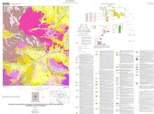
This data set maps and describes the geology of the Porcupine Wash 7.5 minute quadrangle, Riverside County, southern California. The quadrangle, situated in Joshua Tree National Park in the eastern Transverse Ranges physiographic and structural province, encompasses parts of the Hexie Mountains, Cottonwood Mountains, northern Eagle Mountains, and south flank of Pinto Basin. It is underlain by a basement terrane comprising Proterozoic metamorphic rocks, Mesozoic plutonic rocks, and Mesozoic and Mesozoic or Cenozoic hypabyssal dikes. The basement terrane is capped by a widespread Tertiary erosion surface preserved in remnants in the Eagle and Cottonwood Mountains and buried beneath Cenozoic deposits in Pinto Basin. Locally, Miocene basalt overlies the erosion surface. A sequence of at least three Quaternary pediments is planed into the north piedmont of the Eagle and Hexie Mountains, each in turn overlain by successively younger residual and alluvial deposits. The Tertiary erosion surface is deformed and broken by north-northwest-trending, high-angle, dip-slip faults and an east-west trending system of high-angle dip- and left-slip faults. East-west trending faults are younger than and perhaps in part coeval with faults of the northwest-trending set. The Porcupine Wash database was created using ARCVIEW and ARC/INFO, which are geographical information system (GIS) software products of Envronmental Systems Research Institute (ESRI). The database consists of the following items: (1) a map coverage showing faults and geologic contacts and units, (2) a separate coverage showing dikes, (3) a coverage showing structural data, (4) a scanned topographic base at a scale of 1:24,000, and (5) attribute tables for geologic units (polygons and regions), contacts (arcs), and site-specific data (points). The database, accompanied by a pamphlet file and this metadata file, also includes the following graphic and text products: (1) A portable document file (.pdf) containing a navigable graphic of the geologic map on a 1:24,000 topographic base. The map is accompanied by a marginal explanation consisting of a Description of Map and Database Units (DMU), a Correlation of Map and Database Units (CMU), and a key to point-and line-symbols. (2) Separate .pdf files of the DMU and CMU, individually. (3) A PostScript graphic-file containing the geologic map on a 1:24,000 topographic base accompanied by the marginal explanation. (4) A pamphlet that describes the database and how to access it. Within the database, geologic contacts , faults, and dikes are represented as lines (arcs), geologic units as polygons and regions, and site-specific data as points. Polygon, arc, and point attribute tables (.pat, .aat, and .pat, respectively) uniquely identify each geologic datum and link it to other tables (.rel) that provide more detailed geologic information.
|
First posted March 14, 2001
Database files
Files for Viewing and Plotting
Learn more about the Porcupine Wash dataset and its contents
Visit the GeoScience Node of the National Spatial Data Clearinghouse to find other geologic-map datasets in southern California or elsewhere in the Nation.
Part or all of this report is presented in Portable Document Format (PDF). For best results viewing and printing PDF documents, it is recommended that you download the documents to your computer and open them with Adobe Reader. PDF documents opened from your browser may not display or print as intended. Download the latest version of Adobe Reader, free of charge.
|

