 Abstract Abstract
A marine K-T boundary interval has been identified throughout the Badlands National Park region of South Dakota. Data from marine sediments suggest that deposits from two asteroid impacts (one close, one far away) may be preserved in the Badlands. These impact-generated deposits may represent late Maestrichtian events or possibly the terminal K-T event. Interpretation is supported by paleontological correlation, sequence stratigraphy, magnetostratigraphy, and strontium isotope geochronology. This research is founded on nearly a decade of NPS approved field work in Badlands National Park and a foundation of previously published data and interpretations.
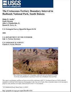
The K-T boundary occurs within or near the base of a stratigraphic interval referred to as the "Interior Zone." We interpret the stratigraphy of the Interior Zone as a series of distinct, recognizable lithologic members and units from oldest to youngest, an upper weathered interval of the Elk Butte Member of the Pierre Shale (early late Maestrichtian), a complete (albeit condensed) interval of Fox Hill Formation, a pedogenically altered K-T Boundary "Disturbed Zone," and a generally unresolved sequence of marine to marginal marine units ranging in age from possibly latest Maestrichtian to late Paleocene (the "Yellow Mounds"), that underlie a basal red clay unit (the late Eocene overbank channel facies of the Chamberlain Pass Formation at the base of the White River Group). Within this sequence is a series of unconformities that all display some degree of subaerial weathering and erosion. The dating of marine fossils above and below these unconformities are in line with generally accepted global sea-level changes recognized for the late Campanian through early Eocene. Within the greater framework of regional geology, these findings support that the Western Interior Seaway and subsequent Cannonball Seaway were dependently linked to the changing base-level controlled by sea-level of the global ocean through the Gulf of Mexico and possibly the Arctic Ocean. The variation of facies preserved in Late Cretaceous strata in the Badlands National Park area were in part controlled by local or regional tectonic blocks that were either rising or sinking contemporaneous with deposition.
|
First posted February 15, 2001
Part or all of this report is presented in Portable Document Format (PDF). For best results viewing and printing PDF documents, it is recommended that you download the documents to your computer and open them with Adobe Reader. PDF documents opened from your browser may not display or print as intended. Download the latest version of Adobe Reader, free of charge.
|

