 Introduction
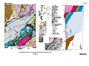
The Dixonville 7.5 minute quadrangle is situated near the edge of two major geologic and tectonic provinces the northernmost Klamath Mountains and the southeastern part of the Oregon Coast Ranges (Figure 1). Rocks of the Klamath Mountains province that lie within the study area include ultramafic, mafic, intermediate and siliceous igneous types (Diller, 1898, Ramp, 1972, Ryberg, 1984). Similar rock associations that lie to the southwest yield Late Jurassic and earliest Cretaceous radiometric ages (Dott, 1965, Saleeby, et al., 1982, Hotz, 1971, Harper and Wright, 1984). These rocks, which are part of the Western Klamath terrane (Western Jurassic belt of (Irwin, 1964), are considered to have formed within an extensive volcanic arc and rifted arc complex (Harper and Wright, 1984) that lay along western North America during the Late Jurassic (Garcia, 1979, Garcia, 1982, Saleeby, et al., 1982, Ryberg, 1984). Imbricate thrust faulting and collapse of the arc during the Nevadan orogeny, which ranged in age between about 150 to 145 Ma in the Klamath region (Coleman, 1972, Saleeby, et al., 1982, Harper and Wright, 1984) was syntectonic with, or closely followed by deposition of the volcano-lithic clastic rocks of the Myrtle Group. The Myrtle Group consists of Upper Jurassic and Lower to middle Cretaceous turbidity and mass flow deposits considered to be either arc basin and/or post-orogenic flysh basins that were syntectonic with the waning phases of arc collapse (Imlay et al., 1959, Ryberg, 1984, Garcia, 1982, Roure.and Blanchet, 1983). The intermediate and mafic igneous rocks of the Rogue arc and the pre-Nevadan sedimentary cover (the Galice Formation, (Garcia, 1979) are intruded by siliceous and intermediate plutonic rocks principally of quartz diorite and granodiorite composition (Dott, 1965, Saleeby, et al., 1982, Garcia, 1982, Harper and Wright, 1984). The plutonic rocks are locally tectonized into amphibolite, gneiss, banded gneiss and augen gneiss. Similar metamorphic rocks have yielded metamorphic ages of 165 to 150 Ma (Coleman, 1972, Hotz, 1971, Saleeby, et al., 1982, Coleman and Lanphere, 1991).
The Jurassic arc rocks and sedimentary cover occur as a tectonic outlier in this region (Figure 2) as they are bound to the northwest and southeast by melange, broken formation and semi-schists of the Dothan Formation and Dothan Formation(?) that are considered part of a late Mesozoic accretion complex (Ramp, 1972, Blake, et al., 1985). The plutonism that accompanied arc formation and tectonic collapse of the arc does not intrude the structurally underlying Dothan Formation, indicating major fault displacements since the Early Cretaceous. Semischistose and schistose rocks of the accretion complex have yielded metamorphic ages of around 125-140 Ma where they have been studied to the southwest (Coleman and Lanphere, 1971, Dott, 1965, Coleman, 1972). These rocks were unroofed and unconformably overlain by marine deposits by late early Eocene time (Baldwin, 1974).
The early Tertiary history of this region is controversial. The most recent interpretation is that during the Paleocene and early Eocene the convergent margin was undergoing transtension or forearc extension as suggested by the voluminous extrusion of pillow basalt and related dike complexes (Wells, et al., 1984, Snavely, 1987). This episode was followed shortly by thrust and strike-slip faulting in the late early Eocene (Ryberg, 1984).
During the Eocene, the Mesozoic convergent margin association of arc, clastic basin, and accretion complex was partly unroofed and faulted against early Cenozoic rocks of the Oregon Coast Ranges (Ramp, 1972, Baldwin, 1974, Champ, 1969, Ryberg, 1984). Faults that are typical of this period of deformation include high-angle reverse faults with a very strong component of strike-slip displacement characterized by a low-angle rake of striae. Thrust and oblique-slip faults are ubiquitous in early Tertiary rocks to the northwest (Ryberg, 1984, Niem and Niem, 1990).
The late Mesozoic and early Cenozoic arc and forearc rocks are unconformably overlain to the east by the late Eocene and younger, mainly continental fluvial deposits and pyroclastic flows of the Cascade arc (Peck, et al., 1964, Baldwin, 1974, Walker and MacLeod, 1991). Minor fossiliferous shallow marine sandstone is locally present. The volcanic sequence consists of a homoclinal section of about 1 to 2 kilometers of andesitic to rhyolitic flows and ash flow tuff. The section is gently east-tilted and is slightly disrupted by NE trending faults with apparent normal separation.

