Open-File Report 01-242
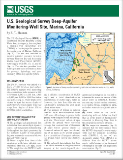
The U.S. Geological Survey (USGS), in cooperation with the Monterey County Water Resource Agency, has completed a multiple-well monitoring site (DMW1) in the deep-aquifer system in the coastal area of Marina, California (fig. 1). The site was installed to monitor potential seawater intrusion between Monterey Bay and the nearby Marina Coast Water District (MCWD) water-supply wells No. 10, 11, and 12 (fig. 1). The site also provides local water agencies basic information about the geology, hydrology, and geochemistry of the deep-aquifer system. |
For additional information contact: Part or all of this report is presented in Portable Document Format (PDF); the latest version of Adobe Reader or similar software is required to view it. Download the latest version of Adobe Reader, free of charge. |
Hanson, R.T., 2001, U.S. Geological Survey Deep-Aquifer Monitoring-Well Site, Marina, California: U.S. Geological Survey Open-File Report 01-242, 2 p.

![]() U.S. Department of the Interior |
U.S. Geological Survey
U.S. Department of the Interior |
U.S. Geological Survey
URL: http://pubsdata.usgs.gov/pubs/of/2001/242/index.html
Page Contact Information: GS Pubs Web Contact
Page Last Modified: Wednesday, 07-Dec-2016 18:56:41 EST
