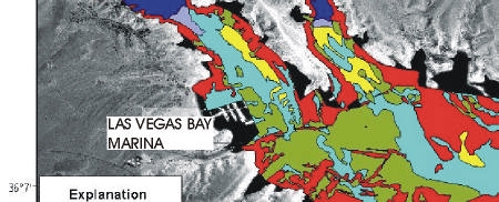
Figure 4. Interpretation of sidescan sonar image shown in Figure 3. Six different surficial geologic units were identified on the sidescan imagery and their distributions are shown here.