U. S. Geological Survey Open-File Report 01-154
|
|
|
U. S. Geological Survey Open-File Report 01-154 |
SEA-FLOOR PHOTOGRAPHY FROM THE CONTINENTAL MARGIN PROGRAM:A Pictorial Survey of Benthic Character and Habitats
|
|
Photographic Gallery of personnel, facilities and equipment from the Continental Margin Program |
|
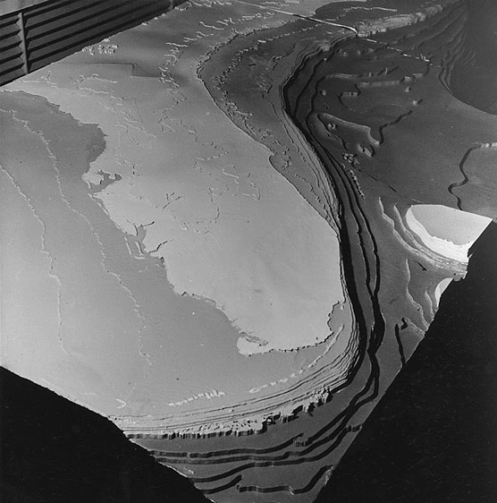
This unique model of the Atlantic Continental Shelf and Slope was built during 1964 by a Woods Hole Oceanographic Institution - U.S. Geological Survey team. The model is patterned after a three-sheet map series of the shelf and slope, also prepared by the WHOI - USGS group, at the scale of 1 inch equals 16 miles. With vertical scale exaggerated, this view shows the ocean bottom contours around Florida and should prove to be a valuable reference tool to marine geologists and oceanographers. |