Link to USGS home page
Coastal and Marine Geology Program

TRACKLINE MAP

Home | Read Me | Cruise Activity | Navigation Data | Seismic Data | USGS Software | Seismic Unix | Disclaimer


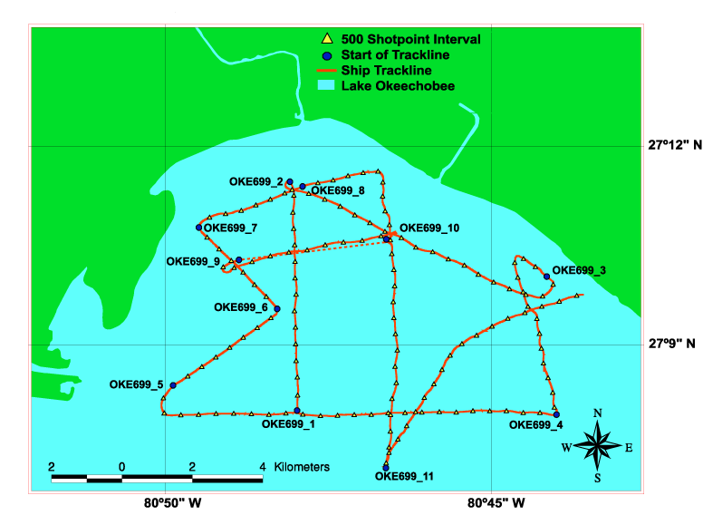
USGS Cruise 99ASR01,
Lake Okeechobee, Florida,
June 29 - 30, 1999
This map contains hotlinks to the seismic profiles -- Click on the trackline name and a GIF image of the seismic profile for that trackline will appear.
USGS Cruise 99ASR01 Trackline Map, Lake Okeechobee, FloridaOKE699_11OKE699_4OKE699_3OKE699_10OKE699_8OKE699_7OKE699_6OKE699_9OKE699_1OKE699_5OKE699_2

NOTE: Dashed line indicates that no data was collected.


Home | Read Me | Cruise Activity | Navigation Data | Seismic Data | USGS Software | Seismic Unix | Disclaimer


[an error occurred while processing this directive]