 |
|
|
||||
| Open-File Report 01–0364 |
Open-File Report 01-364
|
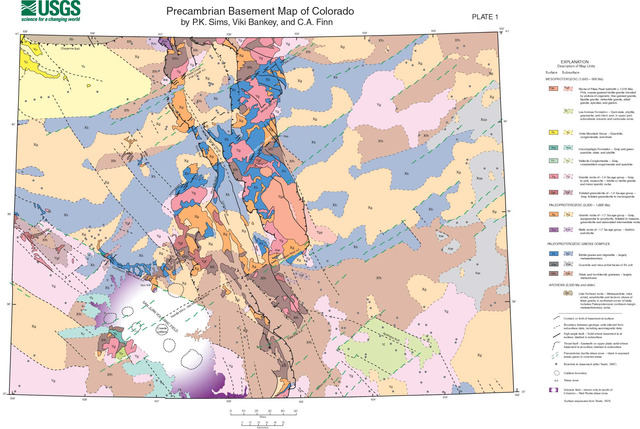
Click on map to view larger version |
Click on map to view larger version |
 |
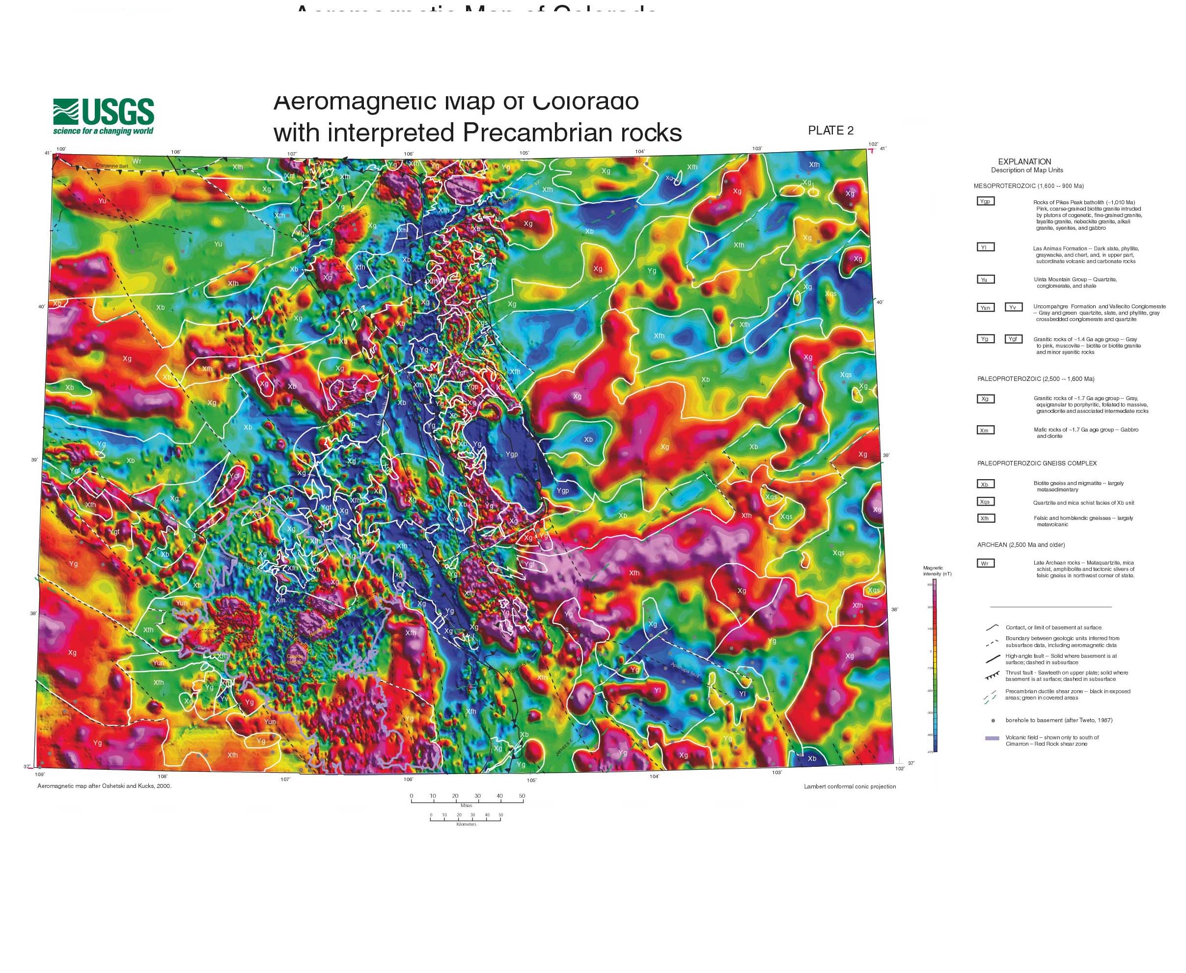 |
Information on magnetic data processing is given in the original publication by Oshetski and Kucks, 2000. We reduced these observed magnetic data to the pole, a technique that attempts to account for the inclination of the Earth's magnetic field. Its principal effect is to shift magnetic anomalies to positions directly above their sources. We used a declination of 11 degrees and inclination of 66 degrees for the entire state in the reduction-to-pole calculation.
1Denver, Colorado
This report is preliminary and has not been reviewed for conformity with U.S. Geological Survey editorial standards or with the North American Stratigraphic Code. Any use of trade, firm, or product names is for descriptive purposes only and does not imply endorsement by the U.S. Government.
Page Maintained by Viki Bankey; email: viki@usgs.gov
| AccessibilityFOIAPrivacyPolicies and Notices | |
| |
|