 |
| Open-File Report 01–0474: Superseded by OF 2004-1085 |
Compilation of Post-Wildfire Runoff-Event Data from the Western United States
by Erica R. Bigio, Susan H. Cannon
2001
This report has been superseded by OF
2004–1085
This report is preliminary and has not been reviewed for
conformity with U.S. Geological Survey editorial standards or with the
North American Stratigraphic Code.
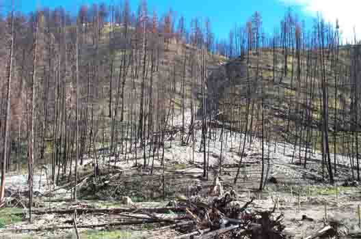
This report is a compilation of peak-discharge and event-volume
data measured from basins which have been burned by wildfire in the western
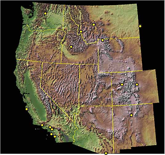
U.S. Each point on the map represents a location for which measurements of
post-fire runoff (either debris flow or flood) have been published or reported
by personal communication. This database was created as a tool for land managers
who need measurements of post-wildfire runoff events in order to make appropriate
mitigation decisions.
You may click on the locations on the map to learn more
about each runoff event. The information is organized in the database by state,
and includes the location and year of the fire, measures of basin area and
relief ratio, the percent of the basin burned by fire, any reported rainfall
information, and the reference for each event. When not reported in the original
reference, we measured the basin area and relief ratio from 7.5' topographic
quadrangle maps. The relief ratio was calculated as the maximum relief from
basin mouth to the drainage divide divided by the length of the longest stream
channel extended to the drainage divide. We also list the flow process (debris
flow, mudflow, flood, etc) as reported by the authors. The bibliography can
be linked by clicking on the reference author's name or source heading in the
table. You may also access the database or bibliography directly
through these links.
We plan to update the database periodically as more information
becomes available. If you have data you would like to contribute, contact Sue
Cannon at cannon@usgs.gov.
Landslides
Geologic Hazards Team
