 |
|
|
||||
| MD-DE-DC Water Science Center |
U.S. GEOLOGICAL SURVEY
Open-File Report 01-209
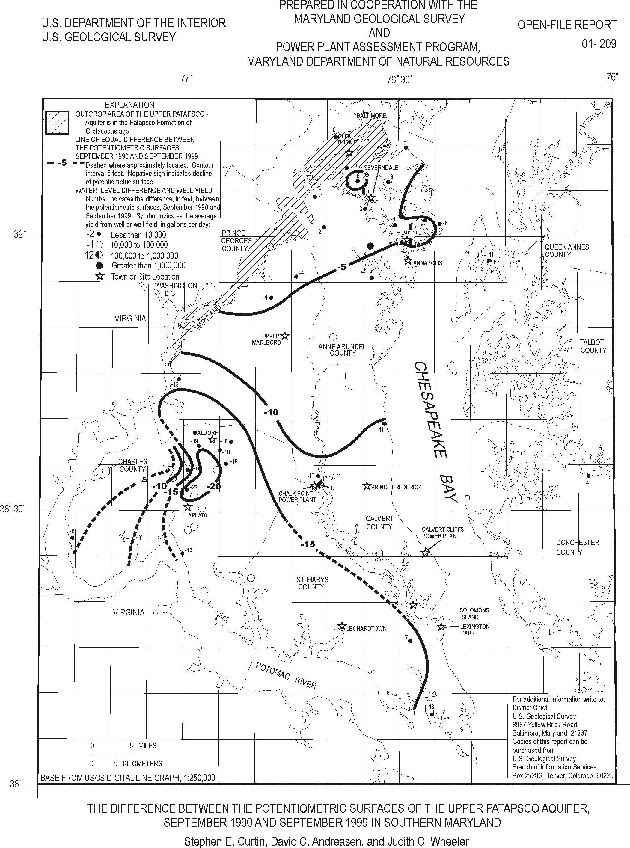
This report presents a map showing the change in the potentiometric surface of the Upper Patapsco aquifer in the Upper Patapsco Formation of Cretaceous age in Southern Maryland for September 1990 and September 1999. The map, based on water?level measurements in 37 wells, shows that the potentiometric surface during the 9- year period ranged from a decline of 1 foot in the northernmost part of the study area, which is near the outcrop of the aquifer, to a decline of 22 feet at LaPlata, which is near the southwesternmost part of the study area.
This report is available as a gif file (Large Print Size) and in Portable Document Format (PDF)(8½ x 11 printed size).
View the OFR 01-209 report in GIF (186 KB)
View the OFR 01-209 report in PDF (103 KB)
If you do not have the Adobe Acrobat PDF Reader, it is available for free download from Adobe Systems Incorporated.
Document Accessibility: Adobe Systems Incorporated has information about PDFs and the visually impaired. This information provides tools to help make PDF files accessible. These tools and the accessible reader may be obtained free from Adobe at Adobe Access.
For more information about USGS activities in Maryland, Delaware, and the District of Columbia, contact:
Director
MD-DE-DC Water Science Center
U.S. Geological Survey
8987 Yellow Brick Road
Baltimore, MD 21237
Telephone: (410) 238-4200
Fax: (410) 238-4210
or access the USGS Water Resources of Maryland, Delaware, and District of Columbia home page at: http://md.water.usgs.gov/.
| AccessibilityFOIAPrivacyPolicies and Notices | |
 |
|