Coastal & Marine Geology Program
>
Center for Coastal & Regional Marine Studies
> Environmental Atlas of Lake Pontchartrain
«
Return to Previous Page
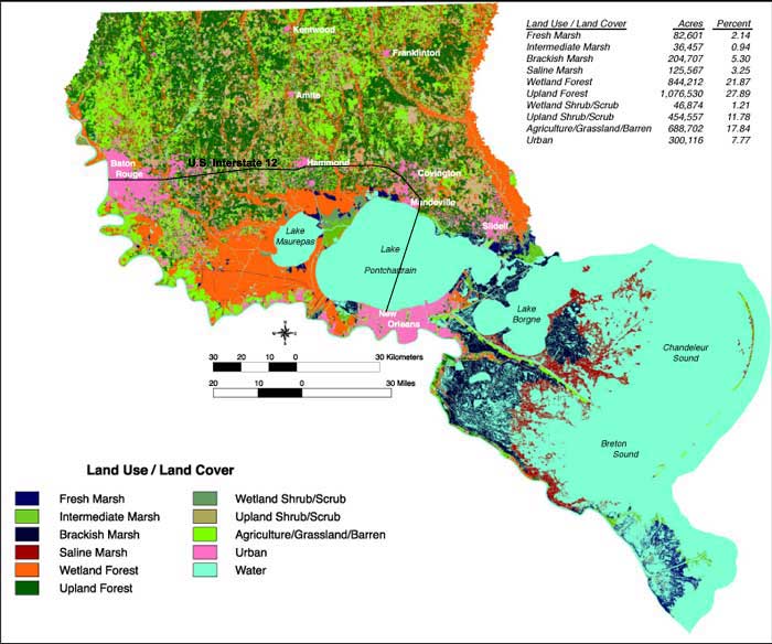
Figure 1:
Land use/land cover map generated by the Louisiana Gap Project for the LPB.
«
Return to Previous Page
Coastal & Marine Geology Program
>
Center for Coastal & Regional Marine Studies
> Environmental Atlas of Lake Pontchartrain
email
Feedback
[an error occurred while processing this directive]