Coastal & Marine Geology Program
>
Center for Coastal & Regional Marine Studies
> Environmental Atlas of Lake Pontchartrain
«
Return to Previous Page
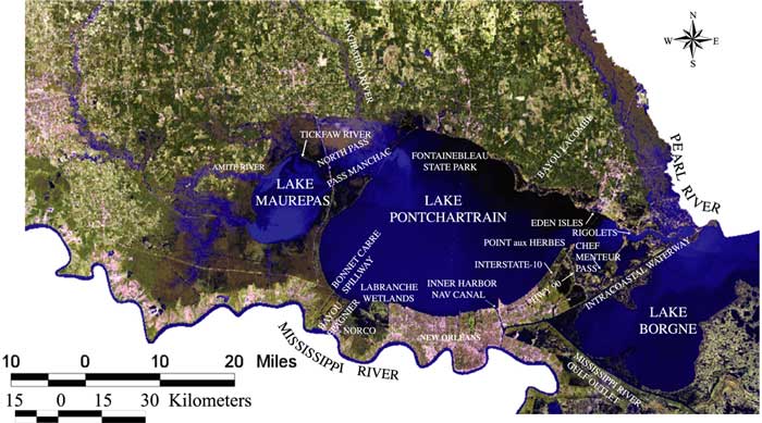
Figure 5:
Satellite image labeled with the areas and rivers that are mentioned throughout the section for the Marginal Deltaic Basin.
«
Return to Previous Page
Coastal & Marine Geology Program
>
Center for Coastal & Regional Marine Studies
> Environmental Atlas of Lake Pontchartrain
email
Feedback
[an error occurred while processing this directive]