
Oceanographic Observations, Hudson Shelf Valley, U.S. Geological Survey Open-File Report 02-217
Site Characterization
|
Maps of each mooring site showing the mooring location, contoured bathymetry and backscatter intensity derived from the multibeam surveys, and sample locations are included in this report (Figure 13A, Figure 14A, Figure 15A, Figure 16A, Figure 17A,
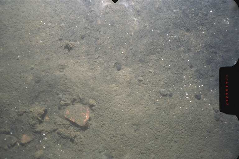
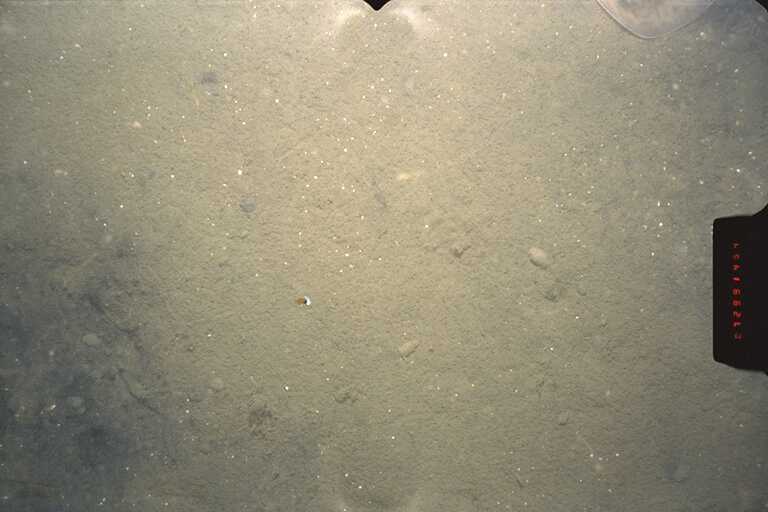
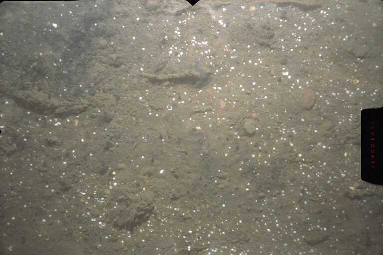
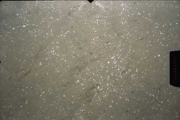
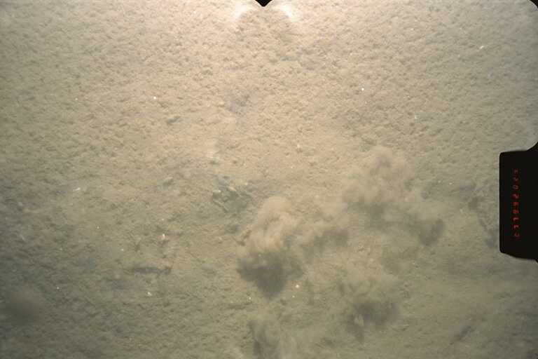
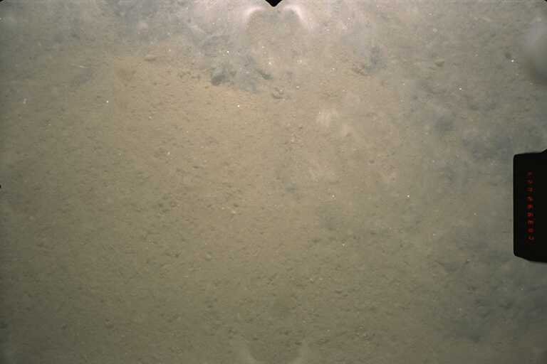
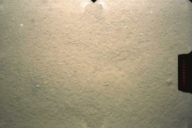
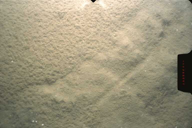
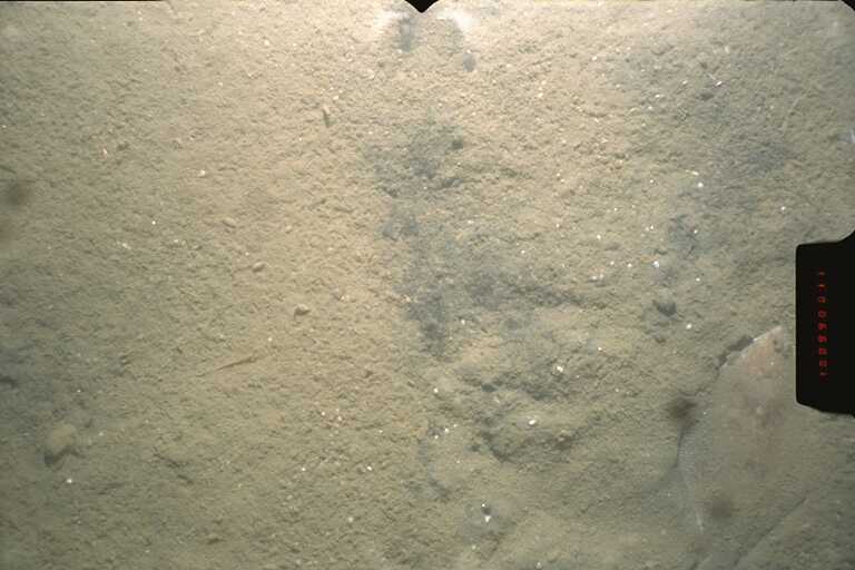
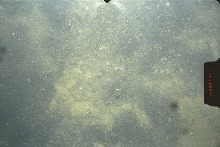
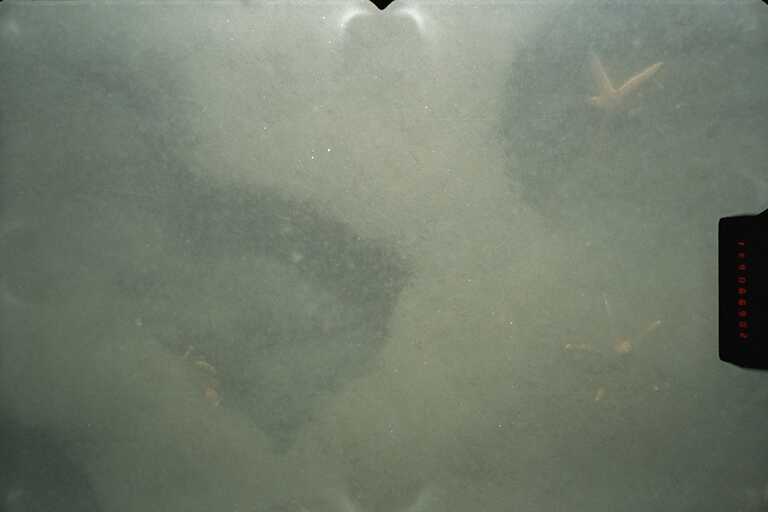
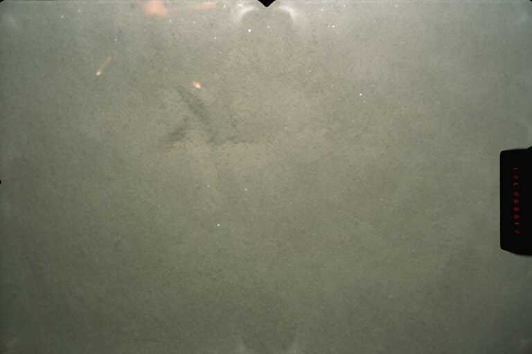
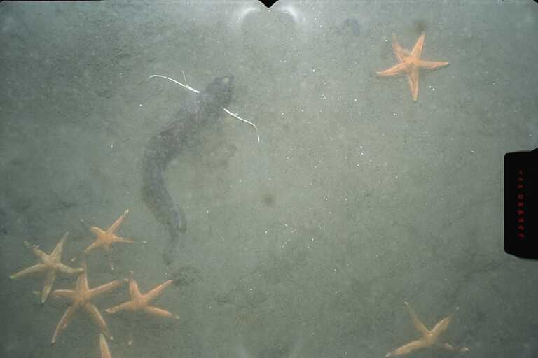
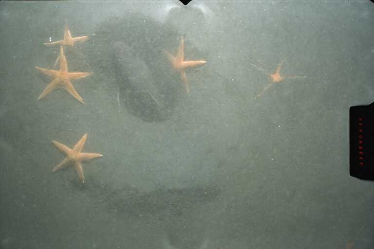
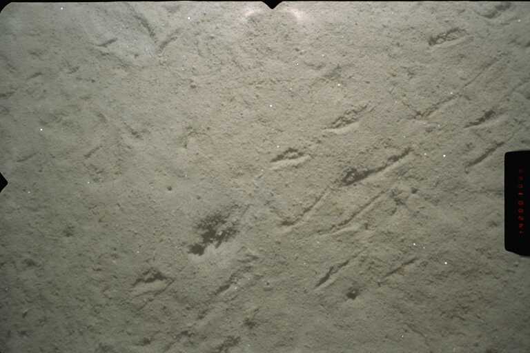
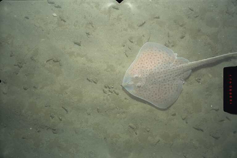
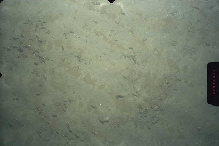
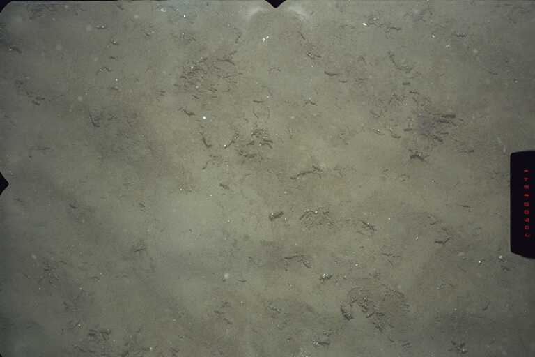
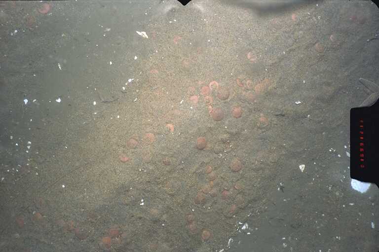
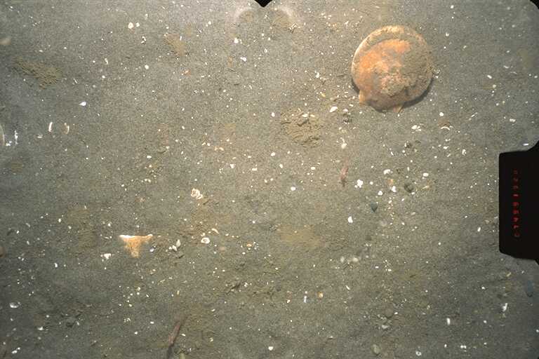
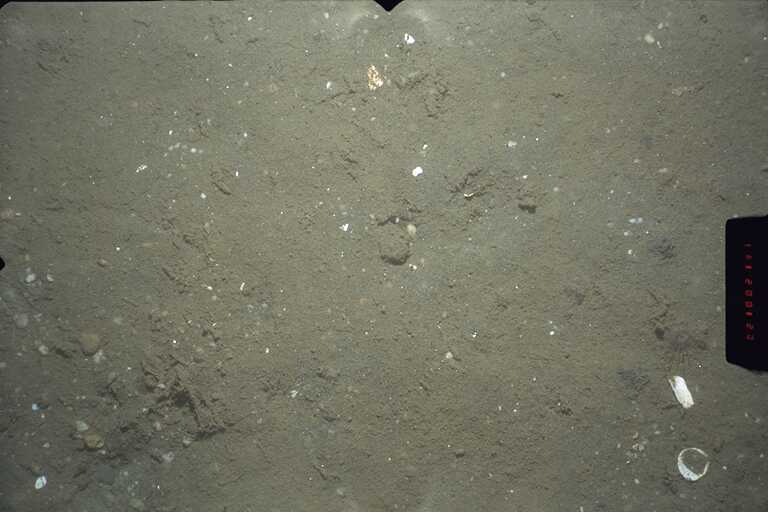
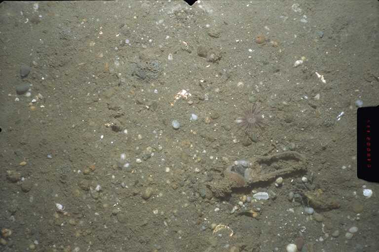
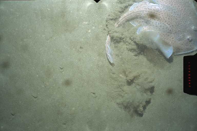
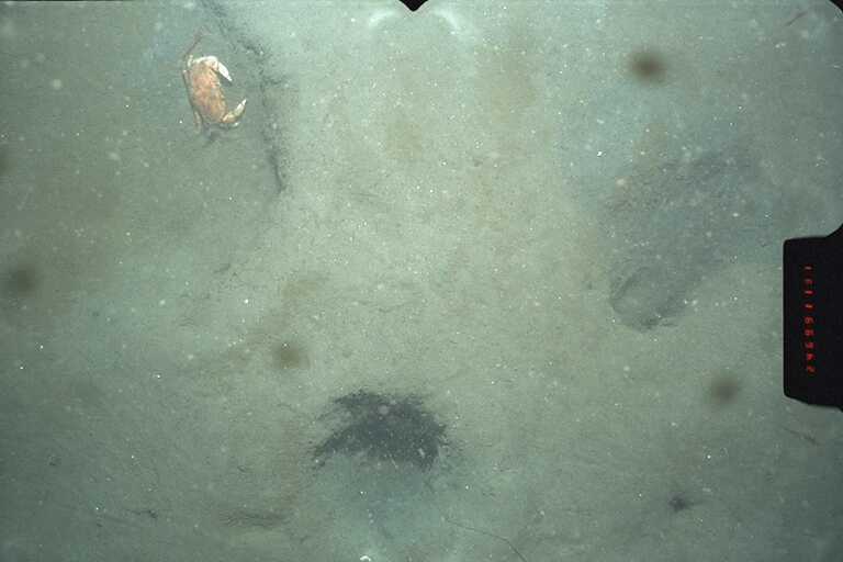
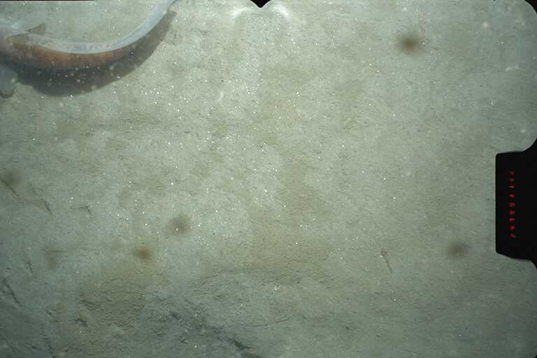
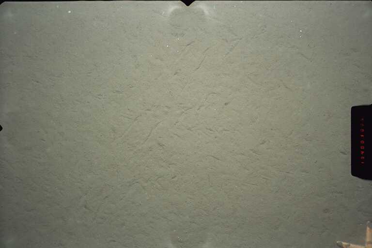
Figure 18A). Backscatter intensity is a measure of surficial sediment texture and bottom roughness. Generally, high backscatter intensity is associated with rock or coarse-grained sediment, and low backscatter intensity characterizes finer grained sediments. Direct observations, using bottom photography or video and sampling techniques such as grab sampling or coring, are needed to verify interpretations of the backscatter intensity. In the images of the mooring sites included in this report, the backscatter intensity is represented by a suite of eight colors ranging from blue, which represents low intensity (fine-grained sediments), to red, which represents high intensity (rock outcrops and coarse-grained sediments). These data are draped over a shaded relief image created by vertically exaggerating the topography four times and then artificially illuminating the relief by a light source positioned 45 degrees above the horizon from the north. The resulting image displays light and dark intensities within each color band that result from a feature's position with respect to the light source. For example, north-facing slopes, receiving strong illumination, show as a light intensity within a color band, whereas south-facing slopes, being in shadow, show as a dark intensity within a color band. The shaded relief image accentuates small features that could not be effectively shown by contours alone at this scale. Some features in the backscatter image are artifacts of data collection and environmental conditions. They include small highs and lows and unnatural-looking features and patterns oriented parallel or perpendicular to survey tracklines (the trackline orientation can be determined by the direction of the faint striping in the images). Site ASite A is located in Christiansen Basin just to the north of the beginning of the Hudson Shelf Valley at a water depth of about 38 m (Figure 1, Figure 13A). The backscatter intensity in the immediate vicinity of Site A is low, but there are individual high backscatter intensity features within a few hundred meters that are interpreted to be dumps of anthropogenic material (see Butman and others (1998) and (2002)). The sediment texture is sand or silty sand (see Table of sediment texture at mooring sites), with the bulk of the sediment (44 to 73 percent) being very fine sand (-4 phi, 62.5 to 125 microns). The bottom photographs taken in December 1999 (see photographs 37580021 and 21620080) suggest a tranquil sea floor with a covering of brownish sediment that appears flocky and is marked by animal tracks. There are occasional burrows, animal tracks, shell fragments, and pebbles, but no suggestion of current scour. An underlying darker sediment is observed where the surface layer has been disturbed. The photographs taken in April 2000 (see photographs 32610054, 32610058 and 32610060) indicate an absence of the light fine material observed in the December photographs, and the presence of filamentous organic material and pebbles on the sediment surface. Site BSite B is located in the thalweg of the upper part of the Hudson Shelf valley, about 8.4 km south of site A, at a water depth of about 56 m (Figure 1, Figure 14A). The valley trends approximately north-south at this location. The water depth on the adjacent shelf to the east and west is about 32 m deep. The backscatter intensity at the mooring site is moderate, with lower backscatter intensity to the east and west. The sediment texture is sandy silty clay (in the area of lower backscatter intensity to the east) or sandy silt (see Table of sediment texture at mooring sites). The bottom photographs taken in December 1999 (see photographs 21620075, 21620069, 21620065, 21620062, 21620052 and 21620048) suggest a tranquil sea floor with a covering of brownish sediment that appears flocky, similar to the material at site A. An underlying darker sediment is observed where the surface layer has been disturbed. No photographs or bottom samples were obtained at site B in April 2000 because of rough weather. Site CSite C is located in the eastern side of the axis of the Hudson Shelf Valley, about 33 km down-valley from site B, at a water depth of about 71 m (Figure 1, Figure 15A). The valley trends approximately northwest-southeast at this location. The water depth on the adjacent shelf to the northeast and southwest is about 42 m deep. Site C is located on topographic high between two local topographic lows in the axis of the valley; the low about 5 km to the northwest is about 76 m deep, and low about 8 km to the southeast is about 87 m deep. The backscatter intensity at the mooring site is uniformly low. The sediment texture is silty sand (see Table of sediment texture at mooring sites), with about 50% of the sediment being very find sand (-4 phi, 62.5 to 125 microns). The bottom photographs taken in December 1999 (see photographs 37510047, 37510034, 37510027, and 37510020) show an extensively burrowed sea floor and numerous sea stars and hake. The visibility was low, consistent with the hydrographic section showing increased suspended sediments at this site. Bottom photographs taken in April 2000 (see photograph 32610043) show a more tranquil sea floor, brittle stars, and animal tracks in the surface sediments. Site DSite D is located on the continental shelf to the east of the Hudson Shelf Valley, about 16 km from the valley axis, at a water depth 27 m (Figure 1, Figure 16A). The backscatter intensity at the mooring site is low to moderate. The bathymetry slopes to about 30 m water depth in a local low about 800 m to the southeast; the backscatter intensity in the low is moderate. The sediment texture is sand (see Table of sediment texture at mooring sites), with most of the sediment being medium to fine sand (125 to 500 microns). The bottom photographs taken in December 1999 (see photographs 37510070 and 37510071) show degraded ripples with darker, perhaps organic material, in the ripple troughs. The bottom photographs taken in April 2000 (see photographs 32740004 and 32740005) are similar except there is no organic material in the toughs. Site ESite E is located on the continental shelf to the west of the Hudson Shelf Valley, about 6 km from the axis of the valley, at a water depth of 26 m (Figure 1, Figure 17A). The mooring is in a region of high backscatter intensity. Less than 100 m to the west is a sharp transition to and area of moderate backscatter intensity. The moderate backscatter intensity material forms a local topographic high, reaching 23 m water depth about 600 m to the west of the tripod location. The sediment in the area of high backscatter intensity near the tripod is composed of greater than 40% gravel (see Table of sediment texture at mooring sites, see station 2002). In the area of moderate backscatter intensity to the west of the tripod location, the sediment texture is sand (Table of sediment texture at mooring sites, see stations 1002, 1003, 1004 and 1007) with most of the sediment being medium and fine sand (125 to 500 microns). The bottom photographs obtained in December 1999 (see photographs, 37580037, 37580028, 37580027, 21620078) show a gravel pavement in the area of high backscatter intensity, and large ripples in the area of lower backscatter intensity to the west with numerous sand dollars. The photographs obtained in April 2000 (see photographs 32740019, 32740018, 32740016) just to the south of the tripod location show gravel. Site FSite F is located in the axis of the Hudson Shelf Valley, about 33 km down-valley from site C, at about 74 m water depth (Figure 1, Figure 18A). The valley axis trends nearly east-west at this location, broadening and changing orientation from northwest-southeast up-valley. The water depth on the adjacent shelf to the north and south is about 55 m. Site F is located on a topographic high between two local topographic lows in the axis of the valley; the deepest part of a low 5 km to the northwest is about 86 m deep, and the deepest part of a low 5.5 km to the east is about 84 m deep. The backscatter intensity is uniformly low surrounding the mooring location. The sediment texture is a silty sand with about 35% of the material in very fine sand (-4 phi, 62.5 to 125 microns). The bottom photographs obtained in December 1999 (see photographs 37510010, 37510007, 37510006) show a smooth bottom with occasional burrows. The bottom photographs obtained in April 2000 (see photograph 32610035) show a smooth bottom with animal tracks. |


To view files in PDF format, download free copy of Adobe Acrobat Reader (www.adobe.com/products/acrobat/alternate.html).
Title Page / Contents / Tables / Figures / Abbreviations / Introduction / Field Program / Observations / Instrumentation / Data Processing / Fouling / Mooring/Data File ID / Results / Digital Data / Acknowledgements / References / Matlab / Supplementary / Metadata
[an error occurred while processing this directive]