
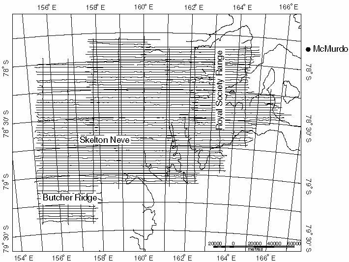
Flight lines flown for the TAMARA project during the 1997-1998 field season. About 14,100 line km of helicopter magnetic data, covering an area just a little less then 30,000 km2. One hundred twenty-five hours of helicopter time were used to complete the survey. The final data, in both point and grid format, are available to copy.
| USGS | Central Region Geology |
CICT | Geology | Search USGS |
| AccessibilityFOIAPrivacyPolicies and Notices | |
| |
|