
U.S. Geological Survey
Open-file Report 03-85
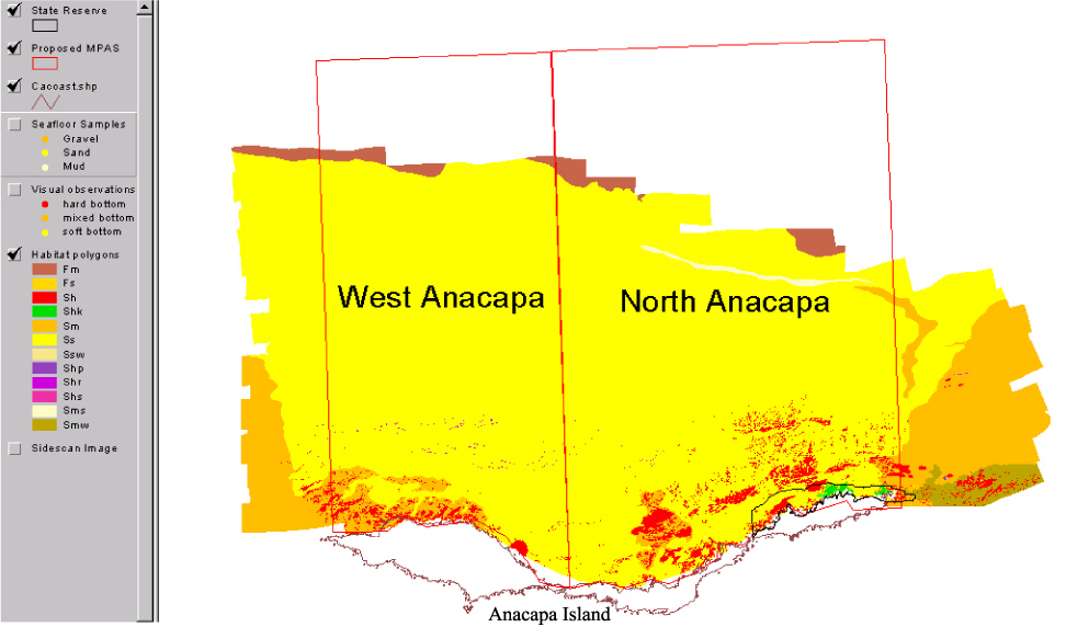
Nearshore Benthic Habitat GIS for the Channel Islands National Marine Sanctuary and Southern California State Fisheries Reserves Volume 1Habitat in the North Anacapa study area can be summarized as rocky from the shoreline to approximately 80 m water depth and sandy from 80 to 100 m water depths. |
|||||||||
 |
|||||||||
|
http://geopubs.wr.usgs.gov/open-file/of03-85/n_ana/nanhab.html
maintained by Carolyn Donlin
last modified 11 March 2003 (grc)
USGS Privacy Statement
| Disclaimer
| Feedback
| Accessibility
Department of the Interior U.S. Geological Survey Geologic Division Western Region Coastal & Marine Geology


