
U.S. Geological Survey
Open-file Report 03-85
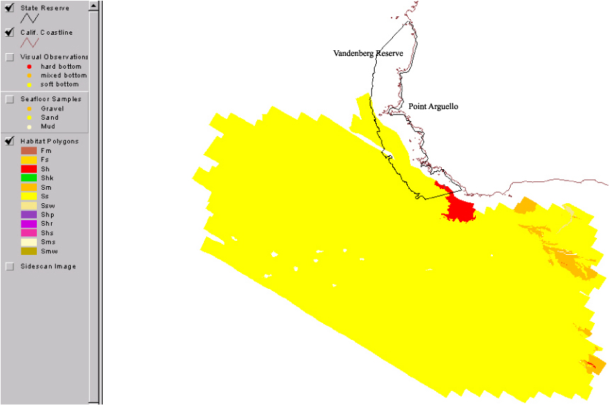
Nearshore Benthic Habitat GIS for the Channel Islands National Marine Sanctuary and Southern California State Fisheries Reserves Volume 1Habitat in the southern part of the Vandenberg reserve was mapped with sidescan sonar . Combined the sidescan data and diver observations suggest that the habitat within the reserve is predominantly sandy, with rocky areas restricted to extensions of onshore rock into the subtidal water. Outside the reserve, the habitat consists of some areas of rock in subtidal waters. We also observed carbonate mounds formed during petroleum seepage (code Shm). |
|||||||||
 |
|||||||||
|
http://geopubs.wr.usgs.gov/open-file/of03-85/s_van/svanhab.html
maintained by Carolyn Donlin
last modified 11 March 2003 (grc)
USGS Privacy Statement | Disclaimer | Feedback | Accessibility
Department of the Interior U.S. Geological Survey Geologic Division Western Region Coastal & Marine Geology


