 Introduction Introduction
Open-File Report 03-102 contains a digital geologic map database of the Bachelor Mountain 7.5’ quadrangle, Riverside County, California that includes:
- ARC/INFO (Environmental Systems Research Institute, http://www.esri.com) version 7.2.1
coverages of the various elements of the geologic map.
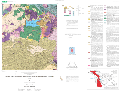
- A Postscript file to plot the geologic map on a topographic base, and containing a Correlation
of Map Units diagram (CMU), a Description of Map Units (DMU), and an index map.
- Portable Document Format (.pdf) files of:
This Readme; includes in Appendix I, data contained in bch_met.txt
The same graphic as plotted in 2 above. Test plots have not produced precise 1:24,000-
scale map sheets. Adobe Acrobat page size setting influences map scale.
The Correlation of Map Units and Description of Map Units is in the editorial format of USGS Geologic Investigations Series (I-series) maps but has not been edited to comply with I-map standards. Within the geologic map data package, map units are identified by standard geologic map criteria such as formationname, age, and lithology. Where known, grain size is indicated on the map by a subscripted letter or letters following the unit symbols as follows: lg, large boulders; b, boulder; g, gravel; a, arenaceous; s, silt; c, clay; e.g. Qyfa is a predominantly young alluvial fan deposit that is arenaceous. Multiple letters are used for more specific identification or for mixed units, e.g., Qfysa is a silty sand. In some cases, mixed units are indicated by a compound symbol; e.g., Qyf2sc.
Even though this is an Open-File Report and includes the standard USGS Open-File disclaimer, the report closely adheres to the stratigraphic nomenclature of the U.S. Geological Survey. Descriptions of units can be obtained by viewing or plotting the .pdf file (3b above) or plotting the postscript file (2 above). This Readme file describes the digital data, such as types and general contents of files making up the database, and includes information on how to extract and plot the map and accompanying graphic file. Metadata information can be accessed at http://geo-nsdi.er.usgs.gov/metadata/open-file/03-102 and is
included in Appendix I of this Readme.
|
First posted March 27, 2003
Part or all of this report is presented in Portable Document Format (PDF). For best results viewing and printing PDF documents, it is recommended that you download the documents to your computer and open them with Adobe Reader. PDF documents opened from your browser may not display or print as intended. Download the latest version of Adobe Reader, free of charge.
|

