Open-File Report 03-120
|
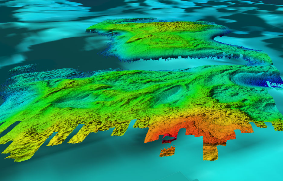
Figure 7.2 - Oblique view looking southeast over Ile Aux Gallet with Dahlia Shoal in background. The rougher relief (of cobbles and boulders or outcrop?) occurs in water depths less than 12-15m. Limestone outcrops are reported from Ile Aux Gallet underwater observations(Somers, 1968). In deeper water patches and re-entrants of smoother morphology indicate depositional sites (sand?). Distance across the bottom of image is about 2.1 km. |

![]() U.S. Department of the Interior |
U.S. Geological Survey
U.S. Department of the Interior |
U.S. Geological Survey
URL: http://pubsdata.usgs.gov/pubs/of/2003/0120/dahlia7_2.html
Page Contact Information: GS Pubs Web Contact
Page Last Modified: Wednesday, 02-Apr-2014 14:49:09 EDT
