|
 |
| U.S. Geological Survey
Open-File Report 03-001 |
|
|
EXTENT: GIS Project background and extent
|
Metadata also available as: FAQ - TEXT
Metadata:
- Identification_Information:
-
- Citation:
-
- Citation_Information:
-
- Originator: Valerie Paskevich
- Publication_Date: 2003
- Title: EXTENT: GIS Project background and extent
- Edition: 1.0
- Geospatial_Data_Presentation_Form: vector digital data
- Publication_Information:
-
- Publication_Place: Woods Hole Field Center, Woods Hole, MA
- Publisher: U. S. Geological Survey, Coastal and Marine Geology Program
- Online_Linkage: <http://pubs.usgs.gov/of/2003/of03-001/data/basemaps/boundaries/extent/extent.zip>
- Online_Linkage:
-
<http://pubs.usgs.gov/of/2003/of03-001/data/basemaps/boundaries/extent/extent.zip>
- Larger_Work_Citation:
-
- Citation_Information:
-
- Originator: L.J. Poppe
- Originator: V.F. Paskevich
- Originator: S.J. Williams
- Originator: M.E. Hastings
- Originator: J.T. Kelley
- Originator: D.F. Belknap
- Originator: L.G. Ward
- Originator: D.M. Fitzgerald
- Originator: P.F. Larsen
- Publication_Date: 2003
- Title:
-
Surficial Sediment Data from the Gulf of Maine, Georges Bank, and vicinity: a GIS Compilation
- Edition: 1.0
- Series_Information:
-
- Series_Name: Open-File Report
- Issue_Identification: 03-001
- Publication_Information:
-
- Publication_Place: Woods Hole Field Center, Woods Hole, MA
- Publisher: U. S. Geological Survey, Coastal and Marine Geology Program
- Other_Citation_Details:
-
Data is released via CD-ROM media. This digital publication may also be available via the web at pubs.usgs.gov
- Online_Linkage: <http://pubs.usgs.gov/of/2003/of03-001>
- Online_Linkage: <http://woodshole.er.usgs.gov/openfile/of03-001>
- Description:
-
- Abstract:
-
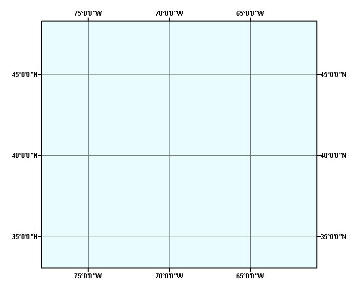
This data layer was created as a basemap data layer to define the project extent for the Gulf of Maine and Georges Bank surficial sediment GIS.
- Purpose:
-
This GIS data layer defined the project extent and was used to clip the miscellaneous basemap layers.
- Time_Period_of_Content:
-
- Time_Period_Information:
-
- Single_Date/Time:
-
- Calendar_Date: 20021101
- Currentness_Reference: publication date
- Status:
-
- Progress: Complete
- Maintenance_and_Update_Frequency: None planned
- Spatial_Domain:
-
- Bounding_Coordinates:
-
- West_Bounding_Coordinate: -77.877236
- East_Bounding_Coordinate: -60.905452
- North_Bounding_Coordinate: 48.277749
- South_Bounding_Coordinate: 33.054966
- Keywords:
-
- Theme:
-
- Theme_Keyword_Thesaurus: General
- Theme_Keyword: U.S. Geological Survey
- Theme_Keyword: USGS
- Theme_Keyword: Coastal and Marine Geology Program
- Theme_Keyword: CMGP
- Theme_Keyword: ArcView shapefile
- Theme_Keyword: polygon
- Theme_Keyword: GIS
- Theme_Keyword: Geographic Information System
- Theme_Keyword: project extent
- Theme_Keyword: Open-File Report 03-001
- Theme_Keyword: OFR 03-001
- Place:
-
- Place_Keyword_Thesaurus: General
- Place_Keyword: U.S. East Coast
- Access_Constraints: None
- Use_Constraints: None
- Point_of_Contact:
-
- Contact_Information:
-
- Contact_Person_Primary:
-
- Contact_Person: Valerie Paskevich
- Contact_Organization: U.S. Geological Survey
- Contact_Position: Information Technology Specialist
- Contact_Address:
-
- Address_Type: mailing and physical address
- Address: 384 Woods Hole Road
- City: Woods Hole
- State_or_Province: MA
- Postal_Code: 02543-1598
- Country: USA
- Contact_Voice_Telephone: (508) 548-8700 x2281
- Contact_Facsimile_Telephone: (508) 457-2310
- Contact_Electronic_Mail_Address: vpaskevich@usgs.gov
- Browse_Graphic:
-
- Browse_Graphic_File_Name: extent.gif
- Browse_Graphic_File_Description:
-
Image map showing extent and of data layer coverage used to define project extent.
- Browse_Graphic_File_Type: GIF
- Native_Data_Set_Environment:
-
Microsoft Windows 2000 Version 5.1 (Build 2600) ; ESRI ArcCatalog 8.2.0.700
- Data_Quality_Information:
-
- Lineage:
-
- Process_Step:
-
- Process_Description:
-
A simple graphic rectangle was drawn to define the GIS extent. The graphic was then converted to an ArcView shapefile using the Xtools extension.
- Source_Used_Citation_Abbreviation: graphic1
- Process_Date: 20021101
- Source_Produced_Citation_Abbreviation: extent.dbf
- Source_Produced_Citation_Abbreviation: extent.shp
- Source_Produced_Citation_Abbreviation: extent.shx
- Process_Contact:
-
- Contact_Information:
-
- Contact_Person_Primary:
-
- Contact_Person: Valerie Paskevich
- Contact_Organization: U.S. Geological Survey
- Contact_Position: Information Technology Specialist
- Contact_Address:
-
- Address_Type: mailing and physical address
- Address: 384 Woods Hole Road
- City: Woods Hole
- State_or_Province: MA
- Postal_Code: 02543-1598
- Country: USA
- Contact_Voice_Telephone: (508) 548-8700 x2281
- Contact_Facsimile_Telephone: (508) 457-2310
- Contact_Electronic_Mail_Address: vpaskevich@usgs.gov
- Spatial_Data_Organization_Information:
-
- Direct_Spatial_Reference_Method: Vector
- Point_and_Vector_Object_Information:
-
- SDTS_Terms_Description:
-
- SDTS_Point_and_Vector_Object_Type: G-polygon
- Point_and_Vector_Object_Count: 0
- Spatial_Reference_Information:
-
- Horizontal_Coordinate_System_Definition:
-
- Geographic:
-
- Latitude_Resolution: 0.0001
- Longitude_Resolution: 0.0001
- Geographic_Coordinate_Units: Decimal degrees
- Geodetic_Model:
-
- Horizontal_Datum_Name: North American Datum of 1983
- Ellipsoid_Name: Geodetic Reference System 80
- Semi-major_Axis: 6378137.000000
- Denominator_of_Flattening_Ratio: 298.257222
- Entity_and_Attribute_Information:
-
- Detailed_Description:
-
- Entity_Type:
-
- Entity_Type_Label: extent.dbf
- Entity_Type_Definition: Shapefile Attribute Table
- Entity_Type_Definition_Source: ESRI
- Attribute:
-
- Attribute_Label: FID
- Attribute_Definition: Internal feature number.
- Attribute_Definition_Source: ESRI
- Attribute_Domain_Values:
-
- Unrepresentable_Domain:
-
Sequential unique whole numbers that are automatically generated.
- Attribute:
-
- Attribute_Label: Shape
- Attribute_Definition: Feature geometry.
- Attribute_Definition_Source: ESRI
- Attribute_Domain_Values:
-
- Unrepresentable_Domain: Coordinates defining the features.
- Distribution_Information:
-
- Distributor:
-
- Contact_Information:
-
- Contact_Person_Primary:
-
- Contact_Person: Valerie Paskevich
- Contact_Organization: U.S. Geological Survey
- Contact_Position: Information Technology Specialist
- Contact_Address:
-
- Address_Type: mailing and physical address
- Address: 384 Woods Hole Road
- City: Woods Hole
- State_or_Province: MA
- Postal_Code: 02543-1598
- Country: USA
- Contact_Voice_Telephone: (508) 548-8700 x2281
- Contact_Facsimile_Telephone: (508) 457-2310
- Contact_Electronic_Mail_Address: vpaskevich@usgs.gov
- Resource_Description:
-
Downloadable Data; Regional Mapping of Surficial Sediments: Gulf of Maine and Georges Bank, Aggregates and Habitats Projects, extent.shp
- Distribution_Liability:
-
Although this data set has been used by the U.S. Geological Survey, no warranty, expressed or implied, is made by the USGS as to the accuracy of the data and/or related materials. The act of distribution shall not constitute any such warranty, and no responsibility is assumed by the USGS in the use of these data or related materials.
- Standard_Order_Process:
-
- Digital_Form:
-
- Digital_Transfer_Information:
-
- Format_Name: ArcView shapefile
- Format_Version_Number: 3.2
- Format_Specification: ESRI point shapefile
- Format_Information_Content:
-
Three files (extent.shp, extent.dbf, extent.shx) comprising the ArcView point shapefile components, 'prj' and 'avl' files, metadata text file and browse graphic.
- File_Decompression_Technique: zip
- Transfer_Size: 0.112
- Digital_Transfer_Option:
-
- Offline_Option:
-
- Offline_Media: CD-ROM
- Recording_Capacity:
-
- Recording_Density: 650
- Recording_Density_Units: Mbytes
- Compatibility_Information:
-
The user must have a computer system with a CD-ROM available. To browse the information contained on this CD-ROM, the user must have a current WWW browser available. The user must also have software installed on their computer to unzip the archived file.
- Technical_Prerequisites:
-
The data is available in ArcView shapefile format. The user must have ArcView 3.0 or greater software to read and process the data file. In lieu of ArcView, the user may utilize another GIS application package capable of importing data.
- Metadata_Reference_Information:
-
- Metadata_Date: 20030303
- Metadata_Contact:
-
- Contact_Information:
-
- Contact_Person_Primary:
-
- Contact_Person: Valerie Paskevich
- Contact_Organization: U.S. Geological Survey
- Contact_Position: Information Technology Specialist
- Contact_Address:
-
- Address_Type: mailing and physical address
- Address: 384 Woods Hole Road
- City: Woods Hole
- State_or_Province: MA
- Postal_Code: 02543-1598
- Country: USA
- Contact_Voice_Telephone: (508) 548-8700 x2281
- Contact_Facsimile_Telephone: (508) 457-2310
- Contact_Electronic_Mail_Address: vpaskevich@usgs.gov
- Metadata_Standard_Name: FGDC Content Standards for Digital Geospatial Metadata
- Metadata_Standard_Version: FGDC-STD-001-1998
- Metadata_Time_Convention: local time
- Metadata_Access_Constraints: None
- Metadata_Use_Constraints: None
Generated by mp version 2.7.3 on Mon Mar 03 10:07:50 2003
OFR03-001 Home | Introduction
| Nomenclature | Browse
Maps | Data Catalog | Data
Dictionary
[an error occurred while processing this directive]