USGS: science for a changing world - www.usgs.gov
Coastal and Marine Geology Program home - marine.usgs.gov
  U.S. Geological Survey Open-File Report 03-001

BROWSE THUMBNAIL IMAGE: Image showing extent and distribution of data layer coverage.

HYDROPLY: U.S. National Atlas Water Feature Areas


Metadata also available as: FAQ - TEXT

Metadata:


Identification_Information:
Citation:
Citation_Information:
Originator: Valerie Paskevich
Publication_Date: 2003
Title: HYDROPLY: U.S. National Atlas Water Feature Areas
Edition: 1.0
Geospatial_Data_Presentation_Form: vector digital data
Series_Information:
Publication_Information:
Publication_Place: Woods Hole Field Center, Woods Hole, MA
Publisher: U.S. Geological Survey, Coastal and Marine Geology Program
Online_Linkage:
<http://pubs.usgs.gov/of/2003/of03-001/data/basemaps/usa/water/hydroply.zip>
Online_Linkage:
<http://pubs.usgs.gov/of/2003/of03-001/data/basemaps/usa/water/hydroply.zip>
Larger_Work_Citation:
Citation_Information:
Originator: L.J. Poppe
Originator: V.F. Paskevich
Originator: S.J. Williams
Originator: M.E. Hastings
Originator: J.T. Kelley
Originator: D.F. Belknap
Originator: L.G. Ward
Originator: D.M. FitzGerald
Originator: P.F. Larsen
Publication_Date: 2003
Title:
Surficial Sediment Data from the Gulf of Maine, Georges Bank, and vicinity: a GIS Compilation
Edition: 1.0
Series_Information:
Series_Name: Open-File Report
Issue_Identification: 03-001
Publication_Information:
Publication_Place: Woods Hole Field Center, Woods Hole, MA
Publisher: U.S. Geological Survey, Coastal and Marine Geology Program
Online_Linkage: <http://pubs.usgs.gov/of/2003/of03-001>
Online_Linkage: <http://woodshole.er.usgs.gov/openfile/of03-001>
Description:
Abstract:
U.S. National Atlas Water Feature Areas represents the water feature areas (e.g., bays, glaciers, lakes, and swamps) of the United States.
Purpose:
U.S. National Atlas Water Feature Areas provides the water feature areas for geographic display and analysis at regional and national levels.
Supplemental_Information:
U.S. National Atlas Water Feature Areas (HYDROPLY) is an ESRI shapefile with polygon features. This is a subset of the original dataset. It has been clipped to the extent of the Gulf of Maine surficial sediment GIS project area.

Largest scale when displaying the data: 1:1,000,000.

Time_Period_of_Content:
Time_Period_Information:
Currentness_Reference:
ground condition: 1995-1999; 1972-1994; publication date: 1998, 1999
Status:
Progress: Complete
Maintenance_and_Update_Frequency: None planned
Spatial_Domain:
Bounding_Coordinates:
West_Bounding_Coordinate: -77.877236
East_Bounding_Coordinate: -66.885902
North_Bounding_Coordinate: 47.383904
South_Bounding_Coordinate: 33.887792
Keywords:
Theme:
Theme_Keyword_Thesaurus: General
Theme_Keyword: polygon
Theme_Keyword: hydrography
Theme_Keyword: water
Theme_Keyword: bays
Theme_Keyword: glaciers
Theme_Keyword: lakes
Theme_Keyword: reservoirs
Theme_Keyword: streams
Theme_Keyword: swamps
Theme_Keyword: inlandWaters
Theme_Keyword: U.S. Geological Survey
Theme_Keyword: USGS
Theme_Keyword: Coastal and Marine Geology Program
Theme_Keyword: CMGP
Theme_Keyword: Open-File Report 03-001
Theme_Keyword: OFR03-001
Place:
Place_Keyword_Thesaurus: General
Place_Keyword: United States
Place_Keyword: northeastern United States
Place_Keyword: Gulf of Maine
Place_Keyword: Eastern United States
Temporal:
Temporal_Keyword_Thesaurus: None
Temporal_Keyword: 1995-1999
Temporal_Keyword: 1972–1994
Temporal_Keyword: 1998
Temporal_Keyword: 1999
Access_Constraints: None
Use_Constraints:
The redistribution rights for this data set: Public domain data from U.S. government is freely redistributable with proper metadata and source attribution.

The data are provided by multiple, third party data vendors under license to ESRI for inclusion on ESRI Data & Maps CD-ROMs for use with ESRI® software. Each data vendor has its own data licensing policies and may grant varying redistribution rights to end users. Please consult the redistribution rights below for this data set provided on ESRI Data & Maps CD-ROMs. As used herein, "Geodata" shall mean any digital data set consisting of geographic data coordinates and associated attributes.

The terms and conditions below apply to all the data sets provided on the ESRI Data & Maps CD-ROMs.

Proprietary Rights and Copyright: Licensee acknowledges that the Data and Related Materials contain proprietary and confidential property of ESRI and its licensor(s). The Data and Related Materials are owned by ESRI and its licensor(s) and are protected by United States copyright laws and applicable international copyright treaties and/or conventions.

Limited Warranty and Disclaimer: ESRI warrants that the media upon which the Data and Related Materials are provided will be free from defects in materials and workmanship under normal use and service for a period of ninety (90) days from the date of receipt.

THE DATA AND RELATED MATERIALS ARE EXCLUDED FROM THE LIMITED WARRANTY, AND THE LICENSEE EXPRESSLY ACKNOWLEDGES THAT THE DATA CONTAINS SOME NONCONFORMITIES, DEFECTS, OR ERRORS. ESRI DOES NOT WARRANT THAT THE DATA WILL MEET LICENSEE'S NEEDS OR EXPECTATIONS; THAT THE USE OF THE DATA WILL BE UNINTERRUPTED; OR THAT ALL NONCONFORMITIES, DEFECTS, OR ERRORS CAN OR WILL BE CORRECTED. ESRI IS NOT INVITING RELIANCE ON THIS DATA, AND THE LICENSEE SHOULD ALWAYS VERIFY ACTUAL DATA.

EXCEPT FOR THE LIMITED WARRANTY SET FORTH ABOVE, THE DATA AND RELATED MATERIALS CONTAINED THEREIN ARE PROVIDED "AS-IS," WITHOUT WARRANTY OF ANY KIND, EITHER EXPRESS OR IMPLIED, INCLUDING, BUT NOT LIMITED TO, THE IMPLIED WARRANTIES OF MERCHANTABILITY AND FITNESS FOR A PARTICULAR PURPOSE.

Exclusive Remedy and Limitation of Liability: The entire liability of ESRI or its licensor(s) and Licensee's exclusive remedy shall be to terminate the Agreement upon Licensee returning the Data and Related Materials to ESRI with a copy of Licensee's invoice/receipt and ESRI returning the license fees paid to Licensee.

IN NO EVENT SHALL ESRI AND/OR ITS LICENSOR(S) BE LIABLE FOR COSTS OF PROCUREMENT OF SUBSTITUTE GOODS OR SERVICES; LOST PROFITS, LOST SALES, OR BUSINESS EXPENDITURES, INVESTMENTS, OR COMMITMENTS IN CONNECTION WITH ANY BUSINESS; LOSS OF ANY GOODWILL; OR FOR ANY INDIRECT, SPECIAL, INCIDENTAL, EXEMPLARY, OR CONSEQUENTIAL DAMAGES ARISING OUT OF THIS AGREEMENT OR USE OF THE DATA AND RELATED MATERIALS, HOWEVER CAUSED, ON ANY THEORY OF LIABILITY, AND WHETHER OR NOT ESRI OR ITS LICENSOR(S) HAVE BEEN ADVISED OF THE POSSIBILITY OF SUCH DAMAGE. THESE LIMITATIONS SHALL APPLY NOTWITHSTANDING ANY FAILURE OF ESSENTIAL PURPOSE OF ANY EXCLUSIVE REMEDY.

Third Party Beneficiary: ESRI's licensor(s) has (have) authorized ESRI to (sub)distribute and (sub)license its (their) data as incorporated into the Data and Related Materials. As an intended third party beneficiary to this Agreement, the ESRI licensor(s) is (are) entitled to directly enforce, in its own name, the rights and obligations undertaken by the Licensee and to seek all legal and equitable remedies as are afforded to ESRI.

In the event that the data vendor(s) has (have) granted the end user permission to redistribute the Geodata, please use proper proprietary or copyright attribution for the various data vendor(s), and provide the associated metadata file(s) with the Geodata. In compliance with FGDC metadata standards, ESRI has attempted to practice proper metadata methodologies by providing any data source information, descriptions, and file names to assist in this effort.

Point_of_Contact:
Contact_Information:
Contact_Organization_Primary:
Contact_Organization: U.S. Geological Survey
Contact_Person: Valerie Paskevich
Contact_Position: Information Specialist
Contact_Address:
Address_Type: mailing and physical address
Address: 384 Woods Hole Road
City: Woods Hole
State_or_Province: MA
Postal_Code: 02543-1598
Country: USA
Contact_Voice_Telephone: (508) 548-8700 x2281
Contact_Facsimile_Telephone: (508) 457-2310
Contact_Electronic_Mail_Address: vpaskevich@usgs.gov
Browse_Graphic:
Browse_Graphic_File_Name: hydroply
Browse_Graphic_File_Description:
Overview showing the extent of the clipped HYDROPLY shapefile for the Gulf of Maine surficial sediment GIS project area.
Browse_Graphic_File_Type: GIF
Data_Set_Credit:
Acknowledgment of the U.S. Geological Survey and Environmental Systems Resources Institute, Inc. as the originators of this dataset would be appreciated.
Native_Data_Set_Environment:
Microsoft Windows 2000 Version 5.1 (Build 2600) ; ESRI ArcCatalog 8.2.0.700
Cross_Reference:
Citation_Information:
Originator:
National Atlas of the United States and the United States Geological Survey
Originator: Environmental Systems Research Institute, Inc. (ESRI)
Publication_Date: 20020000
Title: U.S. National Atlas Water Feature Areas
Edition: 2002
Geospatial_Data_Presentation_Form: vector digital data
Series_Information:
Series_Name: ESRI Data & Maps
Issue_Identification: 2002
Publication_Information:
Publication_Place: Redlands, California, USA
Publisher: Environmental Systems Research Institute, Inc. (ESRI)
Other_Citation_Details: Location: ESRI Data & Maps 2002 (CD 2) \usa

Data_Quality_Information:
Logical_Consistency_Report:
No duplicate features are present. The shapefile is exported using Avenue request ExportClean. This request verifies and enforces the correctness of shapes.
Completeness_Report:
After processing, the data set is checked for drawing display and number of records and file sizes compared with source materials. Data completeness generally reflects the content of the original Digital Line Graph (DLG) files.

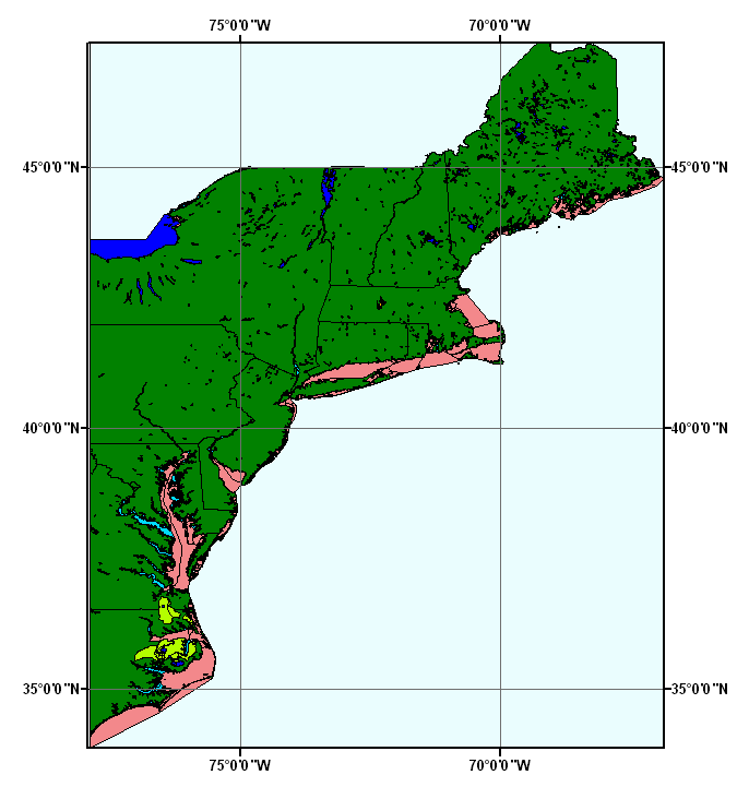
This is a subset of the original dataset and has been clipped to the extent of the Gulf of Maine surficial sediment GIS project area.

Positional_Accuracy:
Horizontal_Positional_Accuracy:
Horizontal_Positional_Accuracy_Report:
The geospatial part of this data set was originally extracted from the individual 1:2,000,000-scale State boundary Digital Line Graph (DLG) files produced by the U.S. Geological Survey which have a positional accuracy of 1,720 meters. It was updated several times using various sources whose horizontal positional accuracies are unknown.
Lineage:
Source_Information:
Source_Citation:
Citation_Information:
Originator:
National Atlas of the United States and the United States Geological Survey
Publication_Date: 19991109
Title: nationalatlas.gov - - Water Features
Geospatial_Data_Presentation_Form: vector digital data
Series_Information:
Publication_Information:
Publication_Place: Reston, Virginia, USA
Publisher: United States Geological Survey
Online_Linkage: <http://www.nationalatlas.gov/atlasftp.html>
Source_Scale_Denominator: 2000000
Type_of_Source_Media: online
Source_Time_Period_of_Content:
Time_Period_Information:
Range_of_Dates/Times:
Source_Currentness_Reference: ground condition: 1972-1994; publication date: 1998, 1999
Source_Citation_Abbreviation: National Atlas
Source_Contribution: Attribute and geospatial data
Process_Step:
Process_Description:
This file was originally digitized by the National Mapping Division based on the sectional maps contained in 'The National Atlas of the United States of America' published by the USGS in 1970. The 1:2,000,000-scale Digital Line Graph (DLG) data were merged into a single national hydrography coverage. Where necessary to effect the merge, alignment changes were made. The names were taken from the USGS Topographic 1:100,000-scale maps. For Alaska, the names were taken from the USGS Topographic 1:250,000-scale maps. State lines across water bodies were removed from the national coverage. State attributes were assigned to the features.

Some spatial features were added and corrected. Some name attributes were added or corrected. All occurrences of St. were changed to Saint. Extra spaces were removed from the attributes. Hydrographic features for Puerto Rico and the U.S. Virgin Islands were added. A minor adjustment was made to the shoreline in Galveston Bay, Texas.

Process_Date: 1999
Source_Produced_Citation_Abbreviation: National Atlas
Process_Step:
Process_Description:
The following steps were performed by ESRI: Downloaded the ArcView Shapefile version of the data, hydrogp020.tar.gz, from <http://www.nationalatlas.gov/atlasftp.html> and extracted it. Removed unneeded attributes. Removed null records. Reduced the width of attributes. Created ArcGIS layer file (.lyr). Created ArcView legend file (.avl). Created projection file (.prj). Ran ArcView Avenue request ExportClean, and created spatial indices.
Source_Used_Citation_Abbreviation: National Atlas
Process_Date: 20000828
Source_Produced_Citation_Abbreviation: hydroply.dbf
Source_Produced_Citation_Abbreviation: hydroply.shp
Source_Produced_Citation_Abbreviation: hydroply.shx
Process_Step:
Process_Description:
The ESRI urban shapefile was clipped to to the extent of the Gulf of Maine surficial sediment GIS project area.
Source_Used_Citation_Abbreviation: hydroply.dbf
Source_Used_Citation_Abbreviation: hydroply.shp
Source_Used_Citation_Abbreviation: hydroply.shx
Process_Date: 20020222
Source_Produced_Citation_Abbreviation: hydroply.dbf
Source_Produced_Citation_Abbreviation: hydroply.shp
Source_Produced_Citation_Abbreviation: hydroply.shx
Process_Contact:
Contact_Information:
Contact_Organization_Primary:
Contact_Organization: U.S. Geological Survey
Contact_Person: Valerie Paskevich
Contact_Position: Information Specialist
Contact_Address:
Address_Type: mailing and physical address
Address: 384 Woods Hole Road
City: Woods Hole
State_or_Province: MA
Postal_Code: 02543-1598
Country: USA
Contact_Voice_Telephone: (508) 548-8700 x2281
Contact_Facsimile_Telephone: (508) 457-2310
Contact_Electronic_Mail_Address: vpaskevich@usgs.gov

Spatial_Data_Organization_Information:
Direct_Spatial_Reference_Method: Vector
Point_and_Vector_Object_Information:
SDTS_Terms_Description:
SDTS_Point_and_Vector_Object_Type: G-polygon
Point_and_Vector_Object_Count: 1155

Spatial_Reference_Information:
Horizontal_Coordinate_System_Definition:
Geographic:
Latitude_Resolution: 0.000000
Longitude_Resolution: 0.000000
Geographic_Coordinate_Units: Decimal degrees
Geodetic_Model:
Horizontal_Datum_Name: North American Datum of 1983
Ellipsoid_Name: Geodetic Reference System 80
Semi-major_Axis: 6378137.000000
Denominator_of_Flattening_Ratio: 298.257222

Entity_and_Attribute_Information:
Detailed_Description:
Entity_Type:
Entity_Type_Label: hydroply
Entity_Type_Definition:
The polygons represent the water feature areas within United States.
Entity_Type_Definition_Source:
National Atlas of the United States and the United States Geological Survey
Attribute:
Attribute_Label: FID
Attribute_Definition: Internal feature number.
Attribute_Definition_Source: ESRI
Attribute_Domain_Values:
Unrepresentable_Domain:
Sequential unique whole numbers that are automatically generated.
Attribute:
Attribute_Label: Shape
Attribute_Definition: Feature geometry.
Attribute_Definition_Source: ESRI
Attribute_Domain_Values:
Unrepresentable_Domain: Coordinates defining the features.
Attribute:
Attribute_Label: FEATURE
Attribute_Definition: The type of water feature.
Attribute_Definition_Source:
National Atlas of the United States and the United States Geological Survey
Attribute_Domain_Values:
Enumerated_Domain:
Enumerated_Domain_Value: Bay or Estuary or Ocean
Enumerated_Domain_Value_Definition: A body of salt water.
Enumerated_Domain_Value_Definition_Source:
National Atlas of the United States and the United States Geological Survey
Enumerated_Domain:
Enumerated_Domain_Value: Canal
Enumerated_Domain_Value_Definition:
An artificial open waterway constructed to carry water, to irrigate or drain land, to connect two or more bodies of water, or to serve as a waterway for water craft.
Enumerated_Domain_Value_Definition_Source:
National Atlas of the United States and the United States Geological Survey
Enumerated_Domain:
Enumerated_Domain_Value: Glacier
Enumerated_Domain_Value_Definition: A field of ice on land.
Enumerated_Domain_Value_Definition_Source:
National Atlas of the United States and the United States Geological Survey
Enumerated_Domain:
Enumerated_Domain_Value: Lake
Enumerated_Domain_Value_Definition:
A standing body of water with a predominately natural shoreline surrounded by land.
Enumerated_Domain_Value_Definition_Source:
National Atlas of the United States and the United States Geological Survey
Enumerated_Domain:
Enumerated_Domain_Value: Lake Dry
Enumerated_Domain_Value_Definition: An area that at one time contained a standing body of water.
Enumerated_Domain_Value_Definition_Source:
National Atlas of the United States and the United States Geological Survey
Enumerated_Domain:
Enumerated_Domain_Value: Lake Intermittent
Enumerated_Domain_Value_Definition:
A standing body of water that contains water for only part of the year.
Enumerated_Domain_Value_Definition_Source:
National Atlas of the United States and the United States Geological Survey
Enumerated_Domain:
Enumerated_Domain_Value: Reservoir
Enumerated_Domain_Value_Definition: A constructed basin formed to contain water.
Enumerated_Domain_Value_Definition_Source:
National Atlas of the United States and the United States Geological Survey
Enumerated_Domain:
Enumerated_Domain_Value: Reservoir Intermittent
Enumerated_Domain_Value_Definition:
A constructed basin formed to contain water for only part of the year.
Enumerated_Domain_Value_Definition_Source:
National Atlas of the United States and the United States Geological Survey
Enumerated_Domain:
Enumerated_Domain_Value: Stream
Enumerated_Domain_Value_Definition: A body of water flowing in a channel or watercourse.
Enumerated_Domain_Value_Definition_Source:
National Atlas of the United States and the United States Geological Survey
Enumerated_Domain:
Enumerated_Domain_Value: Swamp or Marsh
Enumerated_Domain_Value_Definition:
A noncultivated, vegetated area that is inundated or saturated for a significant part of the year.
Enumerated_Domain_Value_Definition_Source:
National Atlas of the United States and the United States Geological Survey
Attribute:
Attribute_Label: NAME
Attribute_Definition: The water feature name.
Attribute_Definition_Source:
National Atlas of the United States and the United States Geological Survey
Attribute_Domain_Values:
Unrepresentable_Domain: Names for the features.
Attribute:
Attribute_Label: STATE
Attribute_Definition:
The two-letter abbreviation for each state in which the water feature is located.
Attribute_Definition_Source:
Department of Commerce, National Institute of Standards and Technology
Attribute_Domain_Values:
Codeset_Domain:
Codeset_Name: Federal Information Processing Standards 5–2
Codeset_Source: National Institute of Standards and Technology

Distribution_Information:
Distributor:
Contact_Information:
Contact_Organization_Primary:
Contact_Organization:
Environmental Systems Research Institute, Inc. (ESRI); ESRI International Distributors
Contact_Address:
Address_Type: mailing and physical address
Address: 380 New York Street
City: Redlands
State_or_Province: California
Postal_Code: 92373-8100
Country: USA
Contact_Voice_Telephone: 800-447-9778
Contact_Instructions:
In the United States, contact the ESRI Telesales staff at 800-447-9778 for more information about our software and data.

Outside the United States, please direct all inquiries to your local ESRI International Distributor. This information can be found at <http://gis.esri.com/intldist/contactint.cfm>.

Resource_Description: Offline Data
Distribution_Liability: See use constraints.
Standard_Order_Process:
Digital_Form:
Digital_Transfer_Information:
Format_Name: SHP
Format_Specification:
The SHP file contains the geospatial data. The SHX file contains the index of the geospatial data. The DBF file contains the attribute data in dBASE format. The PRJ file contains the coordinate system information (optional). The AVL file contains the legend information (optional). The SBN and SBX files contain the spatial index of the geospatial data (optional). The XML file contains the metadata describing the data set <data set name>.shp.xml (optional).
File_Decompression_Technique: no compression applied
Transfer_Size: 1.448
Digital_Transfer_Option:
Offline_Option:
Offline_Media:
ESRI Data & Maps 2002 CD-ROM Set is available only as part of ESRI® software.
Recording_Capacity:
Recording_Density: 650
Recording_Density_Units: MB (megabytes)
Recording_Format: ISO 9660
Fees: Software purchase price
Technical_Prerequisites:
To use this data requires software that supports ArcView® GIS shapefiles.

Distribution_Information:
Distributor:
Contact_Information:
Contact_Organization_Primary:
Contact_Organization: U.S. Geological Survey
Contact_Person: Valerie Paskevich
Contact_Position: Information Specialist
Contact_Address:
Address_Type: mailing and physical address
Address: 384 Woods Hole Road
City: Woods Hole
State_or_Province: MA
Postal_Code: 02543-1598
Country: USA
Contact_Voice_Telephone: (508) 548-8700 x2281
Contact_Facsimile_Telephone: (508) 457-2310
Contact_Electronic_Mail_Address: vpaskevich@usgs.gov
Resource_Description:
Downloadable Data: Regional Mapping of Surficial Sediments: Gulf of Maine and Georges Bank, Aggregates and Habitats Projects, hydroply.shp
Distribution_Liability:
Although this data set has been used by the U.S. Geological Survey, no warranty, expressed or implied, is made by the USGS as to the accuracy of the data and/or related materials. The act of distribution shall not constitute any such warranty, and no responsibility is assumed by the USGS in the use of these data or related materials.
Standard_Order_Process:
Digital_Form:
Digital_Transfer_Information:
Format_Name: ArcView Shapefile
Format_Version_Number: 3.2
Format_Specification: ESRI polygon shapefile
Format_Information_Content:
Five files (urban.shp, urban.dbf, urban.shx, urban.sbx, urban.sbn) comprising the ArcView polygon shapefile components, 'prj' and 'avl' files, metadata text file and browse graphic.
File_Decompression_Technique: zip
Transfer_Size: 23.765
Digital_Transfer_Option:
Offline_Option:
Offline_Media: CD-ROM
Recording_Capacity:
Recording_Density: 650
Recording_Density_Units: Mbytes
Compatibility_Information:
The user must have a computer system with a CD-ROM available. To browse the information contained on this CD-ROM, the user must have a current WWW browser available. The user must also have software installed on their computer to unzip the archived file.
Technical_Prerequisites:
The data is available in ArcView shapefile format. The user must have ArcView 3.0 or greater software to read and process the data file. In lieu of ArcView, the user may utilize another GIS application package capable of importing data.

Metadata_Reference_Information:
Metadata_Date: 20030306
Metadata_Contact:
Contact_Information:
Contact_Organization_Primary:
Contact_Organization: U.S. Geological Survey
Contact_Person: Valerie Paskevich
Contact_Position: Information Specialist
Contact_Address:
Address_Type: mailing and physical address
Address: 384 Woods Hole Road
City: Woods Hole
State_or_Province: MA
Postal_Code: 02543-1598
Country: UAA
Contact_Voice_Telephone: (508) 548-8700 x2281
Contact_Facsimile_Telephone: (508) 457-2310
Contact_Electronic_Mail_Address: vpaskevich@usgs.gov
Metadata_Standard_Name: FGDC Content Standards for Digital Geospatial Metadata
Metadata_Standard_Version: FGDC-STD-001-1998
Metadata_Time_Convention: local time
Metadata_Access_Constraints: None
Metadata_Use_Constraints: None

Generated by mp version 2.7.3 on Thu Mar 06 09:18:38 2003

OFR03-001 Home | Introduction | Nomenclature | Browse Maps | Data Catalog | Data Dictionary


[an error occurred while processing this directive]