Skip past header and index
USGS Logo with link to USGS Home Page
Texture, Carbonate Content, and Preliminary Maps of Surficial Sediments, Flower Garden Banks Area, northwest Gulf of Mexico Outer Shelf, USGS Open-File Report 03-002


Image of bounds_wstglf
Figure 1 (bounds_wstglf)
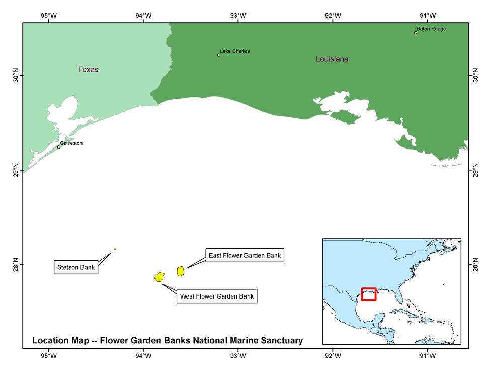
Location map of the Flower Garden Banks National Marine Sancutary in the Northwestern Gulf of Mexico


U.S. Department of the Interior, U.S. Geological Survey
URL: http://pubs.usgs.gov/of/2003/of03-002/html/OFR_figs/bounds_wstglf_med.htm
Maintained by Publishing Services
Last modified: 13:12:47 Tue 21 Oct 2003
Privacy statement | General disclaimer | Accessibility