
![]()
Audio-magnetotelluric Data from the Culpeper Basin, Loudoun, Fauquier, Fairfax, Prince William, Culpeper, and Orange Counties, Virginia:
A Web Site for Distribution of Data
By Herbert A. Pierce and Michael P. Ryan
U.S. Geological Survey Open-File Report 03-056
Online only
2003
![]()
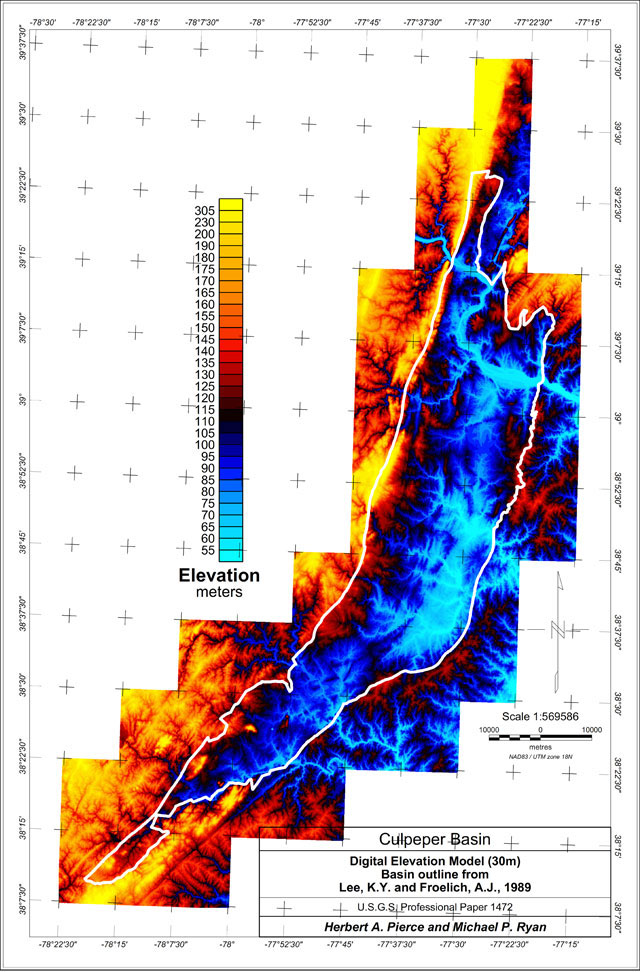
Outline of the Culpeper Basin, Virginia on the Digital Elevation Model
[ Survey Info ] [ Location Maps ] [ Processing ] [ Electric Sections ] [ Data ]
Non-graphical version of this page
|| USGS - Eastern Earth Surface Processes Team || USGS - Geology || USGS ||
This report is preliminary and has not been reviewed for conformity with U.S. Geological Survey editorial standards. Use of brand names is for descriptive purposes and does not constitute endorsement by the U.S. Geological Survey.
This project was supported by the Bedrock Regional Aquifer Systematics Study (BRASS) of the USGS.
Contact: Herbert A. Pierce
[an error occurred while processing this directive]