
![]()
Geological Overview
![]()
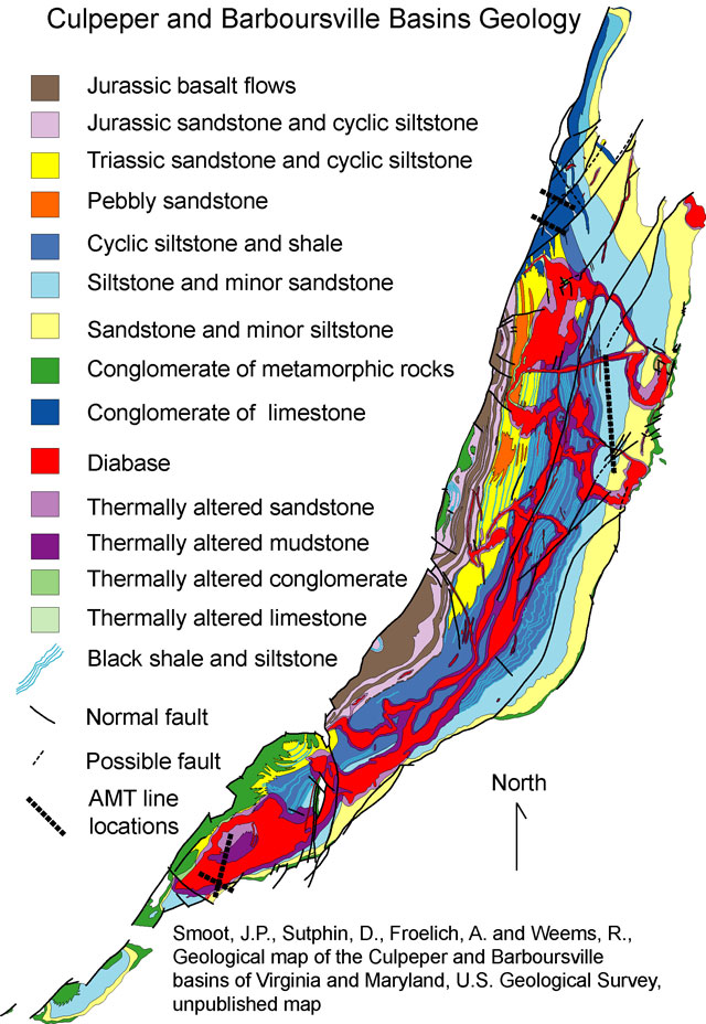
The Culpeper basin is part of a much larger system of ancient depressions or troughs, that lie largely within the Piedmont Geologic Province of eastern North America, and it's transition region with the neighboring Blue Ridge Geologic Province. Formed during an abortive attempt to make a great ocean basin during the Late Triassic and Early Jurassic, their eroded remnants record major episodes of sedimentation, igneous intrusion and eruption, and local contact metamorphism. Altogether, some twenty basins formed between what is now Nova Scotia and Georgia. Many of these basins are discontinuous along their strike, and have therefore formed isolated environments for fluvial and lacustrine sedimentation.
Several of these basins (e.g.: the Culpeper, Gettysburg, and Newark) are fault-bounded in the west. Mesozoic crustal stretching produced asymmetrical basin subsidence that resulted in a progressive basin deepening to the west and unconformable overlap with the pre-basin Proterozoic rocks in the east. An upshot of such a pattern of basin deepening is the development of sequences of sandstones and siltstones that systematically increase in dip towards the accommodating western border faults. A second major structural theme in Mesozoic basin organization concerns the geometry of igneous intrusion, as discussed below. Froelich (1982, 1985) and Lee and Froelich (1989) discuss the geology of the Culpeper basin, and Smoot (1989) discusses the sedimentation environments and sedimentary facies of the Mesozoic with respect to fluvial and lacustrine deposition in the Culpeper.
|| Culpeper Basin AMT || USGS - Eastern Earth Surface Processes Team || USGS - Geology || USGS ||
Contact: Herbert A. Pierce
[an error occurred while processing this directive]