
![]()
New Jersey Complete Bouguer Gravity Anomaly Map
![]()
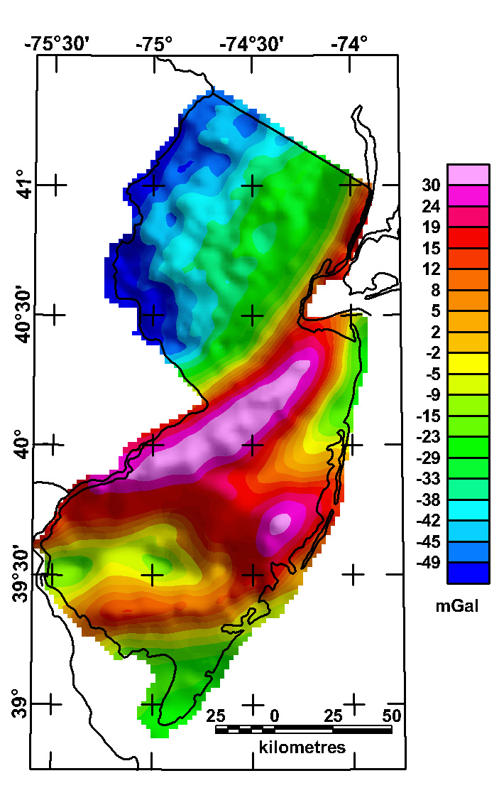
The complete-Bouguer gravity anomaly grid was compiled using data from over 2,400 gravity stations in and adjacent to the state of New Jersey. These data were extracted from the Gravity 1999 edition CD-ROM issued by the National Geophysical Data Center (http://www.ngdc.noaa.gov/) (Dater and others, 1999). Observed gravity relative to the IGSN-71 datum were reduced to the Bouguer anomaly using the 1967 gravity formula (Cordell and others, 1982) and a reduction density of 2.67 g/cc. Terrain corrections were calculated radially outward from each station to a distance of 167 km using a method developed by Plouff (1977). The data were converted to a 2-km grid using minimum curvature techniques (Webring, 1981). The gravity data are available as an ASCII file for station data or as a grid.
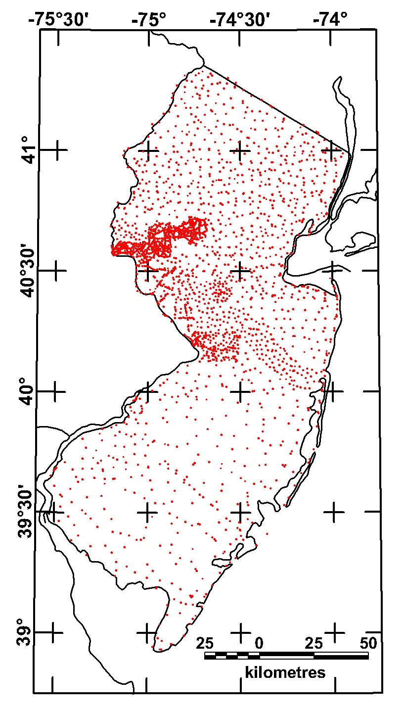
Station Index Map
The grids for this map in various formats are available from the data directory as nj_grav.***
|
|
|