Geophysical Surveys of Bear Lake, Utah-Idaho, September, 2002,
OFR
03-150
OF 03-150
Home
CD-ROM
Contents
Project
Description
GIS
Data
ArcView Project Description
Metadata
3D Visualization
Contacts
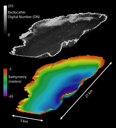
Figure 10.
Three-dimensional view of the sidescan-sonar and bathymetric data collected within Bear Lake, Utah-Idaho.
Back GIS Data -
3D
Views
Title Page
/
Contents
/
Project Description
/
GIS
Data
/
Contacts
[an error occurred while processing this directive]