Introduction
The Contaminated Sediments Database for Long Island Sound and the New York Bight is a compilation of published and unpublished ("gray literature") analyses of texture (grain-size distribution) and contaminants (chemical pollutants) in marine sediment samples collected between 1956-1997. This web site provides background information, images, and descriptions of the Long Island Sound and New York Bight database, access to viewing and downloading data tables, and information describing the size and format of tables and figures. Full references are provided, as well as suggestions for using the data to assess the environmental status of these coastal areas. The database is a valuable historical foundation for future contaminant studies in the region.
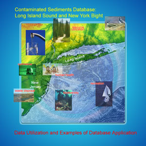
Data Utilization
Data tables can be queried to provide appropriate subsets of data for the generation of plots, maps, statistical analysis, and scientific interpretation needed to address specific questions. In order to manage or restore degraded coastal and marine sediment systems, information is needed about the type and location of
1) human activities,
2) contaminants,
3) biological habitats and
4) detrimental effects.
The information provided in the Contaminated Sediments Database can be used to help address issues such as:
-
Protecting human health
-
Improving quality of (human) life: aesthetics, disease, reproduction, and perception of risk
-
Providing multiple use: recreation, commerce, waste disposal, and resource utilization
-
Protecting living resources: recreation, diversity, health, and commerce
-
Optimizing ecosystem health for its own sake: habitat losses, restoration, and biodiversity
-
Planning effective and economical monitoring programs and environmental regulations
-
Better understanding naturally occurring concentrations and variability
-
Identifying and quantifying natural processes: erosion, sediment transport, storms, population growth
-
Determining system sensitivity
-
Identifying data gaps, unknowns or poorly constrained terms
-
Providing guidance as to how to reach the desired endpoints
-
Providing information on the implications of various practices: sewage treatment, industrial effluent, waste disposal
|