Coastal and Marine Geology / Woods Hole Field Center
Topography, shaded relief, and backscatter intensity of the Hudson Shelf Valley, offshore of New York
By
Bradford Butman, Tammie J. Middleton, E. Robert Thieler, and William C. Schwab
U.S. GEOLOGICAL SURVEY OPEN-FILE REPORT 03-372
 |
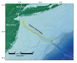
| Map showing the location of the Hudson Shelf Valley offshore of the New York - New Jersey metropolitan region. The area of the maps presented in this report is outlined in yellow. |
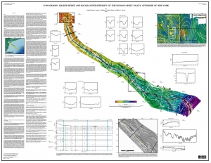
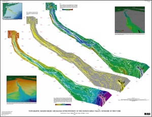
This report presents maps of the sea floor topography, shaded relief, and backscatter intensity of the Hudson Shelf Valley at a scale of 1:150,000 based on multibeam echo-sounder data. The multibeam surveys were conducted aboard the vessel Frederick G. Creed in fall 1996, 1998, and spring 2000. The maps are presented on two sheets in PDF format (see links below).
The discussion on the map sheets is also available in HTML (with links to individual figures), PDF [133 kb], or TEXT-ONLY version. The Figures page includes thumbnails and links to all the figures in this report; open this page to preview and link to figures while reading the text. For best viewing of the map sheets in Adobe Reader, go to edit/preferences/general and select "Smooth Text", "Smooth Line Art" and "Smooth Images" options.
![]() To view files in PDF format, download free copy of Adobe Acrobat Reader.
To view files in PDF format, download free copy of Adobe Acrobat Reader.
 |
| Map Sheet 1. |
 |
| Map Sheet 2. |
This report is preliminary and has not been reviewed for conformity with U.S. Geological Survey editorial standards or with the North American Stratigraphic code. Any use of trade, product, or firm names is for descriptive purposes only and does not imply endorsement by the U.S. Government. Although all data and software released with this open file have been used by the USGS, no warranty, expressed or implied, is made by the USGS as to the accuracy of the data and related materials and (or) the functioning of the software.

[an error occurred while processing this directive]